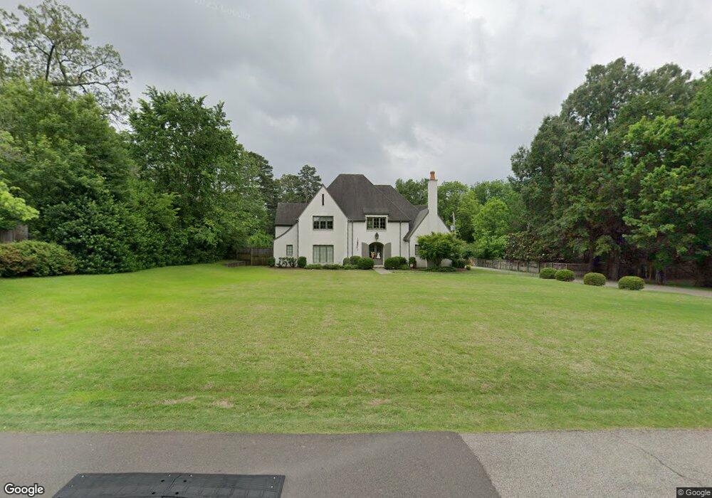
4699 Shady Grove Rd Memphis, TN 38117
Audubon Park NeighborhoodEstimated Value: $758,000 - $1,549,000
5
Beds
6
Baths
5,169
Sq Ft
$228/Sq Ft
Est. Value
About This Home
This home is located at 4699 Shady Grove Rd, Memphis, TN 38117 and is currently estimated at $1,178,505, approximately $227 per square foot. 4699 Shady Grove Rd is a home located in Shelby County with nearby schools including White Station Elementary School, White Station High, and White Station Middle.
Ownership History
Date
Name
Owned For
Owner Type
Purchase Details
Closed on
Aug 12, 2002
Sold by
The Martha B Barton Living Trust
Bought by
Butler John Wesley and Butler Leigh Lewis
Current Estimated Value
Home Financials for this Owner
Home Financials are based on the most recent Mortgage that was taken out on this home.
Original Mortgage
$101,000
Outstanding Balance
$42,677
Interest Rate
6.53%
Estimated Equity
$1,135,828
Purchase Details
Closed on
Apr 12, 2000
Sold by
Barton Martha B
Bought by
Chancey Margaret B and Chancey Keith D
Create a Home Valuation Report for This Property
The Home Valuation Report is an in-depth analysis detailing your home's value as well as a comparison with similar homes in the area
Home Values in the Area
Average Home Value in this Area
Purchase History
| Date | Buyer | Sale Price | Title Company |
|---|---|---|---|
| Butler John Wesley | $200,000 | -- | |
| Chancey Margaret B | -- | -- |
Source: Public Records
Mortgage History
| Date | Status | Borrower | Loan Amount |
|---|---|---|---|
| Open | Butler John Wesley | $101,000 |
Source: Public Records
Tax History Compared to Growth
Tax History
| Year | Tax Paid | Tax Assessment Tax Assessment Total Assessment is a certain percentage of the fair market value that is determined by local assessors to be the total taxable value of land and additions on the property. | Land | Improvement |
|---|---|---|---|---|
| 2025 | $7,665 | $309,800 | $67,950 | $241,850 |
| 2024 | $7,665 | $226,100 | $49,675 | $176,425 |
| 2023 | $13,773 | $226,100 | $49,675 | $176,425 |
| 2022 | $13,773 | $226,100 | $49,675 | $176,425 |
| 2021 | $14,433 | $240,550 | $49,675 | $190,875 |
| 2020 | $15,075 | $208,050 | $49,675 | $158,375 |
| 2019 | $15,075 | $208,050 | $49,675 | $158,375 |
| 2018 | $15,075 | $208,050 | $49,675 | $158,375 |
| 2017 | $8,551 | $208,050 | $49,675 | $158,375 |
| 2016 | $8,842 | $202,325 | $0 | $0 |
| 2014 | $2,143 | $59,825 | $0 | $0 |
Source: Public Records
Map
Nearby Homes
- 427 S Perkins Rd Unit 427-2
- 4654 Hemlock Ln
- 4736 All Spice Dr Unit 71E
- 356 Clove Dr
- 378 Caraway Cove Unit 10A
- 4772 Gwynne Rd
- 154 Perkins Extension
- 405 S Perkins Rd Unit 430
- 4563 Aldersgate Rd
- 271 Wakefield Dr
- 4859 Gwynne Rd
- 137 Perkins Extension
- 455 S Perkins Rd Unit 3
- 453 S Perkins Rd Unit 453-1
- 320 S Grove Park Rd
- 4679 Walnut Grove Rd
- 435 Fairfield Cir
- 326 Cherry Cir E
- 196 E Cherry Cir
- 4916 Greenway Ave
- 4711 Shady Grove Rd
- 4681 Shady Grove Rd
- 272 S Perkins Rd
- 4700 Cole Rd
- 4723 Shady Grove Rd
- 4700 Shady Grove Rd Unit 3215A
- 4712 Cole Rd
- 4690 Cole Rd
- 234 Perkins Extension
- 288 Perkins Extension
- 4724 Cole Rd
- 288 S Perkins Rd
- 4737 Shady Grove Rd
- 4710 Gwynne Rd
- 4732 Shady Grove Rd
- 4705 Gwynne Rd
- 4650 Woodmont Place
- 4734 Cole Rd
- 247 S Perkins Rd
- 241 S Perkins Rd