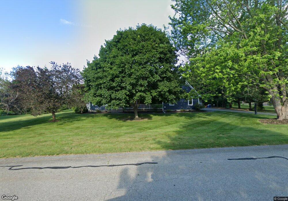
47 Betty Ann Ln Dracut, MA 01826
Estimated Value: $851,530 - $952,000
4
Beds
3
Baths
2,808
Sq Ft
$325/Sq Ft
Est. Value
About This Home
This home is located at 47 Betty Ann Ln, Dracut, MA 01826 and is currently estimated at $911,883, approximately $324 per square foot. 47 Betty Ann Ln is a home located in Middlesex County with nearby schools including Greenmont Avenue School, Richardson Middle School, and Dracut Senior High School.
Ownership History
Date
Name
Owned For
Owner Type
Purchase Details
Closed on
Aug 4, 2020
Sold by
Taylor Bryce R and Taylor Ashley G
Bought by
47 Betty Lane Rt
Current Estimated Value
Purchase Details
Closed on
Aug 15, 2016
Sold by
Costa Ashley G
Bought by
Costa Ashley G and Taylor Bryce R
Purchase Details
Closed on
Mar 6, 2013
Sold by
Costa Justin J and Costa Ashley G
Bought by
Costa Ashley G
Purchase Details
Closed on
Mar 16, 2011
Sold by
Griffin John P and Griffin Priscilla C
Bought by
Costa Ashley G and Costa Justin J
Home Financials for this Owner
Home Financials are based on the most recent Mortgage that was taken out on this home.
Original Mortgage
$408,500
Interest Rate
3%
Mortgage Type
Purchase Money Mortgage
Create a Home Valuation Report for This Property
The Home Valuation Report is an in-depth analysis detailing your home's value as well as a comparison with similar homes in the area
Home Values in the Area
Average Home Value in this Area
Purchase History
| Date | Buyer | Sale Price | Title Company |
|---|---|---|---|
| 47 Betty Lane Rt | -- | None Available | |
| Costa Ashley G | -- | -- | |
| Costa Ashley G | -- | -- | |
| Costa Ashley G | $430,000 | -- |
Source: Public Records
Mortgage History
| Date | Status | Borrower | Loan Amount |
|---|---|---|---|
| Previous Owner | Costa Ashley G | $408,500 |
Source: Public Records
Tax History Compared to Growth
Tax History
| Year | Tax Paid | Tax Assessment Tax Assessment Total Assessment is a certain percentage of the fair market value that is determined by local assessors to be the total taxable value of land and additions on the property. | Land | Improvement |
|---|---|---|---|---|
| 2025 | $8,194 | $809,700 | $265,300 | $544,400 |
| 2024 | $8,190 | $783,700 | $252,800 | $530,900 |
| 2023 | $7,940 | $685,700 | $219,900 | $465,800 |
| 2022 | $7,609 | $619,100 | $200,000 | $419,100 |
| 2021 | $7,342 | $564,300 | $181,600 | $382,700 |
| 2020 | $7,209 | $540,000 | $176,100 | $363,900 |
| 2019 | $7,362 | $535,400 | $167,700 | $367,700 |
| 2018 | $7,425 | $525,100 | $175,000 | $350,100 |
| 2017 | $7,257 | $525,100 | $175,000 | $350,100 |
| 2016 | $7,049 | $475,000 | $168,200 | $306,800 |
| 2015 | $6,766 | $453,200 | $168,200 | $285,000 |
| 2014 | $6,434 | $444,000 | $168,200 | $275,800 |
Source: Public Records
Map
Nearby Homes
- 167 Betty Ann Ln
- 121 Old Marsh Hill Rd
- 321 Old Marsh Hill Rd
- 67 Lincoln Ln
- 19 Esther Way Unit Lot 10
- 20 Esther Way Unit 11
- 26 Frank St
- 109 Meadow Creek Dr
- 67 Foxhill Ln Unit 67
- 315 Broadway Rd Unit 7
- 241 Broadway Rd Unit 50
- 1572 Bridge St
- 81 Spring Park Ave
- 18 Stone St
- 35 Thissell Ave
- 190 Old Rd
- 675 Robbins Ave Unit 1
- 999 Hildreth St
- 700 Robbins Ave Unit 6
- 174 Old Rd
- 123 Anywhere
- 10 Lots Liakas Way
- Lot 14 Burgess Farm Rd
- Lot 9 Burgess Farm Rd
- Lot 6 Burgess Farm Rd
- 13 Black Hawk Rd Unit 2-19
- 9 Black Hawk Rd Unit 2-17
- 39 Betty Ann Ln
- 0 Busy St Unit 71911033
- 55 Betty Ann Ln
- 135 Betty Ann Ln
- 54 Betty Ann Ln
- 127 Betty Ann Ln
- 46 Betty Ann Ln
- 44+48 Hilcrest Rd
- 204 Pleasant St Bldg One Unit 2
- 52 Barn Rd Unit LOT15
- 52 Schiripo Way
- 62 Betty Ann Ln
- 31 Betty Ann Ln