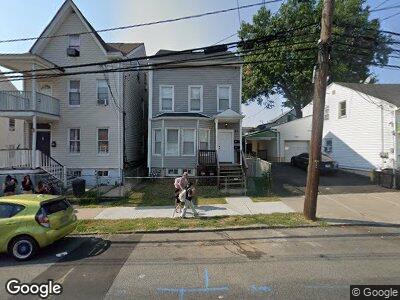
47 Bloomfield Ave Paterson, NJ 07503
South Paterson NeighborhoodEstimated Value: $217,000 - $514,000
3
Beds
2
Baths
1,100
Sq Ft
$337/Sq Ft
Est. Value
About This Home
This home is located at 47 Bloomfield Ave, Paterson, NJ 07503 and is currently estimated at $371,033, approximately $337 per square foot. 47 Bloomfield Ave is a home located in Passaic County with nearby schools including Dale Avenue Elementary School, Edward W. Kilpatrick School of Discovery, and Paterson Public School No. 3.
Ownership History
Date
Name
Owned For
Owner Type
Purchase Details
Closed on
Feb 12, 2021
Sold by
Ozden Monica and Quiros Monica
Bought by
Forty Seven Bloomfield Llc
Current Estimated Value
Home Financials for this Owner
Home Financials are based on the most recent Mortgage that was taken out on this home.
Original Mortgage
$200,000
Interest Rate
2.73%
Mortgage Type
Commercial
Purchase Details
Closed on
Mar 20, 2014
Sold by
Vanvandalinda Hella Van
Bought by
Quiros Monica
Create a Home Valuation Report for This Property
The Home Valuation Report is an in-depth analysis detailing your home's value as well as a comparison with similar homes in the area
Home Values in the Area
Average Home Value in this Area
Purchase History
| Date | Buyer | Sale Price | Title Company |
|---|---|---|---|
| Forty Seven Bloomfield Llc | -- | Prestige Title Agency Nos | |
| Quiros Monica | $30,000 | None Available |
Source: Public Records
Mortgage History
| Date | Status | Borrower | Loan Amount |
|---|---|---|---|
| Closed | Forty Seven Bloomfield Llc | $200,000 |
Source: Public Records
Tax History Compared to Growth
Tax History
| Year | Tax Paid | Tax Assessment Tax Assessment Total Assessment is a certain percentage of the fair market value that is determined by local assessors to be the total taxable value of land and additions on the property. | Land | Improvement |
|---|---|---|---|---|
| 2024 | $6,624 | $135,100 | $51,900 | $83,200 |
| 2022 | $6,271 | $135,100 | $51,900 | $83,200 |
| 2021 | $6,047 | $135,100 | $51,900 | $83,200 |
| 2020 | $5,640 | $135,100 | $51,900 | $83,200 |
| 2019 | $5,457 | $132,000 | $50,700 | $81,300 |
| 2018 | $5,632 | $130,200 | $50,200 | $80,000 |
| 2017 | $3,827 | $92,000 | $49,900 | $42,100 |
| 2016 | $4,209 | $97,000 | $52,500 | $44,500 |
| 2015 | $3,985 | $97,000 | $52,500 | $44,500 |
| 2014 | $7,337 | $253,000 | $167,100 | $85,900 |
Source: Public Records
Map
Nearby Homes
- 285 Paxton St Unit 287
- 285-287 Paxton St
- 284 Paxton St Unit 286
- 247-249 Sussex St
- 304 Pacific St
- 235 Dakota St Unit 10
- 20 Elk St
- 180 Pacific St Unit 182
- 1252 Madison Ave Unit 1254
- 81 George St
- 82 Valley Rd
- 117 Valley Rd
- 79 Thomas St
- 21 Thomas St
- 52 Silleck St
- 102 Nelson St
- 127 Knickerbocker Ave
- 249 Silleck St
- 132 Warren St
- 557 Crooks Ave
- 47 Bloomfield Ave
- 43 Bloomfield Ave Unit 45
- 49 Bloomfield Ave Unit 51
- 41 Bloomfield Ave
- 53 Bloomfield Ave Unit 55
- 50 Bloomfield Ave
- 42 Bloomfield Ave Unit 44
- 52 Bloomfield Ave
- 46 Bloomfield Ave Unit 48
- 54 Bloomfield Ave Unit 56
- 261 Paxton St
- 257-259 Paxton St
- 268 Sussex St Unit 270
- 257 Paxton St Unit 259
- 56 Field Rd
- 253 Paxton St Unit 255
- 54-56 Bloomfield Ave
- 33 Bloomfield Ave Unit 35
- 264 Sussex St Unit 266
- 264-266 Sussex St