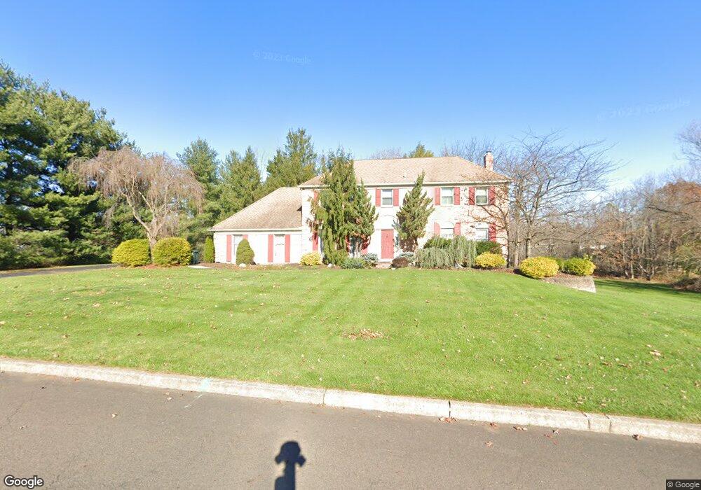
47 Bobbie Dr Warminster, PA 18974
Estimated Value: $1,040,000 - $1,214,000
4
Beds
4
Baths
4,065
Sq Ft
$284/Sq Ft
Est. Value
About This Home
This home is located at 47 Bobbie Dr, Warminster, PA 18974 and is currently estimated at $1,156,175, approximately $284 per square foot. 47 Bobbie Dr is a home located in Bucks County with nearby schools including Maureen M. Welch Elementary School, Richboro Middle School, and Council Rock High School - South.
Ownership History
Date
Name
Owned For
Owner Type
Purchase Details
Closed on
Oct 25, 2010
Sold by
Vishnevskiy Aleksandr
Bought by
Vishnevskiy Aleksandr and Crichton Oksana
Current Estimated Value
Home Financials for this Owner
Home Financials are based on the most recent Mortgage that was taken out on this home.
Original Mortgage
$417,000
Outstanding Balance
$6,307
Interest Rate
4.41%
Mortgage Type
New Conventional
Estimated Equity
$1,149,868
Purchase Details
Closed on
Feb 27, 2004
Sold by
Ballod Martin C and Ballod Joann S
Bought by
Vishnevskiy Aleksandr
Home Financials for this Owner
Home Financials are based on the most recent Mortgage that was taken out on this home.
Original Mortgage
$333,700
Interest Rate
5.67%
Mortgage Type
Unknown
Create a Home Valuation Report for This Property
The Home Valuation Report is an in-depth analysis detailing your home's value as well as a comparison with similar homes in the area
Home Values in the Area
Average Home Value in this Area
Purchase History
| Date | Buyer | Sale Price | Title Company |
|---|---|---|---|
| Vishnevskiy Aleksandr | -- | None Available | |
| Vishnevskiy Aleksandr | $582,000 | Lawyers Title Ins |
Source: Public Records
Mortgage History
| Date | Status | Borrower | Loan Amount |
|---|---|---|---|
| Open | Vishnevskiy Aleksandr | $417,000 | |
| Closed | Vishnevskiy Aleksandr | $333,700 |
Source: Public Records
Tax History Compared to Growth
Tax History
| Year | Tax Paid | Tax Assessment Tax Assessment Total Assessment is a certain percentage of the fair market value that is determined by local assessors to be the total taxable value of land and additions on the property. | Land | Improvement |
|---|---|---|---|---|
| 2025 | $14,261 | $74,040 | $11,520 | $62,520 |
| 2024 | $14,261 | $74,040 | $11,520 | $62,520 |
| 2023 | $13,440 | $74,040 | $11,520 | $62,520 |
| 2022 | $13,317 | $74,040 | $11,520 | $62,520 |
| 2021 | $12,896 | $74,040 | $11,520 | $62,520 |
| 2020 | $12,606 | $74,040 | $11,520 | $62,520 |
| 2019 | $12,066 | $74,040 | $11,520 | $62,520 |
| 2018 | $11,852 | $74,040 | $11,520 | $62,520 |
| 2017 | $11,395 | $74,040 | $11,520 | $62,520 |
| 2016 | $11,395 | $74,040 | $11,520 | $62,520 |
| 2015 | -- | $74,040 | $11,520 | $62,520 |
| 2014 | -- | $74,040 | $11,520 | $62,520 |
Source: Public Records
Map
Nearby Homes
- 290 Hatboro Rd
- 8 Shady Pines Dr
- 223 Cecelia Acres Dr
- 3 Shady Pines Dr
- 18 Lacey Ln
- 59 Parry Way
- 8 Lacey Ln
- 21 Spring Mill Dr Unit 12
- The Addis Plan at The Reserve at Spring Mill
- The Beckett Plan at The Reserve at Spring Mill
- 55 Parry Way
- 23 Oxford Dr
- 11 Spring Mill Dr
- 9 Spring Mill Dr
- 56 Parry Way
- 105 Edwards Dr
- 56 Joshua Dr
- 636 Almshouse Rd
- 115 Grandview Dr
- 29 Devon Rd