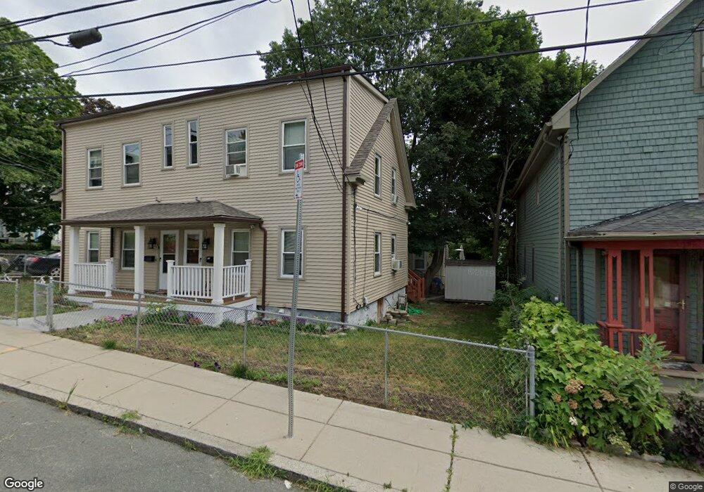
47 Cedar St Mattapan, MA 02126
West Codman Hill-West Lowe NeighborhoodEstimated Value: $655,000 - $760,000
2
Beds
1
Bath
1,695
Sq Ft
$427/Sq Ft
Est. Value
About This Home
This home is located at 47 Cedar St, Mattapan, MA 02126 and is currently estimated at $723,705, approximately $426 per square foot. 47 Cedar St is a home located in Suffolk County with nearby schools including Conservatory Lab Upper School, Saint John Paul II Catholic Academy, and Epiphany School.
Ownership History
Date
Name
Owned For
Owner Type
Purchase Details
Closed on
Jun 17, 2015
Sold by
Rabouin-Williams Joyce
Bought by
Sneed Eli
Current Estimated Value
Home Financials for this Owner
Home Financials are based on the most recent Mortgage that was taken out on this home.
Original Mortgage
$410,000
Outstanding Balance
$317,896
Interest Rate
3.78%
Mortgage Type
New Conventional
Estimated Equity
$405,809
Purchase Details
Closed on
Feb 27, 1998
Sold by
Winter Stephen J
Bought by
Rabouin Joyce
Home Financials for this Owner
Home Financials are based on the most recent Mortgage that was taken out on this home.
Original Mortgage
$26,000
Interest Rate
6.85%
Create a Home Valuation Report for This Property
The Home Valuation Report is an in-depth analysis detailing your home's value as well as a comparison with similar homes in the area
Home Values in the Area
Average Home Value in this Area
Purchase History
| Date | Buyer | Sale Price | Title Company |
|---|---|---|---|
| Sneed Eli | $410,000 | -- | |
| Rabouin Joyce | $130,000 | -- |
Source: Public Records
Mortgage History
| Date | Status | Borrower | Loan Amount |
|---|---|---|---|
| Open | Sneed Eli | $410,000 | |
| Previous Owner | Rabouin Joyce | $35,000 | |
| Previous Owner | Rabouin Joyce | $19,087 | |
| Previous Owner | Rabouin Joyce | $26,000 | |
| Previous Owner | Rabouin Joyce | $97,500 |
Source: Public Records
Tax History Compared to Growth
Tax History
| Year | Tax Paid | Tax Assessment Tax Assessment Total Assessment is a certain percentage of the fair market value that is determined by local assessors to be the total taxable value of land and additions on the property. | Land | Improvement |
|---|---|---|---|---|
| 2025 | $7,852 | $678,100 | $191,000 | $487,100 |
| 2024 | $7,864 | $721,500 | $180,600 | $540,900 |
| 2023 | $7,109 | $661,900 | $165,700 | $496,200 |
| 2022 | $6,606 | $607,200 | $152,000 | $455,200 |
| 2021 | $6,352 | $595,300 | $149,000 | $446,300 |
| 2020 | $5,457 | $516,800 | $144,800 | $372,000 |
| 2019 | $4,954 | $470,000 | $108,500 | $361,500 |
| 2018 | $4,690 | $447,500 | $108,500 | $339,000 |
| 2017 | $4,386 | $414,200 | $108,500 | $305,700 |
| 2016 | $4,258 | $387,100 | $108,500 | $278,600 |
| 2015 | $2,576 | $212,700 | $72,000 | $140,700 |
| 2014 | $2,498 | $198,600 | $72,000 | $126,600 |
Source: Public Records
Map
Nearby Homes
- 67 Idaho St
- 32-32R Temple St
- 8-14R Temple St
- 131 Eliot St Unit 312
- 131 Eliot St Unit 408
- 131 Eliot St Unit 305
- 23 Maryknoll St
- 36 Oakridge St
- 30 Pleasant Hill Ave Unit 32
- 1245 Adams St Unit B406
- 1245 Adams St Unit B210
- 4 School St
- 84-86 Codman Hill Ave
- 21A High St Unit 2
- 30 Glenhill Rd
- 147 Fairmount St
- 14 Valley Rd
- 56 Fairmount St Unit 2
- 183 Fuller St Unit 1
- 2 Ogden St Unit 1
- 49 Cedar St
- 47-49 Cedar Unit 1
- 47-49 Cedar
- 72 Sanford St Unit 1
- 72 Sanford St Unit 72
- 70 Sanford St Unit 72
- 70 Sanford St Unit 1
- 45 Cedar St
- 45 Cedar St
- 45 Cedar St Unit 2
- 42 Cedar St Unit 46R
- 42 Cedar St Unit 42R
- 44-46 Cedar St
- 42 Cedar St Unit 2
- 41 Cedar St
- 53 Cedar St
- 48 Cedar St
- 64 Sanford St
- 42-46R Cedar St
- 42-46R Cedar St Unit 2