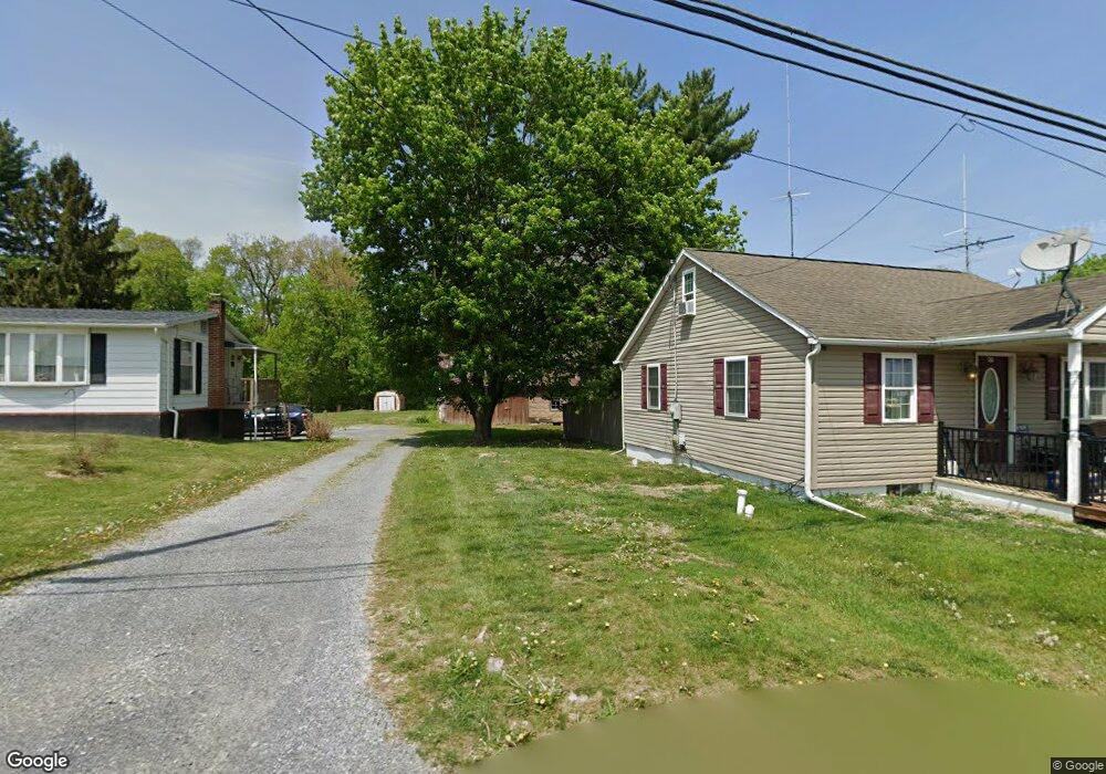
47 Commons Rd Kutztown, PA 19530
Maxatawny NeighborhoodEstimated Value: $248,000 - $351,000
2
Beds
1
Bath
1,260
Sq Ft
$242/Sq Ft
Est. Value
About This Home
This home is located at 47 Commons Rd, Kutztown, PA 19530 and is currently estimated at $305,071, approximately $242 per square foot. 47 Commons Rd is a home located in Berks County with nearby schools including Kutztown Area Senior High School, Pleasant Hills Mennonite School, and LIGHTHOUSE ISLAND ACADEMY.
Ownership History
Date
Name
Owned For
Owner Type
Purchase Details
Closed on
Nov 12, 2014
Sold by
Katz Shawn S and Wolfgang Justin W
Bought by
Howe James D and Howe Melanie L
Current Estimated Value
Home Financials for this Owner
Home Financials are based on the most recent Mortgage that was taken out on this home.
Original Mortgage
$128,025
Outstanding Balance
$98,683
Interest Rate
4.17%
Mortgage Type
New Conventional
Estimated Equity
$206,388
Purchase Details
Closed on
Jun 1, 2007
Sold by
Gehringer Lee C
Bought by
Katz Shawn S and Wolfgang Justin W
Home Financials for this Owner
Home Financials are based on the most recent Mortgage that was taken out on this home.
Original Mortgage
$145,000
Interest Rate
6.24%
Mortgage Type
New Conventional
Purchase Details
Closed on
Oct 16, 2006
Sold by
Miller Arlan J
Bought by
Gehringer Lee C
Create a Home Valuation Report for This Property
The Home Valuation Report is an in-depth analysis detailing your home's value as well as a comparison with similar homes in the area
Home Values in the Area
Average Home Value in this Area
Purchase History
| Date | Buyer | Sale Price | Title Company |
|---|---|---|---|
| Howe James D | $142,250 | None Available | |
| Katz Shawn S | $189,900 | None Available | |
| Gehringer Lee C | $39,500 | None Available |
Source: Public Records
Mortgage History
| Date | Status | Borrower | Loan Amount |
|---|---|---|---|
| Open | Howe James D | $128,025 | |
| Previous Owner | Katz Shawn S | $145,000 |
Source: Public Records
Tax History
| Year | Tax Paid | Tax Assessment Tax Assessment Total Assessment is a certain percentage of the fair market value that is determined by local assessors to be the total taxable value of land and additions on the property. | Land | Improvement |
|---|---|---|---|---|
| 2025 | $1,336 | $109,400 | $42,800 | $66,600 |
| 2024 | $4,518 | $109,400 | $42,800 | $66,600 |
| 2023 | $4,373 | $109,400 | $42,800 | $66,600 |
| 2022 | $4,373 | $109,400 | $42,800 | $66,600 |
| 2021 | $4,373 | $109,400 | $42,800 | $66,600 |
| 2020 | $4,373 | $109,400 | $42,800 | $66,600 |
| 2019 | $4,373 | $109,400 | $42,800 | $66,600 |
| 2018 | $4,373 | $109,400 | $42,800 | $66,600 |
| 2017 | $4,342 | $109,400 | $42,800 | $66,600 |
| 2016 | $1,065 | $109,400 | $42,800 | $66,600 |
| 2015 | $1,043 | $109,400 | $42,800 | $66,600 |
| 2014 | $1,043 | $109,400 | $42,800 | $66,600 |
Source: Public Records
Map
Nearby Homes
- 474 W Walnut St
- 164 W Main St
- 113 W Main St
- 504-512 E Main St
- 97 S Kemp Rd
- 112 Portia Blvd
- 122 Portia Blvd
- 647 Seem Dr
- 602 Seem Dr
- 111 Portia Blvd
- 121 Portia Blvd
- 161 Portia Blvd
- 131 Portia Blvd
- 141 Portia Blvd
- 0 College Blvd Unit PABK2022518
- 0 Siegfriedale Rd
- 32 N Main St
- 119 Smoketown Rd
- 201 Lucille Way
- 209 Lucille Way
Your Personal Tour Guide
Ask me questions while you tour the home.