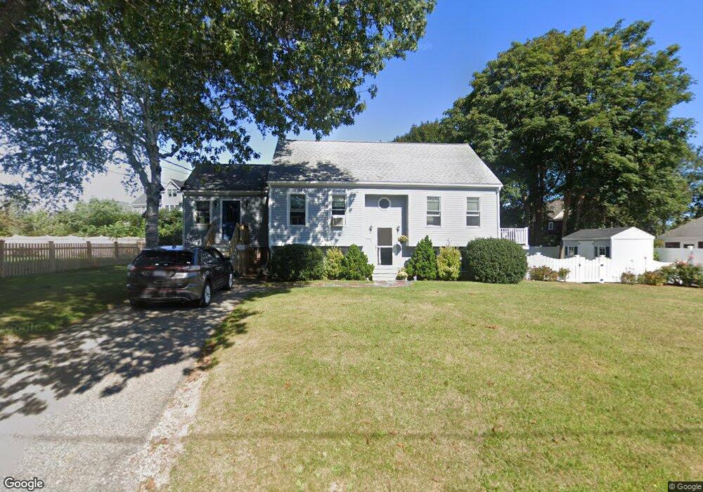
47 Marion Road Extension Scituate, MA 02066
Estimated Value: $792,662 - $1,024,000
2
Beds
2
Baths
1,735
Sq Ft
$513/Sq Ft
Est. Value
About This Home
This home is located at 47 Marion Road Extension, Scituate, MA 02066 and is currently estimated at $890,166, approximately $513 per square foot. 47 Marion Road Extension is a home located in Plymouth County with nearby schools including Wampatuck Elementary School, Lester J. Gates Middle School, and Scituate High School.
Ownership History
Date
Name
Owned For
Owner Type
Purchase Details
Closed on
Jun 27, 1997
Sold by
Ahern Robert W and Ahern Linda S
Bought by
Cronin Stephen J and Cronin Nancy J
Current Estimated Value
Home Financials for this Owner
Home Financials are based on the most recent Mortgage that was taken out on this home.
Original Mortgage
$169,600
Interest Rate
7.81%
Mortgage Type
Purchase Money Mortgage
Purchase Details
Closed on
May 11, 1993
Sold by
Arnold Timothy J and Arnold Debra L
Bought by
Ahern Robert W and Covert Linda S
Home Financials for this Owner
Home Financials are based on the most recent Mortgage that was taken out on this home.
Original Mortgage
$141,000
Interest Rate
7.47%
Mortgage Type
Purchase Money Mortgage
Create a Home Valuation Report for This Property
The Home Valuation Report is an in-depth analysis detailing your home's value as well as a comparison with similar homes in the area
Home Values in the Area
Average Home Value in this Area
Purchase History
| Date | Buyer | Sale Price | Title Company |
|---|---|---|---|
| Cronin Stephen J | $212,000 | -- | |
| Ahern Robert W | $161,000 | -- |
Source: Public Records
Mortgage History
| Date | Status | Borrower | Loan Amount |
|---|---|---|---|
| Open | Ahern Robert W | $173,200 | |
| Closed | Ahern Robert W | $169,600 | |
| Previous Owner | Ahern Robert W | $141,000 |
Source: Public Records
Tax History Compared to Growth
Tax History
| Year | Tax Paid | Tax Assessment Tax Assessment Total Assessment is a certain percentage of the fair market value that is determined by local assessors to be the total taxable value of land and additions on the property. | Land | Improvement |
|---|---|---|---|---|
| 2025 | $6,871 | $687,800 | $397,300 | $290,500 |
| 2024 | $6,694 | $646,100 | $361,200 | $284,900 |
| 2023 | $6,195 | $585,400 | $328,400 | $257,000 |
| 2022 | $6,195 | $490,900 | $275,200 | $215,700 |
| 2021 | $5,759 | $432,000 | $249,000 | $183,000 |
| 2020 | $5,619 | $416,200 | $239,400 | $176,800 |
| 2019 | $5,519 | $401,700 | $234,700 | $167,000 |
| 2018 | $5,679 | $407,100 | $250,300 | $156,800 |
| 2017 | $5,588 | $396,600 | $239,800 | $156,800 |
| 2016 | $5,314 | $375,800 | $219,000 | $156,800 |
| 2015 | $4,785 | $365,300 | $208,500 | $156,800 |
Source: Public Records
Map
Nearby Homes
- 86 Hatherly Rd
- 33 Oceanside Dr
- 23 Oceanside Dr
- 105 Turner Rd
- 12 Richfield Rd
- 32 Barker Rd Unit 3
- 17 Bradford Ave
- 46 Tilden Rd
- 25 Morton Place
- 76 A Brook St
- 76 A Brook St Unit 1
- 74 Branch St Unit 15
- 91 Front St Unit 106
- 33 Rosas Ln
- 23 Sunset Rd
- 54 Woodland Rd
- 50 First Parish Rd
- 48 Captain Peirce Rd
- 111 Elm St
- 3 Grace Way Unit 3
- 43 Marion Road Extension
- 115 Hatherly Rd
- 42 Marion Road Extension
- 42
- 35 Lois Ann Ct Unit 127
- 119 Hatherly Rd
- 119 Hatherly Rd Unit 119
- 33 Lois Ann Ct Unit 128
- 111 Hatherly Rd
- 48 Marion Road Extension
- 39 Marion Road Extension
- 31 Lois Ann Ct Unit 129
- 38 Marion Road Extension
- 29 Lois Ann Ct Unit 130
- 107 Hatherly Rd
- 105 Hatherly Rd
- 35 Marion Road Extension
- 109 Hatherly Rd
- 55 Marion Rd
- 55 Marion Rd Unit sf