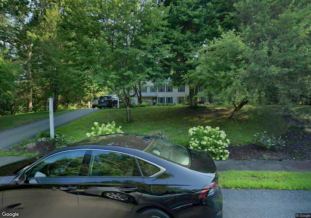
47 Robinson Creek Rd Pembroke, MA 02359
Estimated Value: $929,000 - $1,185,000
5
Beds
4
Baths
5,268
Sq Ft
$206/Sq Ft
Est. Value
About This Home
This home is located at 47 Robinson Creek Rd, Pembroke, MA 02359 and is currently estimated at $1,087,359, approximately $206 per square foot. 47 Robinson Creek Rd is a home located in Plymouth County with nearby schools including Pembroke High School and Cardinal Cushing Centers.
Ownership History
Date
Name
Owned For
Owner Type
Purchase Details
Closed on
Jul 20, 2018
Sold by
Cross Rt
Bought by
Rushing Matthew and Rushing Jessica
Current Estimated Value
Home Financials for this Owner
Home Financials are based on the most recent Mortgage that was taken out on this home.
Original Mortgage
$660,900
Outstanding Balance
$572,769
Interest Rate
4.5%
Mortgage Type
VA
Estimated Equity
$514,590
Purchase Details
Closed on
Jun 21, 2004
Sold by
Cross Gerd A and Cross Noel D
Bought by
Cross Rt and Cross Gerd A
Create a Home Valuation Report for This Property
The Home Valuation Report is an in-depth analysis detailing your home's value as well as a comparison with similar homes in the area
Home Values in the Area
Average Home Value in this Area
Purchase History
| Date | Buyer | Sale Price | Title Company |
|---|---|---|---|
| Rushing Matthew | $680,000 | -- | |
| Cross Rt | -- | -- |
Source: Public Records
Mortgage History
| Date | Status | Borrower | Loan Amount |
|---|---|---|---|
| Open | Rushing Matthew | $660,900 | |
| Previous Owner | Cross Rt | $75,000 |
Source: Public Records
Tax History Compared to Growth
Tax History
| Year | Tax Paid | Tax Assessment Tax Assessment Total Assessment is a certain percentage of the fair market value that is determined by local assessors to be the total taxable value of land and additions on the property. | Land | Improvement |
|---|---|---|---|---|
| 2025 | $11,099 | $923,400 | $328,500 | $594,900 |
| 2024 | $11,015 | $915,600 | $323,300 | $592,300 |
| 2023 | $10,372 | $815,400 | $298,500 | $516,900 |
| 2022 | $9,871 | $697,600 | $237,700 | $459,900 |
| 2021 | $9,891 | $678,400 | $232,500 | $445,900 |
| 2020 | $9,714 | $670,400 | $232,500 | $437,900 |
| 2019 | $9,284 | $635,900 | $222,300 | $413,600 |
| 2018 | $9,116 | $612,200 | $222,300 | $389,900 |
| 2017 | $9,037 | $598,500 | $207,500 | $391,000 |
| 2016 | $8,834 | $578,900 | $197,500 | $381,400 |
| 2015 | $7,908 | $536,500 | $187,500 | $349,000 |
Source: Public Records
Map
Nearby Homes
- 31 Hillcrest Dr
- 66 Hemlock Dr
- 218 Schoosett St
- 21 Union St
- 5 Royal Dane Dr Unit 46
- 46 Lorna Ave
- 10 Royal Dane Dr Unit 88
- 21 Chowdermarch St
- 451 School St Unit 5-2
- 261 Washington St
- 15 Kings Terrace
- 172 Washington St
- 33 Barker Square Dr Unit 33
- 133 Brigantine Cir
- 17 Sherman Way
- 15 Bagnell Dr Unit 15
- 387 North St
- 55 Shipyard Ln
- 547 Washington St Unit A10
- 2 Proprietors Dr Unit 23
- 41 Robinson Creek Rd
- 53 Robinson Creek Rd
- 56 Robinson Creek Rd
- 35 Robinson Creek Rd
- 46 Robinson Creek Rd
- 50 Robinson Creek Rd
- 40 Robinson Creek Rd
- 34 Robinson Creek Rd
- 130 Corporate Park Dr
- 29 Robinson Creek Rd
- 5 Captain North Way
- 150 Corporate Park Dr
- 23 Robinson Creek Rd
- 100 Corporate Park Dr
- 11 Captain North Way
- 4 Captain North Way
- 17 Robinson Creek Rd
- 17 Captain North Way
- 17 Captain Way N
- 8 Captain North Way