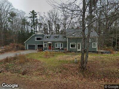
47 Rossmore Rd Brunswick, ME 04011
Estimated Value: $551,007 - $693,000
3
Beds
4
Baths
2,202
Sq Ft
$273/Sq Ft
Est. Value
About This Home
This home is located at 47 Rossmore Rd, Brunswick, ME 04011 and is currently estimated at $600,752, approximately $272 per square foot. 47 Rossmore Rd is a home located in Cumberland County with nearby schools including Kate Furbish Elementary School, Brunswick Jr High School, and Brunswick High School.
Ownership History
Date
Name
Owned For
Owner Type
Purchase Details
Closed on
Nov 14, 2018
Sold by
Rooney Edward F
Bought by
Rooney Edward F and Cannon Patricia J
Current Estimated Value
Home Financials for this Owner
Home Financials are based on the most recent Mortgage that was taken out on this home.
Original Mortgage
$75,000
Interest Rate
4.9%
Mortgage Type
Unknown
Purchase Details
Closed on
Nov 5, 2018
Sold by
Rooney Edward F
Bought by
Rooney Edward F and Cannon Patricia J
Home Financials for this Owner
Home Financials are based on the most recent Mortgage that was taken out on this home.
Original Mortgage
$75,000
Interest Rate
4.9%
Mortgage Type
Unknown
Create a Home Valuation Report for This Property
The Home Valuation Report is an in-depth analysis detailing your home's value as well as a comparison with similar homes in the area
Home Values in the Area
Average Home Value in this Area
Purchase History
| Date | Buyer | Sale Price | Title Company |
|---|---|---|---|
| Rooney Edward F | -- | -- |
Source: Public Records
Mortgage History
| Date | Status | Borrower | Loan Amount |
|---|---|---|---|
| Open | Rooney Edward F | $400,000 | |
| Closed | Rooney Edward F | $75,000 |
Source: Public Records
Tax History Compared to Growth
Tax History
| Year | Tax Paid | Tax Assessment Tax Assessment Total Assessment is a certain percentage of the fair market value that is determined by local assessors to be the total taxable value of land and additions on the property. | Land | Improvement |
|---|---|---|---|---|
| 2024 | $5,745 | $240,900 | $68,900 | $172,000 |
| 2023 | $5,611 | $240,900 | $68,900 | $172,000 |
| 2022 | $5,212 | $240,300 | $68,900 | $171,400 |
| 2021 | $5,013 | $240,300 | $68,900 | $171,400 |
| 2020 | $4,895 | $240,300 | $68,900 | $171,400 |
| 2019 | $4,687 | $237,700 | $68,900 | $168,800 |
| 2018 | $4,497 | $237,700 | $68,900 | $168,800 |
| 2017 | $4,367 | $237,700 | $68,900 | $168,800 |
| 2016 | $4,294 | $146,300 | $32,400 | $113,900 |
| 2015 | $4,138 | $145,900 | $32,400 | $113,500 |
| 2014 | $3,809 | $146,000 | $32,500 | $113,500 |
| 2013 | -- | $146,000 | $32,500 | $113,500 |
Source: Public Records
Map
Nearby Homes
- 80 Scarponi Dr
- 38 Lynch St
- 67 Scarponi Dr
- 22 Amos Way
- 10 Kurt St
- 3 Sagamore Ln
- 121 Old Pennellville Rd
- 667 & 669 Mere Point
- 5 Round Hill Ln
- 360 Church Rd
- 18 Zeitler Farm Rd
- 4 Parsons Farm Rd
- 16 Laurel Rd
- 7 Fiddlehead Fern Trail Unit 7
- 4 Pepperberry Path Unit 14
- 468 Harpswell Rd
- 60 County Crossing
- 0 Woodside Rd
- 26 Forest Terrace
- 9 Shulman Dr