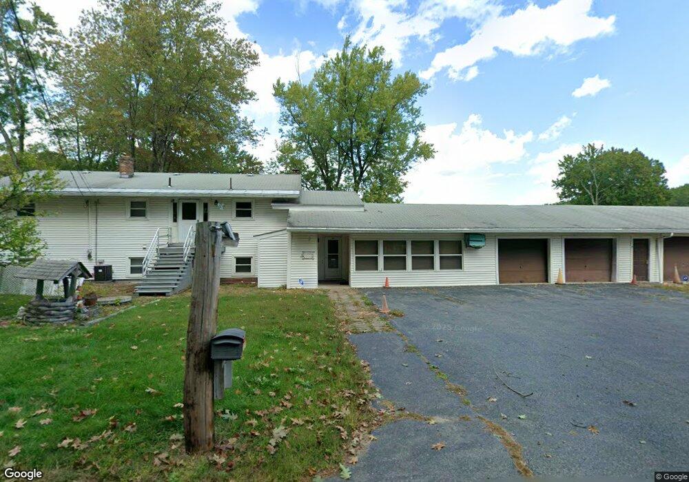
47 Round Rd Lunenburg, MA 01462
Estimated Value: $717,000 - $1,032,000
6
Beds
2
Baths
1,584
Sq Ft
$553/Sq Ft
Est. Value
About This Home
This home is located at 47 Round Rd, Lunenburg, MA 01462 and is currently estimated at $875,914, approximately $552 per square foot. 47 Round Rd is a home located in Worcester County with nearby schools including Lunenburg Primary School and Lunenburg High School.
Ownership History
Date
Name
Owned For
Owner Type
Purchase Details
Closed on
Jun 2, 2016
Sold by
Normandin James and Normandin Elaine
Bought by
Normandin Elaine
Current Estimated Value
Purchase Details
Closed on
May 16, 2016
Sold by
Normandin James and Normandin Elaine
Bought by
Normandin Elaine
Purchase Details
Closed on
Jun 1, 2015
Sold by
Normandin T
Bought by
Normandin Elaine
Purchase Details
Closed on
Jul 17, 2009
Sold by
Normandin Elaine
Bought by
Normandin T and Normandin James
Create a Home Valuation Report for This Property
The Home Valuation Report is an in-depth analysis detailing your home's value as well as a comparison with similar homes in the area
Home Values in the Area
Average Home Value in this Area
Purchase History
| Date | Buyer | Sale Price | Title Company |
|---|---|---|---|
| Normandin Elaine | -- | -- | |
| Normandin Elaine | -- | -- | |
| Normandin Elaine | -- | -- | |
| Normandin Elaine | -- | -- | |
| Normandin T | -- | -- |
Source: Public Records
Tax History Compared to Growth
Tax History
| Year | Tax Paid | Tax Assessment Tax Assessment Total Assessment is a certain percentage of the fair market value that is determined by local assessors to be the total taxable value of land and additions on the property. | Land | Improvement |
|---|---|---|---|---|
| 2025 | $12,900 | $898,300 | $507,100 | $391,200 |
| 2024 | $12,103 | $858,400 | $478,800 | $379,600 |
| 2023 | $13,931 | $952,900 | $588,000 | $364,900 |
| 2022 | $9,372 | $545,200 | $250,100 | $295,100 |
| 2020 | $9,955 | $549,400 | $250,800 | $298,600 |
| 2019 | $9,577 | $512,700 | $228,000 | $284,700 |
| 2018 | $8,928 | $453,200 | $217,300 | $235,900 |
| 2017 | $8,529 | $426,900 | $211,500 | $215,400 |
| 2016 | $7,801 | $397,800 | $198,300 | $199,500 |
| 2015 | -- | $374,200 | $180,300 | $193,900 |
Source: Public Records
Map
Nearby Homes
- 802 Reservoir Rd
- 12 Easter Brook Rd
- 659 Reservoir Rd
- 2 Oakes Landing
- 9 Winter Hill Rd
- 45 Spring St
- 6 Turner Ln
- 878 Flat Hill Rd
- 2038 Lunenburg Rd
- 4 Davis St
- 0 Windsor Rd
- 3 Mill St
- 11 Longwood Dr
- 53 Bridlecross Rd
- 4 Ambrose Way Unit 4
- 7 Ambrose Way Unit 5
- 6 Ambrose Way Unit 3
- 17 Ambrose Way Unit 17
- 9 Ambrose Way Unit 9
- 5 Ambrose Way Unit 5