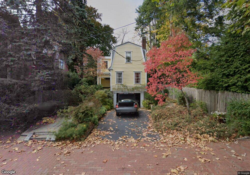
47 Sparks St Cambridge, MA 02138
West Cambridge NeighborhoodEstimated Value: $2,567,482 - $4,103,000
4
Beds
3
Baths
1,942
Sq Ft
$1,643/Sq Ft
Est. Value
About This Home
This home is located at 47 Sparks St, Cambridge, MA 02138 and is currently estimated at $3,191,121, approximately $1,643 per square foot. 47 Sparks St is a home located in Middlesex County with nearby schools including St Peter School, Cambridge Montessori School, and Cambridge Friends School.
Ownership History
Date
Name
Owned For
Owner Type
Purchase Details
Closed on
Jun 2, 2025
Sold by
Shavell Catherine E
Bought by
Catherine E Shavell Ret and Shavell
Current Estimated Value
Purchase Details
Closed on
Jul 17, 1981
Bought by
Shavell Catherine E
Create a Home Valuation Report for This Property
The Home Valuation Report is an in-depth analysis detailing your home's value as well as a comparison with similar homes in the area
Home Values in the Area
Average Home Value in this Area
Purchase History
| Date | Buyer | Sale Price | Title Company |
|---|---|---|---|
| Catherine E Shavell Ret | -- | None Available | |
| Catherine E Shavell Ret | -- | None Available | |
| Shavell Catherine E | $198,000 | -- |
Source: Public Records
Mortgage History
| Date | Status | Borrower | Loan Amount |
|---|---|---|---|
| Previous Owner | Shavell Catherine E | $35,260 | |
| Previous Owner | Shavell Catherine E | $142,000 |
Source: Public Records
Tax History Compared to Growth
Tax History
| Year | Tax Paid | Tax Assessment Tax Assessment Total Assessment is a certain percentage of the fair market value that is determined by local assessors to be the total taxable value of land and additions on the property. | Land | Improvement |
|---|---|---|---|---|
| 2025 | $15,272 | $2,405,000 | $1,626,800 | $778,200 |
| 2024 | $13,964 | $2,358,700 | $1,613,800 | $744,900 |
| 2023 | $13,194 | $2,251,500 | $1,607,200 | $644,300 |
| 2022 | $12,391 | $2,093,100 | $1,522,700 | $570,400 |
| 2021 | $11,664 | $1,993,800 | $1,463,400 | $530,400 |
| 2020 | $10,934 | $1,901,600 | $1,398,900 | $502,700 |
| 2019 | $9,759 | $1,642,900 | $1,178,400 | $464,500 |
| 2018 | $10,069 | $1,600,800 | $1,172,300 | $428,500 |
| 2017 | $9,900 | $1,525,500 | $1,117,900 | $407,600 |
| 2016 | $9,493 | $1,358,100 | $966,900 | $391,200 |
| 2015 | $9,823 | $1,256,100 | $906,400 | $349,700 |
| 2014 | $10,284 | $1,227,200 | $882,200 | $345,000 |
Source: Public Records
Map
Nearby Homes
- 15 Hubbard Park Rd
- 48 Hubbard Park Rd
- 153 Brattle St
- 20 Maynard Place
- 158 Brattle St
- 3 Berkeley Place
- 1010 Memorial Dr Unit 6G
- 172 Brattle St
- 12 Berkeley St
- 32 Hawthorn St
- 22 Concord Ave Unit 10
- 234 Huron Ave
- 52 Garden St Unit B2
- 44 Garden St
- 988 Memorial Dr Unit 386
- 202 Garden St
- 148 Huron Ave
- 12-14 Gray Gardens W
- 986 Memorial Dr Unit 404
- 84 Garden St
- 140 Brattle St
- 142 Brattle St
- 142 Brattle St Unit L
- 3 Hubbard Park Rd
- 138 Brattle St
- 48 Sparks St
- 50 Sparks St
- 7 Hubbard Park Rd
- 144 Brattle St
- 6 Mercer Cir
- 136 Brattle St
- 7 Mercer Cir
- 134 Brattle St
- 8 Hubbard Park Rd
- 0 Hubbard Park Rd Unit 1
- 8 Mercer Cir
- 2 Hubbard Park Rd
- 2 Hubbard Park Rd Unit 3
- 2 Hubbard Park Rd Unit 2
- 146 Brattle St