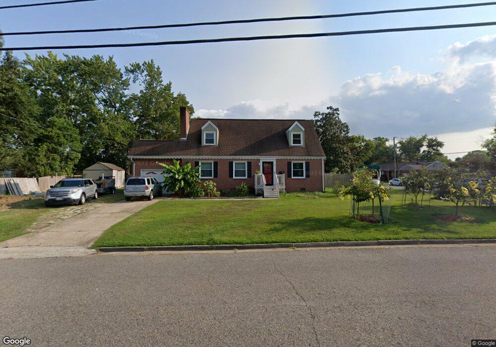
47 Stanley Dr Newport News, VA 23608
Reservoir NeighborhoodEstimated Value: $219,000 - $314,203
4
Beds
4
Baths
1,882
Sq Ft
$151/Sq Ft
Est. Value
About This Home
This home is located at 47 Stanley Dr, Newport News, VA 23608 and is currently estimated at $284,051, approximately $150 per square foot. 47 Stanley Dr is a home located in Newport News City with nearby schools including Stoney Run Elementary School, Mary Passage Middle School, and Denbigh High School.
Ownership History
Date
Name
Owned For
Owner Type
Purchase Details
Closed on
Jul 1, 2015
Sold by
Wells Fargo Financial System V
Bought by
Roum Phet and Roum Sam Koulayan
Current Estimated Value
Home Financials for this Owner
Home Financials are based on the most recent Mortgage that was taken out on this home.
Original Mortgage
$133,475
Interest Rate
4.5%
Mortgage Type
FHA
Purchase Details
Closed on
Feb 17, 2014
Sold by
Equity Trustees Llc and Bates Karen
Bought by
Va Wells Fargo Finacnial Sys
Purchase Details
Closed on
Apr 9, 2004
Sold by
Kidd Family Trustland
Bought by
Bates Thomas
Home Financials for this Owner
Home Financials are based on the most recent Mortgage that was taken out on this home.
Original Mortgage
$145,000
Interest Rate
5.6%
Mortgage Type
New Conventional
Purchase Details
Closed on
Jan 16, 2004
Sold by
Kidd Wayne L
Bought by
Kidd Family Trust
Create a Home Valuation Report for This Property
The Home Valuation Report is an in-depth analysis detailing your home's value as well as a comparison with similar homes in the area
Home Values in the Area
Average Home Value in this Area
Purchase History
| Date | Buyer | Sale Price | Title Company |
|---|---|---|---|
| Roum Phet | $116,000 | -- | |
| Va Wells Fargo Finacnial Sys | $85,842 | -- | |
| Bates Thomas | $145,000 | -- | |
| Kidd Family Trust | $91,032 | -- |
Source: Public Records
Mortgage History
| Date | Status | Borrower | Loan Amount |
|---|---|---|---|
| Previous Owner | Roum Phet | $133,475 | |
| Previous Owner | Bates Thomas | $145,000 |
Source: Public Records
Tax History Compared to Growth
Tax History
| Year | Tax Paid | Tax Assessment Tax Assessment Total Assessment is a certain percentage of the fair market value that is determined by local assessors to be the total taxable value of land and additions on the property. | Land | Improvement |
|---|---|---|---|---|
| 2025 | $3,267 | $284,800 | $66,600 | $218,200 |
| 2024 | $3,120 | $264,400 | $60,500 | $203,900 |
| 2023 | $3,175 | $256,600 | $60,500 | $196,100 |
| 2022 | $2,925 | $231,500 | $60,500 | $171,000 |
| 2021 | $2,630 | $203,500 | $55,000 | $148,500 |
| 2020 | $2,433 | $187,400 | $50,000 | $137,400 |
| 2019 | $2,333 | $179,600 | $50,000 | $129,600 |
| 2018 | $2,269 | $174,600 | $50,000 | $124,600 |
| 2017 | $2,211 | $169,800 | $50,000 | $119,800 |
| 2016 | $2,150 | $165,200 | $50,000 | $115,200 |
| 2015 | $2,144 | $165,200 | $50,000 | $115,200 |
| 2014 | $2,132 | $165,200 | $50,000 | $115,200 |
Source: Public Records
Map
Nearby Homes
- 3 Iris Ln
- 22 Lakeshore Dr
- 364 Thorncliff Dr
- 26 Woodhaven Rd
- 91 W Rexford Dr
- 17 Sandra Dr
- 103 Woodhaven Rd
- 20 Sandra Dr
- 5 Cathy Dr
- 104 W Rexford Dr
- 112 W Rexford Dr
- 139 Linda Dr
- 114 Ashton Green Blvd
- 469 Revolution Ln
- 306 Wythe St
- 502 Thorncliff Dr Unit 104
- 499 Old Colonial Way
- 32 Garfield Dr
- 564 Candle Ln
- 564 Candle Ln Unit 302