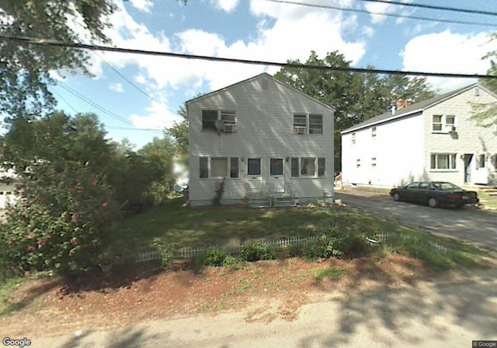
47 Westland Ave Manchester, NH 03103
Highlands NeighborhoodEstimated Value: $485,305 - $547,000
4
Beds
3
Baths
1,792
Sq Ft
$280/Sq Ft
Est. Value
About This Home
This home is located at 47 Westland Ave, Manchester, NH 03103 and is currently estimated at $501,076, approximately $279 per square foot. 47 Westland Ave is a home located in Hillsborough County with nearby schools including Bakersville School, Southside Middle School, and Manchester Memorial High School.
Ownership History
Date
Name
Owned For
Owner Type
Purchase Details
Closed on
Aug 22, 2025
Sold by
Vincent Thongjan
Bought by
Dubois Rene V and Vincent Maceo L
Current Estimated Value
Purchase Details
Closed on
Apr 17, 2000
Sold by
Patricia A Thompson Rv
Bought by
Vincent Thongjan
Home Financials for this Owner
Home Financials are based on the most recent Mortgage that was taken out on this home.
Original Mortgage
$83,300
Interest Rate
8.26%
Mortgage Type
Purchase Money Mortgage
Create a Home Valuation Report for This Property
The Home Valuation Report is an in-depth analysis detailing your home's value as well as a comparison with similar homes in the area
Home Values in the Area
Average Home Value in this Area
Purchase History
| Date | Buyer | Sale Price | Title Company |
|---|---|---|---|
| Dubois Rene V | -- | -- | |
| Vincent Thongjan | $119,000 | -- | |
| Vincent Thongjan | $119,000 | -- |
Source: Public Records
Mortgage History
| Date | Status | Borrower | Loan Amount |
|---|---|---|---|
| Previous Owner | Vincent Thongjan | $119,000 | |
| Previous Owner | Vincent Thongjan | $126,000 | |
| Previous Owner | Vincent Thongjan | $83,300 |
Source: Public Records
Tax History Compared to Growth
Tax History
| Year | Tax Paid | Tax Assessment Tax Assessment Total Assessment is a certain percentage of the fair market value that is determined by local assessors to be the total taxable value of land and additions on the property. | Land | Improvement |
|---|---|---|---|---|
| 2024 | $6,522 | $333,100 | $93,500 | $239,600 |
| 2023 | $6,282 | $333,100 | $93,500 | $239,600 |
| 2022 | $6,076 | $333,100 | $93,500 | $239,600 |
| 2021 | $5,889 | $333,100 | $93,500 | $239,600 |
| 2020 | $4,927 | $199,800 | $58,300 | $141,500 |
| 2019 | $4,859 | $199,800 | $58,300 | $141,500 |
| 2018 | $4,731 | $199,800 | $58,300 | $141,500 |
| 2017 | $4,659 | $199,800 | $58,300 | $141,500 |
| 2016 | $4,623 | $199,800 | $58,300 | $141,500 |
| 2015 | $4,336 | $185,000 | $55,300 | $129,700 |
| 2014 | $4,348 | $185,000 | $55,300 | $129,700 |
| 2013 | $4,194 | $185,000 | $55,300 | $129,700 |
Source: Public Records
Map
Nearby Homes
- 56 Robert Ct Unit H
- 118 W Hillcrest Ave
- 33 W Elmhurst Ave Unit B
- 60 W Elmwood Ave
- 80 Billings St
- 160 S Elm St
- 35 W Mitchell St
- 139 Dunbar St
- 47 Rosedale Ave
- 87 Harrington Ave
- 412 W Mitchell St
- 131 Calef Rd
- 202 Mitchell St
- 49 Harvell St Unit 9
- 161 Flint St
- 545 Calef Rd Unit 26
- 23 Plummer St
- 112 Riverdale Ave
- 52 Erie St
- 700 S Beech St