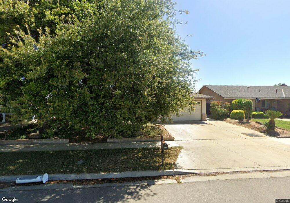
470 N Larkin Ave Fresno, CA 93727
Sunnyside NeighborhoodEstimated Value: $390,000 - $402,815
3
Beds
2
Baths
1,755
Sq Ft
$225/Sq Ft
Est. Value
About This Home
This home is located at 470 N Larkin Ave, Fresno, CA 93727 and is currently estimated at $395,454, approximately $225 per square foot. 470 N Larkin Ave is a home located in Fresno County with nearby schools including Temperance-Kutner Elementary School, Reyburn Intermediate School, and Clovis East High School.
Ownership History
Date
Name
Owned For
Owner Type
Purchase Details
Closed on
Jan 13, 2025
Sold by
Lynch Timothy D and Lynch Susan F
Bought by
Lynch Family Living Trust and Lynch
Current Estimated Value
Purchase Details
Closed on
Jul 24, 2000
Sold by
Gayle Copeland D and Gayle Deborah
Bought by
Lynch Timothy D and Lynch Susan F
Home Financials for this Owner
Home Financials are based on the most recent Mortgage that was taken out on this home.
Original Mortgage
$108,120
Interest Rate
8.12%
Mortgage Type
VA
Create a Home Valuation Report for This Property
The Home Valuation Report is an in-depth analysis detailing your home's value as well as a comparison with similar homes in the area
Home Values in the Area
Average Home Value in this Area
Purchase History
| Date | Buyer | Sale Price | Title Company |
|---|---|---|---|
| Lynch Family Living Trust | -- | None Listed On Document | |
| Lynch Timothy D | $106,000 | First American Title Ins Co |
Source: Public Records
Mortgage History
| Date | Status | Borrower | Loan Amount |
|---|---|---|---|
| Previous Owner | Lynch Timothy D | $108,120 |
Source: Public Records
Tax History Compared to Growth
Tax History
| Year | Tax Paid | Tax Assessment Tax Assessment Total Assessment is a certain percentage of the fair market value that is determined by local assessors to be the total taxable value of land and additions on the property. | Land | Improvement |
|---|---|---|---|---|
| 2025 | $1,835 | $159,698 | $37,654 | $122,044 |
| 2023 | $1,835 | $153,498 | $36,193 | $117,305 |
| 2022 | $1,773 | $150,489 | $35,484 | $115,005 |
| 2021 | $1,723 | $147,539 | $34,789 | $112,750 |
| 2020 | $1,715 | $146,027 | $34,433 | $111,594 |
| 2019 | $1,681 | $143,164 | $33,758 | $109,406 |
| 2018 | $1,643 | $140,358 | $33,097 | $107,261 |
| 2017 | $1,613 | $137,607 | $32,449 | $105,158 |
| 2016 | $1,558 | $134,910 | $31,813 | $103,097 |
| 2015 | $1,533 | $132,885 | $31,336 | $101,549 |
| 2014 | $1,504 | $130,283 | $30,723 | $99,560 |
Source: Public Records
Map
Nearby Homes
- 5576 E Belmont Ave
- 5771 E Belmont Ave
- 5527 E Grant Ave
- 5846 E Grant Ave
- 5882 E Washington Ave
- 5894 E Madison Ave
- 263 N Stanford Ave
- 6551 E Cresthaven Dr
- 5652 E Dayton Ave
- 6528 E Clingstone Dr
- 6573 E Clingstone Dr
- 6555 E Blushing Dr
- 342 N Minnewawa Ave
- 252 S Kona Ave
- 6080 E Platt Ave
- 350 S Argyle Ave Unit 103
- 350 S Argyle Ave Unit 101
- 372 S Argyle Ave Unit 102
- 5407 E Tulare St
- 851 N Filbert Ave
- 480 N Larkin Ave
- 460 N Larkin Ave
- 467 N Phillip Ave
- 477 N Phillip Ave
- 450 N Larkin Ave
- 490 N Larkin Ave
- 457 N Phillip Ave
- 487 N Phillip Ave
- 471 N Larkin Ave
- 481 N Larkin Ave
- 461 N Larkin Ave
- 447 N Phillip Ave
- 440 N Larkin Ave
- 491 N Larkin Ave
- 451 N Larkin Ave
- 437 N Phillip Ave
- 430 N Larkin Ave
- 441 N Larkin Ave
- 5671 E Madison Ave
- 5670 E Belmont Ave