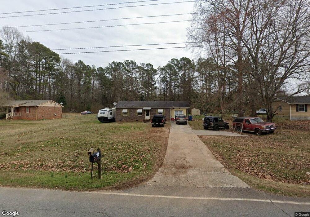
470 N Mcdonough Rd Griffin, GA 30223
Spalding County NeighborhoodEstimated Value: $116,000 - $204,000
3
Beds
2
Baths
1,107
Sq Ft
$142/Sq Ft
Est. Value
About This Home
This home is located at 470 N Mcdonough Rd, Griffin, GA 30223 and is currently estimated at $156,787, approximately $141 per square foot. 470 N Mcdonough Rd is a home located in Spalding County with nearby schools including Jackson Road Elementary School, Kennedy Road Middle School, and Spalding High School.
Ownership History
Date
Name
Owned For
Owner Type
Purchase Details
Closed on
Nov 7, 2018
Sold by
Kimbel Barbara Ann
Bought by
Dunn Lynwood Murray
Current Estimated Value
Purchase Details
Closed on
Dec 3, 1982
Sold by
Banks Johnson Const Inc
Bought by
Dunn Barbara W
Purchase Details
Closed on
Oct 21, 1982
Sold by
Ronnie Johnson Const Inc
Bought by
Banks Johnson Const Inc
Purchase Details
Closed on
May 25, 1982
Sold by
Fletcher H B
Bought by
Ronnie Johnson Const Inc
Purchase Details
Closed on
Oct 19, 1979
Sold by
Crowder Annie G
Bought by
Fletcher H B
Purchase Details
Closed on
Oct 24, 1975
Bought by
Crowder Annie G
Create a Home Valuation Report for This Property
The Home Valuation Report is an in-depth analysis detailing your home's value as well as a comparison with similar homes in the area
Home Values in the Area
Average Home Value in this Area
Purchase History
| Date | Buyer | Sale Price | Title Company |
|---|---|---|---|
| Dunn Lynwood Murray | -- | -- | |
| Dunn Barbara W | $35,600 | -- | |
| Banks Johnson Const Inc | $2,500 | -- | |
| Ronnie Johnson Const Inc | $5,000 | -- | |
| Fletcher H B | $6,600 | -- | |
| Crowder Annie G | -- | -- |
Source: Public Records
Tax History Compared to Growth
Tax History
| Year | Tax Paid | Tax Assessment Tax Assessment Total Assessment is a certain percentage of the fair market value that is determined by local assessors to be the total taxable value of land and additions on the property. | Land | Improvement |
|---|---|---|---|---|
| 2024 | $1,173 | $32,791 | $5,880 | $26,911 |
| 2023 | $1,173 | $32,791 | $5,880 | $26,911 |
| 2022 | $1,138 | $31,283 | $4,410 | $26,873 |
| 2021 | $1,002 | $27,547 | $4,410 | $23,137 |
| 2020 | $1,005 | $27,547 | $4,410 | $23,137 |
| 2019 | $1,025 | $27,547 | $4,410 | $23,137 |
| 2018 | $450 | $25,550 | $4,410 | $21,140 |
| 2017 | $614 | $25,550 | $4,410 | $21,140 |
| 2016 | $625 | $25,550 | $4,410 | $21,140 |
| 2015 | $647 | $25,550 | $4,410 | $21,140 |
| 2014 | $658 | $25,550 | $4,410 | $21,140 |
Source: Public Records
Map
Nearby Homes
- 501 Musgrove Rd
- 273 Dutchman Rd
- 0 N Mcdonough Rd Unit 10599249
- 140 Morris Mill Rd
- 230 Sapelo Rd
- 1015 N Walkers Mill Rd
- 121 Orchard Dr
- 0 Chehaw Rd Unit 10594275
- 0 Chehaw Rd Unit 10594272
- 1015 Dutchman Rd
- 2650 Jackson Rd
- 860 N Walkers Mill Rd
- 2014 High Falls Rd
- 2775 Jackson Rd
- 265 Hamil Rd Unit 31.89 AC
- 265 Hamil Rd Unit LOT 9
- 243 Hamil Rd Unit 13.18 AC
- 221 Hamil Rd Unit 12.5 AC
- 243 Hamil Rd
- 414 Allison Dr
- 472 N Mcdonough Rd
- 468 N Mcdonough Rd
- 481 N Mcdonough Rd
- 535 N Mcdonough Rd
- 462 N Mcdonough Rd
- 545 N Mcdonough Rd
- 480 N Mcdonough Rd
- 457 N Mcdonough Rd
- 507 N Mcdonough Rd
- 429 N Mcdonough Rd
- 434 N Mcdonough Rd
- 427 N Mcdonough Rd
- 585 N Mcdonough Rd
- 100 Shady Hill Ln
- 597 N Mcdonough Rd
- 606 N Mcdonough Rd
- 0 Shady Hill Ln Unit 8646976
- 0 Shady Hill Ln Unit 8547176
- 0 Shady Hill Ln Unit 9061317
- 0 Shady Hill Ln Unit 2968048