Estimated Value: $568,531 - $630,000
4
Beds
3
Baths
2,872
Sq Ft
$209/Sq Ft
Est. Value
About This Home
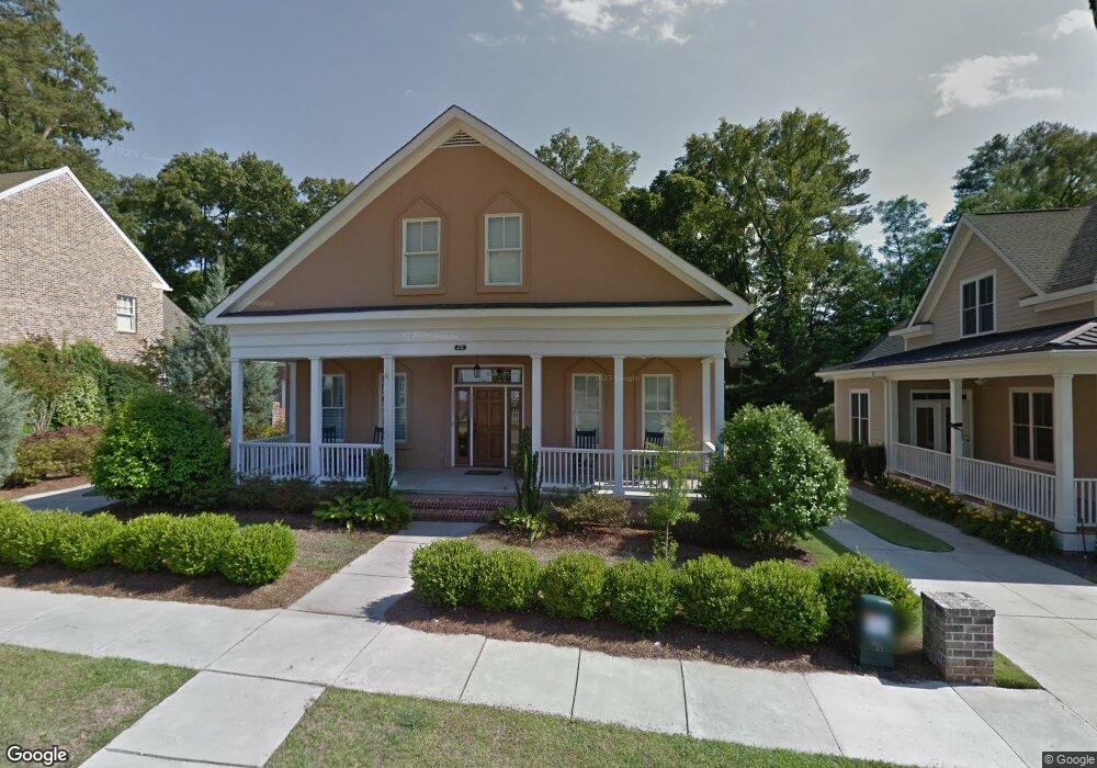
This home is located at 470 Northridge Cir, Evans, GA 30809 and is currently estimated at $601,133, approximately $209 per square foot. 470 Northridge Cir is a home located in Columbia County with nearby schools including River Ridge Elementary School, Riverside Middle School, and Lakeside High School.
Ownership History
Date
Name
Owned For
Owner Type
Purchase Details
Closed on
Nov 10, 2005
Sold by
R T Bailey Construction In
Bought by
Ballance Scott and Ballance Darra
Current Estimated Value
Home Financials for this Owner
Home Financials are based on the most recent Mortgage that was taken out on this home.
Original Mortgage
$288,915
Outstanding Balance
$156,972
Interest Rate
6%
Mortgage Type
New Conventional
Estimated Equity
$444,161
Create a Home Valuation Report for This Property
The Home Valuation Report is an in-depth analysis detailing your home's value as well as a comparison with similar homes in the area
Home Values in the Area
Average Home Value in this Area
Purchase History
| Date | Buyer | Sale Price | Title Company |
|---|---|---|---|
| Ballance Scott | $339,900 | -- |
Source: Public Records
Mortgage History
| Date | Status | Borrower | Loan Amount |
|---|---|---|---|
| Open | Ballance Scott | $288,915 |
Source: Public Records
Tax History Compared to Growth
Tax History
| Year | Tax Paid | Tax Assessment Tax Assessment Total Assessment is a certain percentage of the fair market value that is determined by local assessors to be the total taxable value of land and additions on the property. | Land | Improvement |
|---|---|---|---|---|
| 2025 | $5,578 | $233,452 | $42,704 | $190,748 |
| 2024 | $5,910 | $236,208 | $40,304 | $195,904 |
| 2023 | $5,910 | $167,431 | $30,304 | $137,127 |
| 2022 | $4,347 | $167,050 | $30,304 | $136,746 |
| 2021 | $4,032 | $148,118 | $27,804 | $120,314 |
| 2020 | $3,911 | $140,743 | $26,604 | $114,139 |
| 2019 | $3,761 | $135,318 | $26,004 | $109,314 |
| 2018 | $3,673 | $131,696 | $25,404 | $106,292 |
| 2017 | $3,570 | $127,570 | $23,904 | $103,666 |
| 2016 | $3,325 | $123,184 | $18,780 | $104,404 |
| 2015 | $3,247 | $120,069 | $17,580 | $102,489 |
| 2014 | $2,928 | $106,954 | $15,980 | $90,974 |
Source: Public Records
Map
Nearby Homes
- 322 Sandhills Ln
- 303 N Sandhills Ln
- 787 Springbrook Cir
- 812 Cape Cod Ct
- 829 Woodberry Dr
- 819 Cape Cod Ct
- 854 Sparkleberry Rd
- 4489 Woodberry Ct
- 839 Prairie Ln
- 802 Sparkleberry Rd
- 800 Sparkleberry Rd
- 656 Deerwood Way
- 628 Emerald Crossing
- 612 Emerald Crossing
- 4277 Deerwood Ln
- 644 Emerald Crossing
- 1013 Emerald Place
- 936 Deercrest Cir
- 1062 Emerald Place
- 4305 Southern Pines Dr
- 468 Northridge Cir
- 466 Northridge Cir
- 4457 Dogwood Way
- 4455 Dogwood Way
- 128 Central Park Ln
- 128 S Summerville Terrace
- 120 Summerville Terrace
- 319 Summerville Terrace
- 110 Summerville Terrace
- 464 Northridge Cir
- 125 Central Park Ln
- 127 Central Park Ln
- 100 Summerville Terrace
- 323 Summerville Terrace
- 126 Central Park Ln
- 4459 Dogwood Way
- 462 Northridge Cir
- 124 Central Park Ln
- 123 Central Park Ln
- 124 S Summerville Terrace