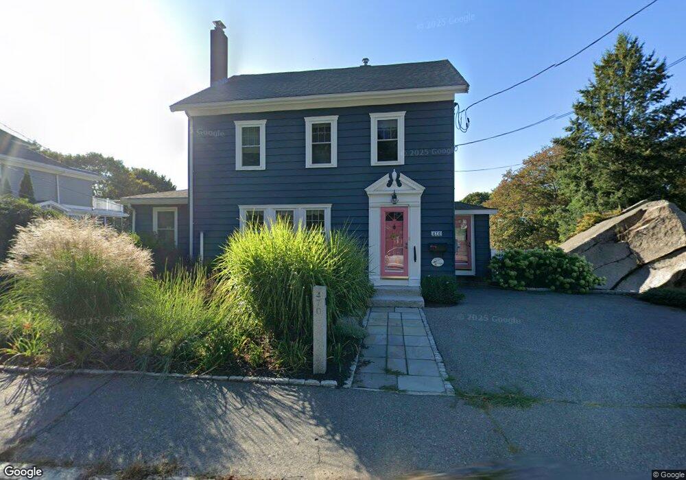
470 Washington St Gloucester, MA 01930
Estimated Value: $856,000 - $1,225,000
3
Beds
2
Baths
1,889
Sq Ft
$524/Sq Ft
Est. Value
About This Home
This home is located at 470 Washington St, Gloucester, MA 01930 and is currently estimated at $989,939, approximately $524 per square foot. 470 Washington St is a home located in Essex County with nearby schools including Beeman Memorial, Ralph B O'maley Middle School, and Gloucester High School.
Ownership History
Date
Name
Owned For
Owner Type
Purchase Details
Closed on
Apr 19, 2023
Sold by
Eliason Deborah A
Bought by
Deborah A Eliason Ret
Current Estimated Value
Purchase Details
Closed on
Apr 3, 2007
Sold by
Sartwell David A and Sartwell Mary K
Bought by
Eliason Deborah A
Home Financials for this Owner
Home Financials are based on the most recent Mortgage that was taken out on this home.
Original Mortgage
$374,000
Interest Rate
6.33%
Mortgage Type
Purchase Money Mortgage
Create a Home Valuation Report for This Property
The Home Valuation Report is an in-depth analysis detailing your home's value as well as a comparison with similar homes in the area
Purchase History
| Date | Buyer | Sale Price | Title Company |
|---|---|---|---|
| Deborah A Eliason Ret | -- | None Available | |
| Eliason Deborah A | $479,000 | -- |
Source: Public Records
Mortgage History
| Date | Status | Borrower | Loan Amount |
|---|---|---|---|
| Previous Owner | Eliason Deborah A | $322,000 | |
| Previous Owner | Eliason Deborah A | $342,000 | |
| Previous Owner | Eliason Deborah A | $32,600 | |
| Previous Owner | Eliason Deborah A | $374,000 |
Source: Public Records
Tax History
| Year | Tax Paid | Tax Assessment Tax Assessment Total Assessment is a certain percentage of the fair market value that is determined by local assessors to be the total taxable value of land and additions on the property. | Land | Improvement |
|---|---|---|---|---|
| 2025 | $8,430 | $867,300 | $347,100 | $520,200 |
| 2024 | $8,277 | $850,700 | $330,500 | $520,200 |
| 2023 | $8,127 | $767,400 | $295,100 | $472,300 |
| 2022 | $7,840 | $668,400 | $256,700 | $411,700 |
| 2021 | $7,567 | $608,300 | $233,300 | $375,000 |
| 2020 | $6,908 | $560,300 | $220,000 | $340,300 |
| 2019 | $6,695 | $527,600 | $220,000 | $307,600 |
| 2018 | $6,519 | $504,200 | $220,000 | $284,200 |
| 2017 | $6,319 | $479,100 | $209,500 | $269,600 |
| 2016 | $6,016 | $442,000 | $198,800 | $243,200 |
| 2015 | $5,779 | $423,400 | $198,800 | $224,600 |
Source: Public Records
Map
Nearby Homes
- 3 Deacon Farm Ln
- 31 Echo Ave
- 13 Honeysuckle Rd
- 2 Breezy Point Rd
- 672 Washington St
- 13 Mystic Ave
- 8 Mystic Ave
- 3 Rockland St
- 6 Monroe Ct
- 98 Maplewood Ave
- 167 Atlantic St
- 178 Atlantic St
- 9 Cleveland Place
- 12 Arthur St
- 40 Sargent St
- 226 Atlantic St
- 19 Trask St Unit 2
- 50 Warner St
- 33 Maplewood Ave Unit 310
- 15 Harvard St
- 474 Washington St
- 3 Reef Knot Way
- 468 Washington St
- 476 Washington St
- 483 Washington St
- 485 Washington St
- 464 Washington St
- 4 Reef Knot Way
- 5 Reef Knot Way
- 480 Washington St
- 489 Washington St
- 462 Washington St
- 477 Washington St
- 480A Washington St
- 491 Washington St
- 482 Washington St
- 475 Washington St
- 458 Washington St
- 497 Washington St
- 473 Washington St
Your Personal Tour Guide
Ask me questions while you tour the home.