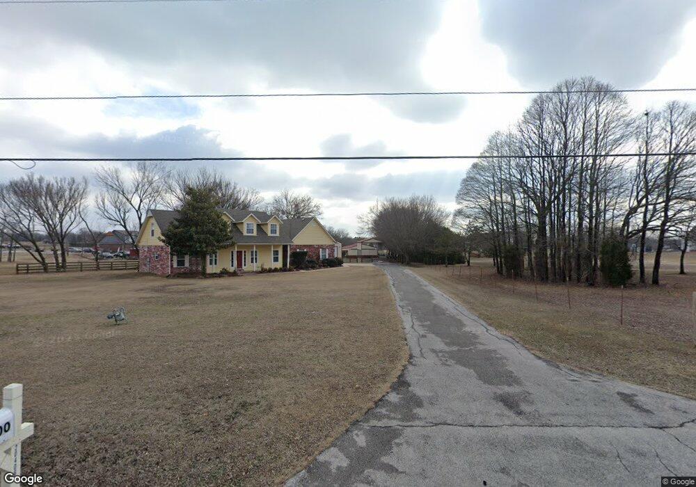
4700 E 490 Rd Claremore, OK 74019
Estimated Value: $362,689 - $451,000
3
Beds
2
Baths
2,148
Sq Ft
$185/Sq Ft
Est. Value
About This Home
This home is located at 4700 E 490 Rd, Claremore, OK 74019 and is currently estimated at $398,172, approximately $185 per square foot. 4700 E 490 Rd is a home located in Rogers County with nearby schools including Pamela Hodson Elementary School, Owasso 6th Grade Center, and Owasso 8th Grade Center.
Ownership History
Date
Name
Owned For
Owner Type
Purchase Details
Closed on
Jul 20, 2015
Sold by
Penix Terry L and Penix Pamela N
Bought by
The Terry And Pamela Penix Trust
Current Estimated Value
Purchase Details
Closed on
May 27, 2005
Sold by
American Escrow & Closing Co
Bought by
Penix Terry L and Penix Pamela N
Home Financials for this Owner
Home Financials are based on the most recent Mortgage that was taken out on this home.
Original Mortgage
$105,000
Outstanding Balance
$54,853
Interest Rate
5.87%
Mortgage Type
New Conventional
Estimated Equity
$343,319
Purchase Details
Closed on
Jan 12, 1996
Sold by
Joe Hamilton Construction~Inc
Purchase Details
Closed on
Sep 7, 1995
Sold by
Camp Clay W
Purchase Details
Closed on
Jun 22, 1994
Sold by
Wylie Construction Co
Create a Home Valuation Report for This Property
The Home Valuation Report is an in-depth analysis detailing your home's value as well as a comparison with similar homes in the area
Purchase History
| Date | Buyer | Sale Price | Title Company |
|---|---|---|---|
| The Terry And Pamela Penix Trust | -- | None Available | |
| Penix Terry L | $88,000 | None Available | |
| American Escrow & Closing Co | $88,000 | None Available | |
| -- | $127,000 | -- | |
| -- | -- | -- | |
| -- | $15,000 | -- |
Source: Public Records
Mortgage History
| Date | Status | Borrower | Loan Amount |
|---|---|---|---|
| Open | Penix Terry L | $105,000 |
Source: Public Records
Tax History
| Year | Tax Paid | Tax Assessment Tax Assessment Total Assessment is a certain percentage of the fair market value that is determined by local assessors to be the total taxable value of land and additions on the property. | Land | Improvement |
|---|---|---|---|---|
| 2025 | $2,649 | $28,044 | $6,228 | $21,816 |
| 2024 | $2,520 | $27,228 | $6,047 | $21,181 |
| 2023 | $2,520 | $26,435 | $5,721 | $20,714 |
| 2022 | $2,416 | $25,665 | $5,478 | $20,187 |
| 2021 | $2,314 | $25,665 | $5,566 | $20,099 |
| 2020 | $2,240 | $24,918 | $5,282 | $19,636 |
| 2019 | $2,174 | $24,192 | $5,031 | $19,161 |
| 2018 | $2,029 | $23,488 | $4,593 | $18,895 |
| 2017 | $1,988 | $22,139 | $3,939 | $18,200 |
| 2016 | $1,930 | $21,494 | $3,612 | $17,882 |
| 2015 | $1,902 | $20,868 | $3,267 | $17,601 |
| 2014 | $1,844 | $20,261 | $2,896 | $17,365 |
Source: Public Records
Map
Nearby Homes
- 5132 E Madison St
- 19715 E Clear Brook Rd
- 20624 S Brentwood Ave
- 5207 E Brookhaven St
- 5226 E Madison St
- 20706 S Concord Ave
- 20823 S Concord Ave
- 5225 E Norwood St
- 20903 S Richmond Ave
- 9931 N Chadford
- 19000 E Knightsbridge Rd
- 20925 S Windsor Ave
- 19837 E Woodhaven Rd
- 18509 E 100th St N
- 11738 N 194th East Ave
- 0 E 106th St N Unit 2543814
- 0 E 106th St N Unit 2546711
- 11671 N 191st Ave E
- 4728 E Hwy 20
- 11827 Valley Ave
- 5149 100th
- 4532 E 490 Rd
- 460 100th
- 8034 100th Ct
- 4668 E 490 Rd
- 4590 E 490 Rd
- 4504 E 490 Rd
- 1814 N 202nd East Ave
- 20718 S 4074 Rd
- 20718 S 4074 Rd
- 20606 S 4074 Rd
- 20558 S 4074 Rd
- 20550 S 4074 Rd
- 20551 S 4074 Rd
- 4598 E 490 Rd
- 20205 E 106th St N
- 4826 E 490 Rd
- 4669 E 490 Rd
- 19800 E 108th St N
- 20318 E 106th St N
Your Personal Tour Guide
Ask me questions while you tour the home.