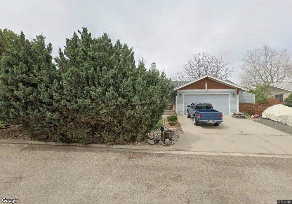
4701 Date Ct Loveland, CO 80538
Estimated Value: $537,000 - $623,000
3
Beds
3
Baths
2,352
Sq Ft
$246/Sq Ft
Est. Value
About This Home
This home is located at 4701 Date Ct, Loveland, CO 80538 and is currently estimated at $578,307, approximately $245 per square foot. 4701 Date Ct is a home located in Larimer County with nearby schools including Peakview Academy at Conrad Ball, Stansberry Elementary School, and Mountain View High School.
Ownership History
Date
Name
Owned For
Owner Type
Purchase Details
Closed on
Sep 29, 2011
Sold by
Benson Douglas R and Benson Myra J
Bought by
Hein Joseph M and Hein Christiana A
Current Estimated Value
Home Financials for this Owner
Home Financials are based on the most recent Mortgage that was taken out on this home.
Original Mortgage
$193,600
Outstanding Balance
$132,931
Interest Rate
4.24%
Mortgage Type
New Conventional
Estimated Equity
$445,376
Purchase Details
Closed on
Jun 16, 1999
Sold by
Benson Douglas and Benson Myra
Bought by
Benson Douglas R and Benson Myra J
Home Financials for this Owner
Home Financials are based on the most recent Mortgage that was taken out on this home.
Original Mortgage
$90,000
Interest Rate
7.02%
Purchase Details
Closed on
Jul 1, 1998
Sold by
Asnicar Richard J and Wehrer Helen C
Bought by
Benson Douglas and Benson Myra
Create a Home Valuation Report for This Property
The Home Valuation Report is an in-depth analysis detailing your home's value as well as a comparison with similar homes in the area
Home Values in the Area
Average Home Value in this Area
Purchase History
| Date | Buyer | Sale Price | Title Company |
|---|---|---|---|
| Hein Joseph M | $242,000 | Tggt | |
| Benson Douglas R | -- | -- | |
| Benson Douglas | $38,500 | -- |
Source: Public Records
Mortgage History
| Date | Status | Borrower | Loan Amount |
|---|---|---|---|
| Open | Hein Joseph M | $193,600 | |
| Previous Owner | Benson Douglas R | $90,000 |
Source: Public Records
Tax History Compared to Growth
Tax History
| Year | Tax Paid | Tax Assessment Tax Assessment Total Assessment is a certain percentage of the fair market value that is determined by local assessors to be the total taxable value of land and additions on the property. | Land | Improvement |
|---|---|---|---|---|
| 2025 | $3,114 | $41,299 | $13,400 | $27,899 |
| 2024 | $3,006 | $41,299 | $13,400 | $27,899 |
| 2022 | $2,469 | $30,733 | $9,730 | $21,003 |
| 2021 | $2,534 | $31,617 | $10,010 | $21,607 |
| 2020 | $2,292 | $28,600 | $10,010 | $18,590 |
| 2019 | $2,254 | $28,600 | $10,010 | $18,590 |
| 2018 | $2,247 | $27,079 | $7,560 | $19,519 |
| 2017 | $1,939 | $27,079 | $7,560 | $19,519 |
| 2016 | $1,666 | $22,503 | $3,980 | $18,523 |
| 2015 | $1,652 | $27,090 | $3,980 | $23,110 |
| 2014 | $1,819 | $23,980 | $4,270 | $19,710 |
Source: Public Records
Map
Nearby Homes
- 584 Sunwood Dr
- 4386 Suncreek Dr
- 4342 Sunridge Dr
- 4789 Sunvalley Dr
- 4453 N Lincoln Ave
- 324 Sagewood Dr
- 204 E 50th St
- 171 E 42nd St Unit C
- 127 Juniper Place
- 126 Juniper Place
- 119 E 42nd St Unit 3B
- 132 W 47th Place Unit 1
- 138 Juniper Place
- 307 Juniper Place
- 4384 Grant Ave
- 420 E 57th St Unit 163
- 420 E 57th St Unit 203
- 420 E 57th St Unit 297
- 420 E 57th St Unit 104
- 420 E 57th St Unit 6
- 713 Engleman Place
- 801 Engleman Place
- 712 Engleman Place
- 804 Engleman Place
- 4704 Date Ct
- 709 Engleman Place
- 800 Engleman Place
- 805 Engleman Place
- 4713 Date Ct
- 710 Engleman Place
- 4708 Date Ct
- 808 Engleman Place
- 716 Knobcone Place
- 812 Engleman Place
- 708 Engleman Place
- 4717 Date Ct
- 809 Engleman Place
- 900 Engleman Place
- 4712 Date Ct
- 712 Knobcone Place