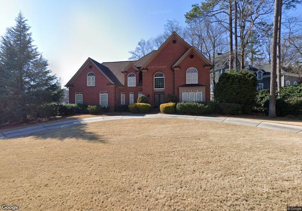
4703 Berwick Trace Marietta, GA 30068
East Cobb NeighborhoodEstimated Value: $968,000 - $1,311,000
4
Beds
5
Baths
6,313
Sq Ft
$188/Sq Ft
Est. Value
About This Home
This home is located at 4703 Berwick Trace, Marietta, GA 30068 and is currently estimated at $1,189,608, approximately $188 per square foot. 4703 Berwick Trace is a home located in Cobb County with nearby schools including Mount Bethel Elementary School, Dickerson Middle School, and Walton High School.
Ownership History
Date
Name
Owned For
Owner Type
Purchase Details
Closed on
Jan 23, 2012
Sold by
Fortier Gary S
Bought by
Fortier Gary S and Fortier Sarah H
Current Estimated Value
Purchase Details
Closed on
Mar 26, 2010
Sold by
Harper Lawrence E and Harper Judy L
Bought by
Fortier Gary S
Home Financials for this Owner
Home Financials are based on the most recent Mortgage that was taken out on this home.
Original Mortgage
$516,000
Interest Rate
4.5%
Mortgage Type
New Conventional
Create a Home Valuation Report for This Property
The Home Valuation Report is an in-depth analysis detailing your home's value as well as a comparison with similar homes in the area
Home Values in the Area
Average Home Value in this Area
Purchase History
| Date | Buyer | Sale Price | Title Company |
|---|---|---|---|
| Fortier Gary S | -- | -- | |
| Fortier Gary S | $645,000 | -- |
Source: Public Records
Mortgage History
| Date | Status | Borrower | Loan Amount |
|---|---|---|---|
| Previous Owner | Fortier Gary S | $516,000 |
Source: Public Records
Tax History Compared to Growth
Tax History
| Year | Tax Paid | Tax Assessment Tax Assessment Total Assessment is a certain percentage of the fair market value that is determined by local assessors to be the total taxable value of land and additions on the property. | Land | Improvement |
|---|---|---|---|---|
| 2025 | $10,281 | $389,140 | $92,000 | $297,140 |
| 2024 | $10,289 | $389,140 | $92,000 | $297,140 |
| 2023 | $9,349 | $370,856 | $80,000 | $290,856 |
| 2022 | $9,448 | $347,252 | $80,000 | $267,252 |
| 2021 | $9,292 | $340,156 | $80,000 | $260,156 |
| 2020 | $8,327 | $296,084 | $80,000 | $216,084 |
| 2019 | $8,327 | $296,084 | $80,000 | $216,084 |
| 2018 | $8,327 | $296,084 | $80,000 | $216,084 |
| 2017 | $8,196 | $307,372 | $78,000 | $229,372 |
| 2016 | $8,203 | $307,372 | $78,000 | $229,372 |
| 2015 | $8,390 | $307,372 | $78,000 | $229,372 |
| 2014 | $8,454 | $307,372 | $0 | $0 |
Source: Public Records
Map
Nearby Homes
- 1420 Lafayette Ln
- 1448 Heritage Glen Dr
- 4528 Lashley Ct NE
- 4580 Roswell Rd
- 4871 Karls Gate Dr
- 5000 Lakeland Dr
- 909 Otter Way NE
- 748 Olde Towne Ln
- 742 Olde Towne Ln
- 5197 Forest Brook Pkwy
- 5184 Deering Trail Unit 2
- 4599 Lasalle Ct Unit 8A
- 4831 Emmitt Point NE
- 748 Noble Oak Dr
- 5157 Forest Brook Pkwy
- 767 Hadley Ln NE
- 861 Chestnut Lake Dr NE
- 0 Broxbourne Dr Unit 7101227
- 0 Broxbourne Dr Unit 7055760
- 0 Broxbourne Dr Unit 8825891
- 0 Broxbourne Dr Unit 8873536
- 4782 Broxbourne Dr
- 4701 Berwick Trace
- 4785 Broxbourne Dr
- 4783 Broxbourne Dr
- 4702 Berwick Trace
- 4787 Broxbourne Dr
- 4700 Berwick Trace
- 4780 Broxbourne Dr
- 4789 Broxbourne Dr
- 4781 Broxbourne Dr
- 4788 Broxbourne Dr
- 1307 Amherst Ct Unit 2
- 4779 Broxbourne Dr
- 4778 Broxbourne Dr
- 1209 Lexham Dr
- 4793 Broxbourne Dr