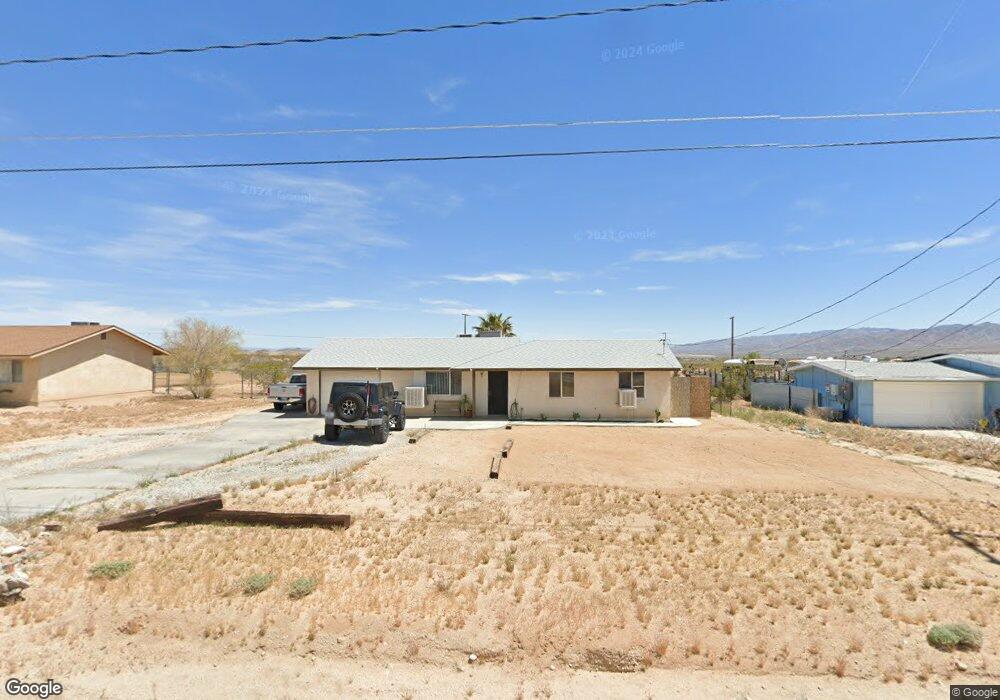
4705 Avenida la Mirada Joshua Tree, CA 92252
Estimated Value: $277,558 - $445,000
2
Beds
1
Bath
864
Sq Ft
$386/Sq Ft
Est. Value
About This Home
This home is located at 4705 Avenida la Mirada, Joshua Tree, CA 92252 and is currently estimated at $333,390, approximately $385 per square foot. 4705 Avenida la Mirada is a home located in San Bernardino County with nearby schools including Joshua Tree Elementary School, La Contenta Middle School, and Yucca Valley High School.
Ownership History
Date
Name
Owned For
Owner Type
Purchase Details
Closed on
May 24, 2018
Sold by
Arbuckle Dennis and Arbuckle Diana J
Bought by
Arbuckle Christopher Lee
Current Estimated Value
Home Financials for this Owner
Home Financials are based on the most recent Mortgage that was taken out on this home.
Original Mortgage
$108,000
Outstanding Balance
$93,205
Interest Rate
4.5%
Mortgage Type
VA
Estimated Equity
$240,185
Purchase Details
Closed on
Dec 7, 2005
Sold by
Anderson Harold W
Bought by
Arbuckle Dennis and Arbuckle Diana J
Home Financials for this Owner
Home Financials are based on the most recent Mortgage that was taken out on this home.
Original Mortgage
$109,600
Interest Rate
6.16%
Mortgage Type
Fannie Mae Freddie Mac
Create a Home Valuation Report for This Property
The Home Valuation Report is an in-depth analysis detailing your home's value as well as a comparison with similar homes in the area
Home Values in the Area
Average Home Value in this Area
Purchase History
| Date | Buyer | Sale Price | Title Company |
|---|---|---|---|
| Arbuckle Christopher Lee | $108,000 | Chicago Title Company | |
| Arbuckle Dennis | $137,000 | Fidelity National Title Co |
Source: Public Records
Mortgage History
| Date | Status | Borrower | Loan Amount |
|---|---|---|---|
| Open | Arbuckle Christopher Lee | $108,000 | |
| Previous Owner | Arbuckle Dennis | $109,600 |
Source: Public Records
Tax History Compared to Growth
Tax History
| Year | Tax Paid | Tax Assessment Tax Assessment Total Assessment is a certain percentage of the fair market value that is determined by local assessors to be the total taxable value of land and additions on the property. | Land | Improvement |
|---|---|---|---|---|
| 2025 | $1,617 | $122,886 | $24,577 | $98,309 |
| 2024 | $1,617 | $120,476 | $24,095 | $96,381 |
| 2023 | $1,585 | $118,114 | $23,623 | $94,491 |
| 2022 | $1,553 | $115,798 | $23,160 | $92,638 |
| 2021 | $1,533 | $113,528 | $22,706 | $90,822 |
| 2020 | $1,519 | $112,364 | $22,473 | $89,891 |
| 2019 | $1,597 | $110,160 | $22,032 | $88,128 |
| 2018 | $1,131 | $84,100 | $21,300 | $62,800 |
| 2017 | $1,065 | $78,200 | $19,800 | $58,400 |
| 2016 | $1,011 | $73,800 | $18,700 | $55,100 |
| 2015 | $950 | $71,000 | $18,000 | $53,000 |
| 2014 | $992 | $71,000 | $18,000 | $53,000 |
Source: Public Records
Map
Nearby Homes
- 4742 Avenida la Mirada
- 4805 Avenida la Mirada
- 4758 Avenue La Flora Desierta
- 4854 Avenida la Mirada
- 4742 Avenida la Flora Desierta
- 4869 Avenida la Manana
- 4601 Avenida la Espana Daga
- 4757 Avenida la Espana Daga
- 6001522000 Avenue La Espana Daga
- 4444 Avenue La Candela
- 0 Broadway St Unit SN25187022
- 0 Broadway St Unit NP24151597
- 0 Broadway St Unit SB25119800
- 4375 Sunburst (9 77 Acres) Ave
- 4741 Avenida Del Sol
- 4838 Avenida la Mirada
- 4762 Avenida Del Sol
- 4574 Avenida Del Sol
- 62259 Dixie Ln
- 2700 Avenida Del Sol
- 4691 Avenida la Mirada
- 4719 Avenida la Mirada
- 4677 Avenida la Mirada
- 4733 Avenida la Mirada
- 4710 Avenida la Mirada
- 4694 Avenida la Mirada
- 62075 Calle Las Sierras
- 4747 Avenida la Mirada
- 4680 Avenida la Mirada
- 4761 Avenida la Mirada
- 4747 Sunburst St
- 4689 Avenida la Manana
- 4731 Avenida la Manana
- 4775 Avenida la Mirada
- 4638 Avenida la Mirada
- 4743 Avenida la Manana
- 4661 Avenida la Manana
- 4625 Avenida la Mirada
- 4774 N Avenida la
- 4789 Avenida la Mirada