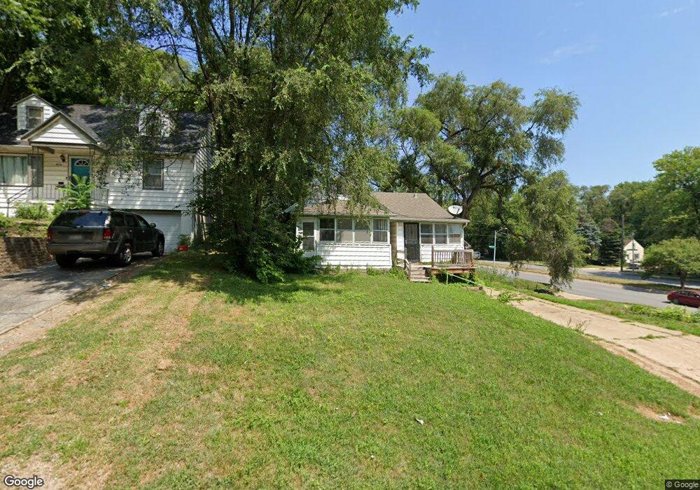
4706 Parker St Omaha, NE 68104
Military Avenue NeighborhoodEstimated Value: $169,000 - $226,751
3
Beds
3
Baths
2,045
Sq Ft
$98/Sq Ft
Est. Value
About This Home
This home is located at 4706 Parker St, Omaha, NE 68104 and is currently estimated at $200,188, approximately $97 per square foot. 4706 Parker St is a home located in Douglas County with nearby schools including Walnut Hill Elementary School, Lewis & Clark Middle School, and Benson Magnet High School.
Ownership History
Date
Name
Owned For
Owner Type
Purchase Details
Closed on
Sep 18, 2023
Sold by
5109 Real Estate Llc
Bought by
Queen Jonathon L
Current Estimated Value
Purchase Details
Closed on
Feb 7, 2014
Sold by
Dalton Brenda J and Dalton Justin
Bought by
Dal Equities Llc
Purchase Details
Closed on
Jul 15, 2005
Sold by
Wells Fargo Bank
Bought by
Dal Equities
Purchase Details
Closed on
Jul 14, 2005
Sold by
Mers
Bought by
Wells Fargo Bank
Purchase Details
Closed on
Mar 16, 2005
Sold by
Camille Hawk
Bought by
Mortgage Electronic Tregistration Systerms In
Purchase Details
Closed on
Jul 11, 2003
Sold by
Cronin Terry P and Cronin Marissa
Bought by
Miller Pamela S
Home Financials for this Owner
Home Financials are based on the most recent Mortgage that was taken out on this home.
Original Mortgage
$105,400
Interest Rate
8.35%
Mortgage Type
Purchase Money Mortgage
Create a Home Valuation Report for This Property
The Home Valuation Report is an in-depth analysis detailing your home's value as well as a comparison with similar homes in the area
Home Values in the Area
Average Home Value in this Area
Purchase History
| Date | Buyer | Sale Price | Title Company |
|---|---|---|---|
| Queen Jonathon L | $135,000 | Nebraska Title | |
| Dal Equities Llc | -- | None Available | |
| Dal Equities | $55,000 | -- | |
| Wells Fargo Bank | $55,000 | -- | |
| Mortgage Electronic Tregistration Systerms In | $89,300 | -- | |
| Miller Pamela S | $120,000 | -- |
Source: Public Records
Mortgage History
| Date | Status | Borrower | Loan Amount |
|---|---|---|---|
| Previous Owner | Miller Pamela S | $105,400 |
Source: Public Records
Tax History Compared to Growth
Tax History
| Year | Tax Paid | Tax Assessment Tax Assessment Total Assessment is a certain percentage of the fair market value that is determined by local assessors to be the total taxable value of land and additions on the property. | Land | Improvement |
|---|---|---|---|---|
| 2025 | $2,070 | $127,600 | $24,800 | $102,800 |
| 2024 | $2,644 | $127,600 | $24,800 | $102,800 |
| 2023 | $2,644 | $125,300 | $24,800 | $100,500 |
| 2022 | $2,675 | $125,300 | $24,800 | $100,500 |
| 2021 | $1,744 | $82,400 | $24,800 | $57,600 |
| 2020 | $1,764 | $82,400 | $24,800 | $57,600 |
| 2019 | $1,321 | $61,500 | $6,800 | $54,700 |
| 2018 | $1,363 | $63,400 | $6,800 | $56,600 |
| 2017 | $1,370 | $63,400 | $6,800 | $56,600 |
| 2016 | $1,360 | $63,400 | $6,800 | $56,600 |
| 2015 | $1,755 | $63,400 | $6,800 | $56,600 |
| 2014 | $1,755 | $82,900 | $6,800 | $76,100 |
Source: Public Records
Map
Nearby Homes
- 1825 NW Radial Hwy
- 4523 Blondo St
- 2016 N 48th St
- 4719 Grant St
- 2002 N 45th St
- 2214 N 48th St
- 4537 Franklin St
- 1801 N 49th St
- 2031 N 49th St
- 1721 N 49th St
- 4548 Seward St
- 2321 N 49th St
- 2318 N 49th St
- 4855 NW Radial Hwy
- 2408 N 49th St
- 2476 N 47th Ave
- 2516 N 48th Ave
- 4245 Grant St
- 2525 N 48th Ave
- 2460 N 45th Ave
- 4706 Parker St
- 1900 NW Radial Hwy
- 4710 Parker St
- 2002 NW Radial Hwy
- 4720 Parker St
- 4706 Blondo St
- 4719 Parker St
- 4712 Blondo St
- 4711 Parker St
- 2006 NW Radial Hwy
- 1824 NW Radial Hwy
- 4715 Parker St
- 4724 Parker St
- 4716 Blondo St
- 1911 NW Radial Hwy
- 1901 NW Radial Hwy
- 4723 Parker St
- 4720 Blondo St
- 4530 Blondo St
- 4729 Parker St