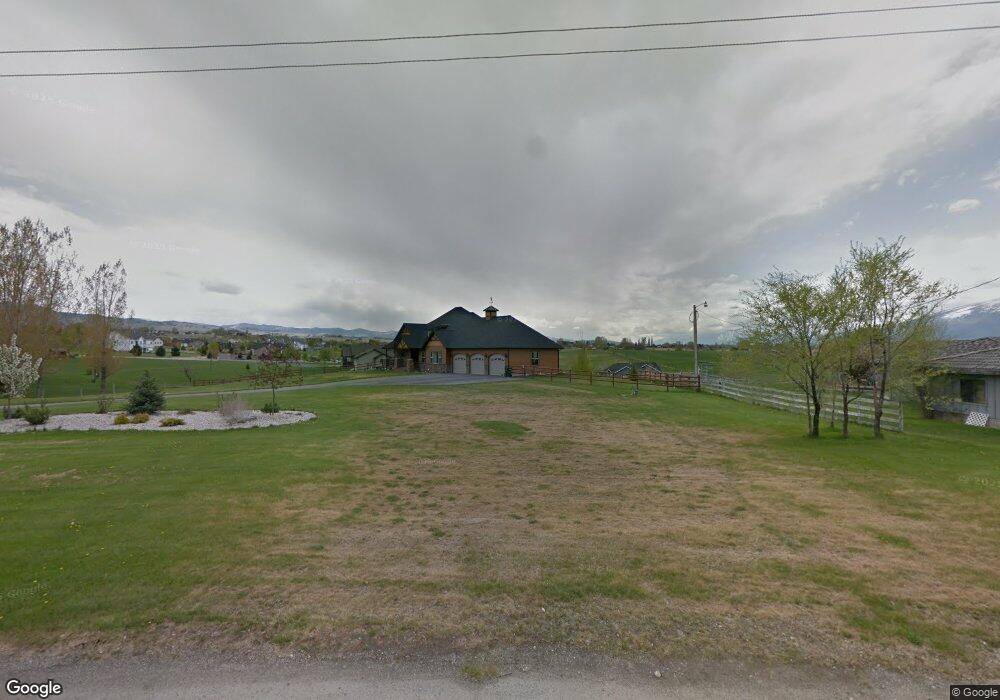
471 Cemetary Rd Corvallis, MT 59828
Estimated Value: $595,000 - $1,008,000
5
Beds
3
Baths
1,688
Sq Ft
$524/Sq Ft
Est. Value
About This Home
This home is located at 471 Cemetary Rd, Corvallis, MT 59828 and is currently estimated at $884,220, approximately $523 per square foot. 471 Cemetary Rd is a home located in Ravalli County with nearby schools including Quentin Brown Primary School and Corvallis High School.
Ownership History
Date
Name
Owned For
Owner Type
Purchase Details
Closed on
Jan 21, 2016
Bought by
Wilson Ronald Lee
Current Estimated Value
Home Financials for this Owner
Home Financials are based on the most recent Mortgage that was taken out on this home.
Original Mortgage
$100,000
Outstanding Balance
$79,428
Interest Rate
3.92%
Mortgage Type
New Conventional
Estimated Equity
$804,792
Purchase Details
Closed on
Sep 18, 1997
Bought by
Wilson Ronald Lee
Create a Home Valuation Report for This Property
The Home Valuation Report is an in-depth analysis detailing your home's value as well as a comparison with similar homes in the area
Purchase History
| Date | Buyer | Sale Price | Title Company |
|---|---|---|---|
| Wilson Ronald Lee | -- | -- | |
| Wilson Ronald Lee | -- | -- |
Source: Public Records
Mortgage History
| Date | Status | Borrower | Loan Amount |
|---|---|---|---|
| Open | Wilson Ronald Lee | $100,000 | |
| Closed | Wilson Ronald Lee | $91,900 |
Source: Public Records
Tax History
| Year | Tax Paid | Tax Assessment Tax Assessment Total Assessment is a certain percentage of the fair market value that is determined by local assessors to be the total taxable value of land and additions on the property. | Land | Improvement |
|---|---|---|---|---|
| 2025 | $3,142 | $849,500 | $0 | $0 |
| 2024 | $3,432 | $653,100 | $0 | $0 |
| 2023 | $3,526 | $653,100 | $0 | $0 |
| 2022 | $3,304 | $519,700 | $0 | $0 |
| 2021 | $3,557 | $519,700 | $0 | $0 |
| 2020 | $3,472 | $473,500 | $0 | $0 |
| 2019 | $3,412 | $473,500 | $0 | $0 |
| 2018 | $3,520 | $458,600 | $0 | $0 |
| 2017 | $3,052 | $427,700 | $0 | $0 |
| 2016 | $3,045 | $425,600 | $0 | $0 |
| 2015 | $3,007 | $425,600 | $0 | $0 |
| 2014 | $2,802 | $232,276 | $0 | $0 |
Source: Public Records
Map
Nearby Homes
- 472 Magpie Ln
- 946 Joy St
- 455 Clearview Dr
- 675 Warbler Ln
- 340 Selway View Rd
- 563 Bass Ln
- 512 Willow Ridge Way
- 344 Harold Ln
- 612 Wises Way
- Nhn Oil Well Rd
- 412 Bass Ln
- 117 Martin Dr
- 586 Little Sky Ln
- 780 Mason Ln
- 1084 Centennial Ln
- 794 Mason Ln
- 1090 Centennial Ln
- 588 Willow Creek Rd
- 446 Eagle Ln
- 894 Doty Ln
- 457 Corvallis Cemetery Rd
- 477 Cemetary Rd
- 466 Misty Vale Loop
- 468 Misty Vale Loop
- 477 Corvallis Cemetery Rd
- 479 Corvallis Cemetery Rd
- 479 Cemetery Rd
- 464 Misty Vale Loop
- 480 Misty Vale Loop
- 483 Misty Vale Loop
- 473 Misty Vale Loop
- NHN Misty Vale Loop
- 481 Cemetary Rd
- 481 Corvallis Cemetery Rd
- 477 Misty Vale Loop
- Lot 9 Misty Vale Loop
- Lot 8 Misty Vale Loop
- 3 Misty Vale Loop
- 0 Misty Vale Loop
- 4 Misty Vale Loop
Your Personal Tour Guide
Ask me questions while you tour the home.