Estimated Value: $135,000 - $145,416
--
Bed
1
Bath
1,608
Sq Ft
$87/Sq Ft
Est. Value
About This Home
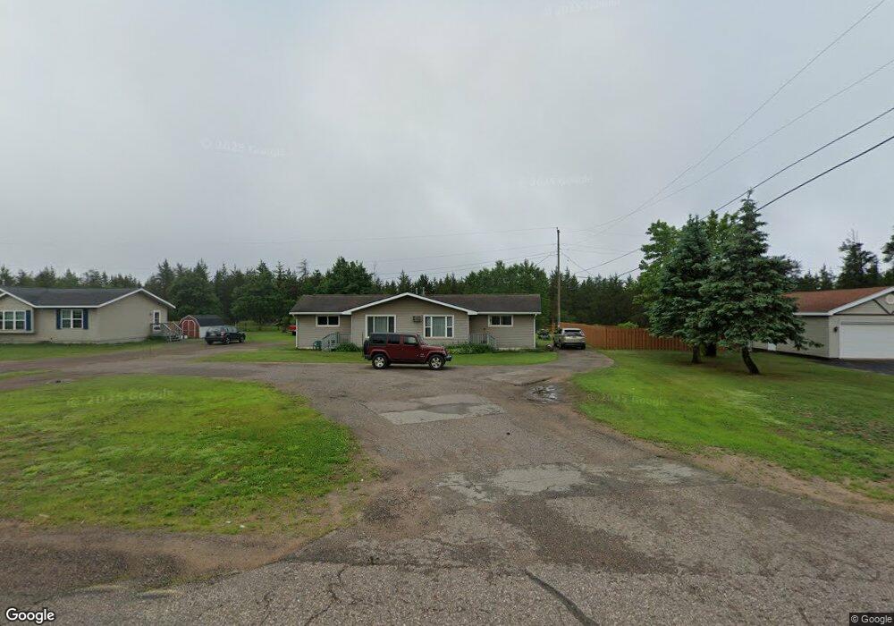
This home is located at 471 E State Highway M35, Gwinn, MI 49841 and is currently estimated at $140,208, approximately $87 per square foot. 471 E State Highway M35 is a home located in Marquette County with nearby schools including K.I. Sawyer Elementary School and Gwinn Middle/High School.
Ownership History
Date
Name
Owned For
Owner Type
Purchase Details
Closed on
Aug 22, 2025
Sold by
Donald And Brenda Host Family Trust and Host Donald C
Bought by
Balbierz Steven Jay
Current Estimated Value
Purchase Details
Closed on
Sep 25, 2024
Sold by
Host Donald C and Host Brenda S
Bought by
Donald And Brenda Host Family Trust and Host
Purchase Details
Closed on
Oct 13, 2001
Bought by
Host Donald and Host Brenda
Create a Home Valuation Report for This Property
The Home Valuation Report is an in-depth analysis detailing your home's value as well as a comparison with similar homes in the area
Home Values in the Area
Average Home Value in this Area
Purchase History
| Date | Buyer | Sale Price | Title Company |
|---|---|---|---|
| Balbierz Steven Jay | $160,000 | None Listed On Document | |
| Donald And Brenda Host Family Trust | -- | None Listed On Document | |
| Host Donald | $35,000 | -- |
Source: Public Records
Tax History Compared to Growth
Tax History
| Year | Tax Paid | Tax Assessment Tax Assessment Total Assessment is a certain percentage of the fair market value that is determined by local assessors to be the total taxable value of land and additions on the property. | Land | Improvement |
|---|---|---|---|---|
| 2025 | $4 | $48,000 | $0 | $0 |
| 2024 | $4 | $41,400 | $0 | $0 |
| 2023 | $404 | $39,100 | $0 | $0 |
| 2022 | $1,261 | $30,200 | $0 | $0 |
| 2021 | $1,222 | $31,800 | $0 | $0 |
| 2020 | $1,204 | $30,200 | $0 | $0 |
| 2019 | $1,151 | $23,900 | $0 | $0 |
| 2018 | $1,148 | $23,850 | $0 | $0 |
| 2017 | $1,096 | $23,850 | $0 | $0 |
| 2016 | $1,089 | $23,350 | $0 | $0 |
| 2015 | -- | $23,350 | $0 | $0 |
| 2014 | -- | $23,700 | $0 | $0 |
| 2012 | -- | $25,300 | $0 | $0 |
Source: Public Records
Map
Nearby Homes
- 215 Driftwood Dr
- 115 N M553
- 115 N Marshall Dr
- 171 E Sands St
- 148 E Sands St
- 71 E Stephenson Ave
- 192 Johnson Lake Rd
- Parcel 6 Off Johnson Lake Rd
- Parcel 7 Off Johnson Lake Rd
- Parcel 4 Off Johnson Lake Rd
- Parcel 8 Off Johnson Lake Rd
- on S Bertrand Lake Rd
- 353 S Johnson Lake Dr
- Parcel 1 Iron Pin Trail
- Parcel 3 Iron Pin Trail
- 149 N Spruce St
- Parcel 5 S Rice Lake Dr
- Parcel 4 S Rice Lake Dr
- Parcel 3 S Rice Lake Dr
- Parcel 2 S Rice Lake Dr
- 487 E State Highway M35 Unit 487,489,495,497
- 487 E State Highway M35 Unit 489
- 495 E State Highway M35 Unit 497
- 487 E State Highway M35 Unit 487,489,495,497
- 384 and 396 E M35
- 384 and 396 E M35
- 397 E State Highway M35
- 387 E State Highway M35
- 387 Michigan 35
- 411 E State Highway M35
- 381 E State Highway M35
- 381 E State Highway M35
- 381 E State Highway M35
- 419 E State Highway M35
- 419 E State Highway M35
- 419 E State Highway M35
- 419 Michigan 35
- TBD Off E M35
- 425 E State Highway M35
- 433 E State Highway M35