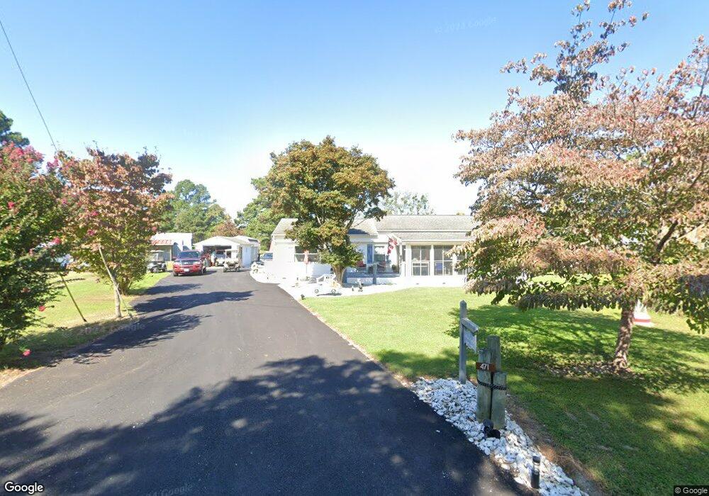
471 Eubank Landing Rd Topping, VA 23169
Estimated Value: $211,000 - $339,948
3
Beds
1
Bath
1,248
Sq Ft
$227/Sq Ft
Est. Value
About This Home
This home is located at 471 Eubank Landing Rd, Topping, VA 23169 and is currently estimated at $283,237, approximately $226 per square foot. 471 Eubank Landing Rd is a home located in Middlesex County with nearby schools including Middlesex Elementary School, St. Clare Walker Middle School, and Middlesex High School.
Ownership History
Date
Name
Owned For
Owner Type
Purchase Details
Closed on
Jan 13, 2022
Sold by
Beazley Bradford M and Beazley Carla E
Bought by
Beazley Bradford M and Beazley Carla E
Current Estimated Value
Purchase Details
Closed on
Mar 31, 2020
Sold by
Layne C William C and Layne Bonnie D
Bought by
Beazley Bradford M and Beazley Carla
Home Financials for this Owner
Home Financials are based on the most recent Mortgage that was taken out on this home.
Original Mortgage
$149,300
Interest Rate
3.5%
Mortgage Type
New Conventional
Purchase Details
Closed on
Jul 16, 2007
Sold by
Willett Barbara S
Bought by
Layne C William
Home Financials for this Owner
Home Financials are based on the most recent Mortgage that was taken out on this home.
Original Mortgage
$120,000
Interest Rate
6.48%
Mortgage Type
New Conventional
Create a Home Valuation Report for This Property
The Home Valuation Report is an in-depth analysis detailing your home's value as well as a comparison with similar homes in the area
Home Values in the Area
Average Home Value in this Area
Purchase History
| Date | Buyer | Sale Price | Title Company |
|---|---|---|---|
| Beazley Bradford M | -- | None Listed On Document | |
| Beazley Bradford M | $166,500 | Signature Title & Stlmnt Llc | |
| Layne C William | $195,000 | -- |
Source: Public Records
Mortgage History
| Date | Status | Borrower | Loan Amount |
|---|---|---|---|
| Previous Owner | Beazley Bradford M | $149,300 | |
| Previous Owner | Layne C William | $120,000 |
Source: Public Records
Tax History Compared to Growth
Tax History
| Year | Tax Paid | Tax Assessment Tax Assessment Total Assessment is a certain percentage of the fair market value that is determined by local assessors to be the total taxable value of land and additions on the property. | Land | Improvement |
|---|---|---|---|---|
| 2025 | $1,037 | $170,000 | $62,000 | $108,000 |
| 2024 | $1,037 | $170,000 | $62,000 | $108,000 |
| 2023 | $1,037 | $170,000 | $62,000 | $108,000 |
| 2022 | $1,037 | $170,000 | $62,000 | $108,000 |
| 2021 | $888 | $143,300 | $57,500 | $85,800 |
| 2020 | $888 | $143,300 | $57,500 | $85,800 |
| 2019 | $888 | $143,300 | $57,500 | $85,800 |
| 2018 | $802 | $143,300 | $57,500 | $85,800 |
| 2017 | $802 | $143,300 | $57,500 | $85,800 |
| 2016 | $803 | $151,600 | $56,000 | $95,600 |
| 2015 | -- | $0 | $0 | $0 |
| 2014 | -- | $0 | $0 | $0 |
| 2013 | -- | $0 | $0 | $0 |
Source: Public Records
Map
Nearby Homes
- 810 Long Point Ln
- 102 Mechams Cove Rd
- 1667 Locust Grove Rd
- 100 Pinetop Rd
- 337 Hideaway Point Rd
- 842 Robinson Ln
- 00 Masons Cove Ln
- 32 Masons Cove Ln
- 170 Rappa Run Rd
- 113 Rappa Run Rd
- 645 Blue Barn Rd
- 422 Syringa Rd
- 29B-1-8G Bennett Farm Rd
- 367 Barricks Mill Rd
- 108 Spindrift Rd
- 115 Blue Barn Rd
- 1349 James Wharf Rd
- 71 Egret Point Dr
- 000 Whiting Creek Rd
- 5834 Rivers Landing Terrace
- 491 Eubank Landing Rd
- 491 Eubank Landing Rd
- 509 Eubank Landing Rd
- 482 Eubank Landing Rd
- 434 Eubank Landing Rd
- 450 Eubank Landing Rd
- 472 Eubank Landing Rd
- 402 Eubank Landing Rd
- 504 Eubank Landing Rd
- 514 Eubank Landing Rd
- 618 Eubank Landing Rd
- 409 Eubank Landing Rd
- 368 Eubank Landing Rd
- 638 Eubank Landing Rd
- 371 Eubank Landing Rd
- 628 Eubank Landing Rd
- 546 Eubank Landing Rd
- 586 Eubank Landing Rd
- 568 Eubank Landing Rd
- 328 Eubank Landing Rd