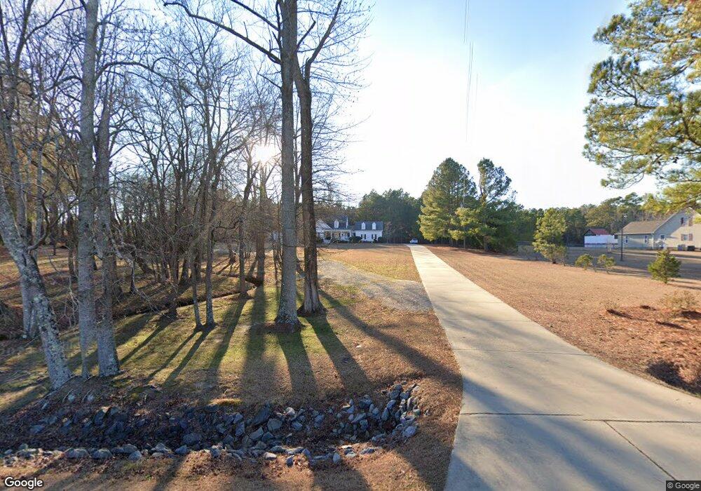
471 Lasater Rd Bunnlevel, NC 28323
Estimated Value: $319,000 - $439,338
3
Beds
3
Baths
2,326
Sq Ft
$166/Sq Ft
Est. Value
About This Home
This home is located at 471 Lasater Rd, Bunnlevel, NC 28323 and is currently estimated at $387,085, approximately $166 per square foot. 471 Lasater Rd is a home located in Harnett County with nearby schools including Anderson Creek Primary School, South Harnett Elementary School, and Western Harnett Middle School.
Ownership History
Date
Name
Owned For
Owner Type
Purchase Details
Closed on
Jul 31, 2008
Sold by
Hugh Surles Builders Llc
Bought by
Ferguson Robert L and Ferguson Sheila D
Current Estimated Value
Home Financials for this Owner
Home Financials are based on the most recent Mortgage that was taken out on this home.
Original Mortgage
$283,125
Outstanding Balance
$186,187
Interest Rate
6.37%
Mortgage Type
VA
Estimated Equity
$200,898
Purchase Details
Closed on
Mar 5, 2008
Sold by
J C Adams Inc
Bought by
Hugh Surles Builders Llc
Home Financials for this Owner
Home Financials are based on the most recent Mortgage that was taken out on this home.
Original Mortgage
$65,000
Interest Rate
5.46%
Mortgage Type
Purchase Money Mortgage
Create a Home Valuation Report for This Property
The Home Valuation Report is an in-depth analysis detailing your home's value as well as a comparison with similar homes in the area
Home Values in the Area
Average Home Value in this Area
Purchase History
| Date | Buyer | Sale Price | Title Company |
|---|---|---|---|
| Ferguson Robert L | $286,000 | -- | |
| Hugh Surles Builders Llc | $65,000 | -- |
Source: Public Records
Mortgage History
| Date | Status | Borrower | Loan Amount |
|---|---|---|---|
| Open | Ferguson Robert L | $283,125 | |
| Previous Owner | Hugh Surles Builders Llc | $65,000 |
Source: Public Records
Tax History
| Year | Tax Paid | Tax Assessment Tax Assessment Total Assessment is a certain percentage of the fair market value that is determined by local assessors to be the total taxable value of land and additions on the property. | Land | Improvement |
|---|---|---|---|---|
| 2025 | $2,526 | $338,553 | $0 | $0 |
| 2024 | $2,526 | $338,553 | $0 | $0 |
| 2023 | $2,526 | $338,553 | $0 | $0 |
| 2022 | $2,114 | $338,553 | $0 | $0 |
| 2021 | $2,114 | $230,530 | $0 | $0 |
| 2020 | $2,114 | $230,530 | $0 | $0 |
| 2019 | $2,099 | $230,530 | $0 | $0 |
| 2018 | $2,076 | $230,530 | $0 | $0 |
| 2017 | $2,076 | $230,530 | $0 | $0 |
| 2016 | $2,127 | $236,480 | $0 | $0 |
| 2015 | $2,127 | $236,480 | $0 | $0 |
| 2014 | $2,127 | $236,480 | $0 | $0 |
Source: Public Records
Map
Nearby Homes
- 95 S Hillside Dr
- 76 N Hillside Dr
- 14 Remington Hill Dr
- 26 Mossburg Ct
- 1712 Hayes Rd
- 70 Wilson Run
- 00 Overhills Rd
- 0 Overhills Rd Unit 10143959
- 49 Whisper Creek Ct
- 1365 Lemuel Black Rd
- 00 Bethel Baptist Rd
- 120 Mockingbird Ln
- 1445 Bethel Baptist Rd
- 270 Storey Acres Rd
- 1283 Bethel Baptist Rd
- 1019 Valley Rd
- 7275 Nc 210 S
- 0 Lemuel Black Rd Unit 750731
- BELHAVEN Plan at Cross Creek
- HANOVER Plan at Cross Creek
- 527 Lasater Rd
- 441 Lasater Rd
- 411 Lasater Rd
- 20 Walnut Grove Dr
- 19 Walnut Grove Dr
- 381 Lasater Rd
- 116 Phipps Pond Ln
- 579 Lasater Rd
- 39 Walnut Grove Dr
- 221 Winged Foot Dr
- 58 Walnut Grove Dr
- 85 Saw Grass Ct
- 185 Winged Foot Dr
- 43 Saw Grass Ct
- 43 Sawgrass Ct
- 0 Winged Foot Dr Unit 515288
- 218 Winged Foot Dr
- 218 Winged Foot Rd
- 724 Walker Rd
