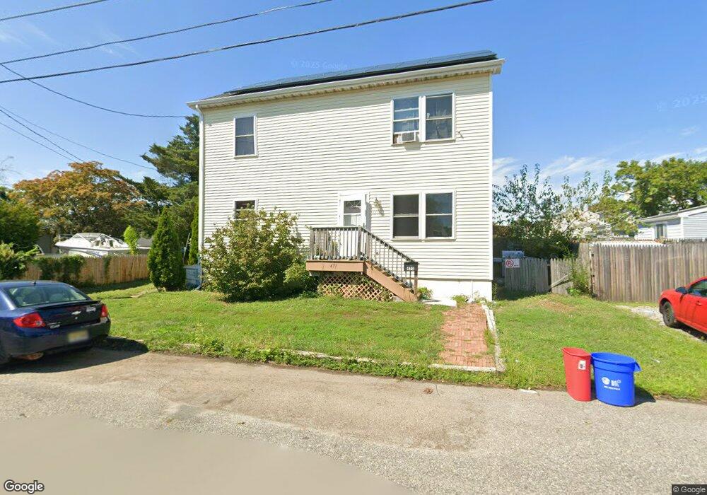
471 Pacific St Long Branch, NJ 07740
Estimated Value: $534,000 - $660,000
3
Beds
3
Baths
1,632
Sq Ft
$377/Sq Ft
Est. Value
About This Home
This home is located at 471 Pacific St, Long Branch, NJ 07740 and is currently estimated at $614,752, approximately $376 per square foot. 471 Pacific St is a home located in Monmouth County with nearby schools including Long Branch High School and Holy Trinity School.
Ownership History
Date
Name
Owned For
Owner Type
Purchase Details
Closed on
Aug 17, 2001
Sold by
Spinelli Richard
Bought by
Raymond George
Current Estimated Value
Home Financials for this Owner
Home Financials are based on the most recent Mortgage that was taken out on this home.
Original Mortgage
$76,500
Outstanding Balance
$29,496
Interest Rate
6.99%
Estimated Equity
$585,256
Purchase Details
Closed on
Oct 27, 2000
Sold by
Bank Of New York
Bought by
Spinelli Richard
Purchase Details
Closed on
Mar 31, 1997
Sold by
Gallo Anthony
Bought by
Rosario George and Morgan Denice
Home Financials for this Owner
Home Financials are based on the most recent Mortgage that was taken out on this home.
Original Mortgage
$65,000
Interest Rate
7.76%
Purchase Details
Closed on
Feb 4, 1997
Sold by
Federal National Mortgage Association
Bought by
Bmb Land Management
Home Financials for this Owner
Home Financials are based on the most recent Mortgage that was taken out on this home.
Original Mortgage
$65,000
Interest Rate
7.76%
Create a Home Valuation Report for This Property
The Home Valuation Report is an in-depth analysis detailing your home's value as well as a comparison with similar homes in the area
Home Values in the Area
Average Home Value in this Area
Purchase History
| Date | Buyer | Sale Price | Title Company |
|---|---|---|---|
| Raymond George | $85,000 | -- | |
| Spinelli Richard | $44,100 | -- | |
| Rosario George | $87,000 | -- | |
| Bmb Land Management | $29,900 | -- |
Source: Public Records
Mortgage History
| Date | Status | Borrower | Loan Amount |
|---|---|---|---|
| Open | Raymond George | $76,500 | |
| Previous Owner | Rosario George | $65,000 |
Source: Public Records
Tax History Compared to Growth
Tax History
| Year | Tax Paid | Tax Assessment Tax Assessment Total Assessment is a certain percentage of the fair market value that is determined by local assessors to be the total taxable value of land and additions on the property. | Land | Improvement |
|---|---|---|---|---|
| 2025 | $8,152 | $560,900 | $244,500 | $316,400 |
| 2024 | $7,450 | $530,400 | $224,500 | $305,900 |
| 2023 | $7,450 | $479,700 | $184,500 | $295,200 |
| 2022 | $6,929 | $395,800 | $133,000 | $262,800 |
| 2021 | $6,929 | $346,300 | $98,000 | $248,300 |
| 2020 | $6,991 | $334,500 | $85,000 | $249,500 |
| 2019 | $6,703 | $318,900 | $81,000 | $237,900 |
| 2018 | $6,564 | $310,500 | $79,000 | $231,500 |
| 2017 | $1,587 | $77,000 | $77,000 | $0 |
| 2016 | $3,698 | $183,000 | $88,000 | $95,000 |
| 2015 | $2,646 | $118,800 | $31,800 | $87,000 |
| 2014 | $2,472 | $117,000 | $39,800 | $77,200 |
Source: Public Records
Map
Nearby Homes
- 222 Coleman Ave
- 401 Joline Ave
- 190 Spruce St Unit 4
- 565 Joline Ave
- 572 Jay St
- 238 Branchport Ave
- 119 Washington St
- 148 Sixth Ave
- 184 N 5th Ave
- 631 Irving Place
- 13 Morris Place
- 151 N 5th Ave
- 211 Rockwell Ave
- 40 N 5th Ave
- 15 Signal Ave
- 14 Slocum Place
- 40 University Dr
- 39 Slocum Place
- 399 Willow Ave
- 11 Clay St
- 204 Coleman Ave
- 200 Coleman Ave
- 473 Pacific St
- 208 Coleman Ave
- 416 Pacific St
- 420 Pacific St
- 475 Pacific St
- 424 Pacific St
- 412 Pacific St
- 428 Pacific St
- 212 Coleman Ave
- 432 Pacific St
- 188 Coleman Ave
- 201 Edwards Ave
- 205 Edwards Ave
- 197 Coleman Ave
- 201 Coleman Ave
- 211 Edwards Ave
- 193 Edwards Ave
- 209 Edwards Ave