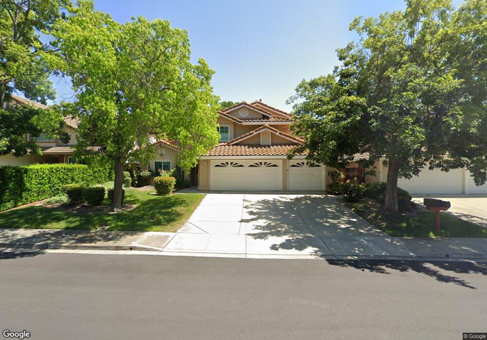
4712 Blackburn Peak Ct Antioch, CA 94531
Lone Tree Valley NeighborhoodEstimated Value: $735,000 - $796,000
5
Beds
3
Baths
2,942
Sq Ft
$259/Sq Ft
Est. Value
About This Home
This home is located at 4712 Blackburn Peak Ct, Antioch, CA 94531 and is currently estimated at $761,314, approximately $258 per square foot. 4712 Blackburn Peak Ct is a home located in Contra Costa County with nearby schools including John Muir Elementary School, Dallas Ranch Middle School, and Deer Valley High School.
Ownership History
Date
Name
Owned For
Owner Type
Purchase Details
Closed on
Aug 16, 2013
Sold by
Solano Robert S and Solano Alicia M
Bought by
Solano Robert S and Solano Alicia M
Current Estimated Value
Purchase Details
Closed on
Jul 7, 1994
Sold by
Warmington Enterprises L P
Bought by
Solano Robert S and Solano Alicia
Home Financials for this Owner
Home Financials are based on the most recent Mortgage that was taken out on this home.
Original Mortgage
$248,850
Interest Rate
4.25%
Mortgage Type
Purchase Money Mortgage
Create a Home Valuation Report for This Property
The Home Valuation Report is an in-depth analysis detailing your home's value as well as a comparison with similar homes in the area
Home Values in the Area
Average Home Value in this Area
Purchase History
| Date | Buyer | Sale Price | Title Company |
|---|---|---|---|
| Solano Robert S | -- | None Available | |
| Solano Robert S | $277,000 | Old Republic Title Company |
Source: Public Records
Mortgage History
| Date | Status | Borrower | Loan Amount |
|---|---|---|---|
| Closed | Solano Robert S | $248,850 |
Source: Public Records
Tax History Compared to Growth
Tax History
| Year | Tax Paid | Tax Assessment Tax Assessment Total Assessment is a certain percentage of the fair market value that is determined by local assessors to be the total taxable value of land and additions on the property. | Land | Improvement |
|---|---|---|---|---|
| 2025 | $5,501 | $488,258 | $67,169 | $421,089 |
| 2024 | $5,300 | $478,685 | $65,852 | $412,833 |
| 2023 | $5,300 | $469,300 | $64,561 | $404,739 |
| 2022 | $5,216 | $460,099 | $63,296 | $396,803 |
| 2021 | $5,057 | $451,078 | $62,055 | $389,023 |
| 2019 | $4,943 | $437,701 | $60,215 | $377,486 |
| 2018 | $4,752 | $429,120 | $59,035 | $370,085 |
| 2017 | $4,652 | $420,707 | $57,878 | $362,829 |
| 2016 | $4,540 | $412,459 | $56,744 | $355,715 |
| 2015 | $4,834 | $406,264 | $55,892 | $350,372 |
| 2014 | $5,271 | $374,500 | $51,523 | $322,977 |
Source: Public Records
Map
Nearby Homes
- 4729 Matterhorn Ct
- 4688 Matterhorn Way
- 4836 Belford Peak Way
- 4925 Cache Peak Dr
- 4864 Belford Peak Way
- 4800 Snowmass Peak Ct
- 4721 Torreys Peak Ct
- 318 Redrock Dr
- 4064 Montgomery Hill Dr
- 4002 Royal Links Ct
- 2003 Barkwood Ct
- 4041 Saint Andrews Way
- 4109 S Royal Links Cir
- 1525 Barkley Mountain Way
- 4010 Boulder Dr
- 5048 Tehachapi Way
- 4913 Stonewood Way
- 2101 Asilomar Dr
- 5002 Hollow Ridge Ct
- 5004 Star Mine Way
- 4708 Blackburn Peak Ct
- 4716 Blackburn Peak Ct
- 4704 Blackburn Peak Ct
- 4720 Blackburn Peak Ct
- 4719 Hunter Peak Ct
- 4723 Hunter Peak Ct
- 4715 Hunter Peak Ct
- 4727 Hunter Peak Ct
- 4713 Blackburn Peak Ct
- 4724 Blackburn Peak Ct
- 4700 Blackburn Peak Ct
- 4709 Blackburn Peak Ct
- 4717 Blackburn Peak Ct
- 4707 Hunter Peak Ct
- 4731 Hunter Peak Ct
- 4705 Blackburn Peak Ct
- 4721 Blackburn Peak Ct
- 4735 Hunter Peak Ct
- 4703 Hunter Peak Ct
- 4701 Blackburn Peak Ct