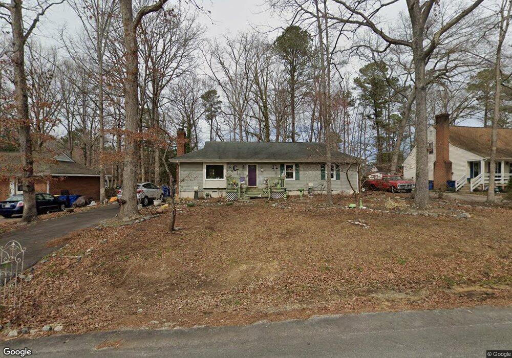
4712 Brookridge Rd Chesterfield, VA 23832
Estimated Value: $315,000 - $324,000
3
Beds
2
Baths
1,248
Sq Ft
$256/Sq Ft
Est. Value
About This Home
This home is located at 4712 Brookridge Rd, Chesterfield, VA 23832 and is currently estimated at $319,246, approximately $255 per square foot. 4712 Brookridge Rd is a home located in Chesterfield County with nearby schools including Thelma Crenshaw Elementary School, Bailey Bridge Middle School, and Manchester High.
Ownership History
Date
Name
Owned For
Owner Type
Purchase Details
Closed on
Apr 29, 1996
Sold by
Clements Patricia S
Bought by
Clements Paul B and Clements Patricia S
Current Estimated Value
Home Financials for this Owner
Home Financials are based on the most recent Mortgage that was taken out on this home.
Original Mortgage
$58,700
Outstanding Balance
$3,287
Interest Rate
7.81%
Mortgage Type
New Conventional
Estimated Equity
$315,959
Create a Home Valuation Report for This Property
The Home Valuation Report is an in-depth analysis detailing your home's value as well as a comparison with similar homes in the area
Home Values in the Area
Average Home Value in this Area
Purchase History
| Date | Buyer | Sale Price | Title Company |
|---|---|---|---|
| Clements Paul B | -- | -- |
Source: Public Records
Mortgage History
| Date | Status | Borrower | Loan Amount |
|---|---|---|---|
| Open | Clements Paul B | $58,700 |
Source: Public Records
Tax History Compared to Growth
Tax History
| Year | Tax Paid | Tax Assessment Tax Assessment Total Assessment is a certain percentage of the fair market value that is determined by local assessors to be the total taxable value of land and additions on the property. | Land | Improvement |
|---|---|---|---|---|
| 2025 | $25 | $283,900 | $60,000 | $223,900 |
| 2024 | $25 | $258,100 | $52,000 | $206,100 |
| 2023 | $2,229 | $244,900 | $49,000 | $195,900 |
| 2022 | $2,038 | $221,500 | $47,000 | $174,500 |
| 2021 | $1,334 | $196,800 | $45,000 | $151,800 |
| 2020 | $1,706 | $179,600 | $45,000 | $134,600 |
| 2019 | $1,656 | $174,300 | $42,000 | $132,300 |
| 2018 | $1,542 | $162,300 | $42,000 | $120,300 |
| 2017 | $1,463 | $152,400 | $42,000 | $110,400 |
| 2016 | $1,357 | $141,400 | $42,000 | $99,400 |
| 2015 | $1,280 | $133,300 | $42,000 | $91,300 |
| 2014 | $1,247 | $129,900 | $42,000 | $87,900 |
Source: Public Records
Map
Nearby Homes
- 10810 Ridgerun Rd
- 4519 Bexwood Dr
- 5101 Blossomwood Cir
- 10524 Genlou Rd
- 5213 Oakforest Dr
- 5124 Rollingway Rd
- 10508 Rollingway Ct
- 11261 Sunfield Dr
- 10339 Qualla Trace Dr
- 10718 Genlou Rd
- 10332 Qualla Trace Dr
- 10927 Decoy Ln
- Stanley Plan at Lawson Mill
- Drexel Plan at Lawson Mill
- Caldwell Plan at Lawson Mill
- Ellerbe Plan at Lawson Mill
- Avery Plan at Lawson Mill
- Raleigh Plan at Lawson Mill
- Oxford Plan at Lawson Mill
- Davidson Plan at Lawson Mill
- 4706 Brookridge Rd
- 4718 Brookridge Rd
- 4723 Bexwood Dr
- 10804 Brookridge Place
- 4700 Brookridge Rd
- 4711 Bexwood Dr
- 4707 Brookridge Rd
- 4672 Brookridge Rd
- 4723 Brookridge Rd
- 10805 Brookridge Way
- 4705 Bexwood Dr
- 10802 Brookridge Place
- 4664 Brookridge Rd
- 4718 Bexwood Dr
- 10631 Bexwood Ct
- 4731 Brookridge Rd
- 10803 Brookridge Way
- 4724 Bexwood Dr
- 4736 Brookridge Rd
- 10801 Brookridge Place