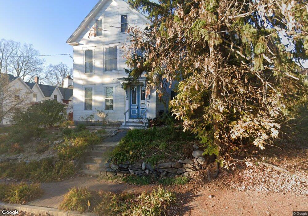
472 Amherst St Manchester, NH 03104
Hanover Hill NeighborhoodEstimated Value: $369,000 - $595,000
4
Beds
2
Baths
2,524
Sq Ft
$184/Sq Ft
Est. Value
About This Home
This home is located at 472 Amherst St, Manchester, NH 03104 and is currently estimated at $465,426, approximately $184 per square foot. 472 Amherst St is a home located in Hillsborough County with nearby schools including McDonough Elementary School, Hillside Middle School, and Manchester Central High School.
Ownership History
Date
Name
Owned For
Owner Type
Purchase Details
Closed on
Nov 10, 2005
Sold by
Bcia New England Holdi
Bought by
Nh B Ii Llc
Current Estimated Value
Purchase Details
Closed on
Jun 23, 1999
Sold by
472 Amherst St Inc
Bought by
Bcia Ne Holdings Llc
Create a Home Valuation Report for This Property
The Home Valuation Report is an in-depth analysis detailing your home's value as well as a comparison with similar homes in the area
Home Values in the Area
Average Home Value in this Area
Purchase History
| Date | Buyer | Sale Price | Title Company |
|---|---|---|---|
| Nh B Ii Llc | $6,250,000 | -- | |
| Bcia Ne Holdings Llc | $3,677,600 | -- |
Source: Public Records
Mortgage History
| Date | Status | Borrower | Loan Amount |
|---|---|---|---|
| Open | Bcia Ne Holdings Llc | $94,000 | |
| Closed | Bcia Ne Holdings Llc | $0 |
Source: Public Records
Tax History Compared to Growth
Tax History
| Year | Tax Paid | Tax Assessment Tax Assessment Total Assessment is a certain percentage of the fair market value that is determined by local assessors to be the total taxable value of land and additions on the property. | Land | Improvement |
|---|---|---|---|---|
| 2024 | $6,610 | $337,600 | $89,200 | $248,400 |
| 2023 | $6,367 | $337,600 | $89,200 | $248,400 |
| 2022 | $6,158 | $337,600 | $89,200 | $248,400 |
| 2021 | $5,969 | $337,600 | $89,200 | $248,400 |
| 2020 | $3,667 | $207,600 | $64,800 | $142,800 |
| 2019 | $3,529 | $207,600 | $64,800 | $142,800 |
| 2018 | $4,916 | $207,600 | $64,800 | $142,800 |
| 2017 | $4,841 | $207,600 | $64,800 | $142,800 |
| 2016 | $2,858 | $207,600 | $64,800 | $142,800 |
| 2015 | $4,400 | $187,700 | $64,800 | $122,900 |
| 2014 | $4,411 | $187,700 | $64,800 | $122,900 |
| 2013 | $4,255 | $187,700 | $64,800 | $122,900 |
Source: Public Records
Map
Nearby Homes
- 601 Hall St
- 383 Concord St Hcrd Plan 42577
- 352 Lowell St
- 445 E High St
- 426 Manchester St
- 527 Hanover St
- 14 Dufort St
- 330 Bridge St
- 383 Manchester St
- 379 Manchester St
- 377 Manchester St
- 362 Amherst St
- 21 South St
- 53 Arlington St
- 41 Russell St
- 269 Orange St
- 662 Amherst St
- 567 Cedar St
- 870 Hall St
- 10 Hayes Ave
- 464 Amherst St
- 574 Belmont St
- 423 Concord St Unit B
- 423 Concord St Unit A
- 423 Concord St Unit 423
- 469 Amherst St Unit 1F
- 469 Amherst St Unit 3F
- 469 Amherst St Unit 2R
- 469 Amherst St
- 469 Amherst St Unit 2F
- 469 Amherst St Unit 1R
- 582 Belmont St
- 409 Concord St
- 409 Concord St Unit B
- 409 Concord St Unit A
- 467 Amherst St Unit 1R
- 467 Amherst St Unit 1F
- 467 Amherst St Unit 3F
- 467 Amherst St
- 567 Hall St