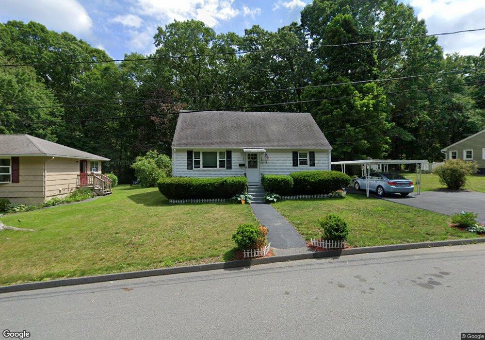
472 Coburn Ave Worcester, MA 01604
Grafton Hill NeighborhoodEstimated Value: $386,000 - $405,118
3
Beds
2
Baths
1,224
Sq Ft
$326/Sq Ft
Est. Value
About This Home
This home is located at 472 Coburn Ave, Worcester, MA 01604 and is currently estimated at $399,030, approximately $326 per square foot. 472 Coburn Ave is a home located in Worcester County with nearby schools including Jacob Hiatt Magnet School, Chandler Magnet, and Lake View Elementary School.
Ownership History
Date
Name
Owned For
Owner Type
Purchase Details
Closed on
Jul 14, 2021
Sold by
Lucier Deborah J
Bought by
Deborah Lucier Irt 2021
Current Estimated Value
Purchase Details
Closed on
Sep 8, 2009
Sold by
Paolino Henry and Paolino Beverly
Bought by
Lucier Deborah J
Purchase Details
Closed on
Mar 15, 2005
Sold by
Paolino Beverly A and Paolino Henry
Bought by
Sliwoski Deborah J
Create a Home Valuation Report for This Property
The Home Valuation Report is an in-depth analysis detailing your home's value as well as a comparison with similar homes in the area
Home Values in the Area
Average Home Value in this Area
Purchase History
| Date | Buyer | Sale Price | Title Company |
|---|---|---|---|
| Deborah Lucier Irt 2021 | -- | None Available | |
| Lucier Deborah J | -- | -- | |
| Sliwoski Deborah J | -- | -- |
Source: Public Records
Tax History
| Year | Tax Paid | Tax Assessment Tax Assessment Total Assessment is a certain percentage of the fair market value that is determined by local assessors to be the total taxable value of land and additions on the property. | Land | Improvement |
|---|---|---|---|---|
| 2025 | $4,584 | $347,500 | $117,800 | $229,700 |
| 2024 | $4,506 | $327,700 | $117,800 | $209,900 |
| 2023 | $4,392 | $306,300 | $102,400 | $203,900 |
| 2022 | $4,022 | $264,400 | $82,000 | $182,400 |
| 2021 | $3,779 | $232,100 | $65,600 | $166,500 |
| 2020 | $3,711 | $218,300 | $65,600 | $152,700 |
| 2019 | $3,533 | $196,300 | $59,000 | $137,300 |
| 2018 | $3,553 | $187,900 | $59,000 | $128,900 |
| 2017 | $3,413 | $177,600 | $59,000 | $118,600 |
| 2016 | $3,331 | $161,600 | $42,900 | $118,700 |
| 2015 | $3,243 | $161,600 | $42,900 | $118,700 |
| 2014 | $3,158 | $161,600 | $42,900 | $118,700 |
Source: Public Records
Map
Nearby Homes
- 41 Modoc St
- 365 Lake Ave
- 496 Hamilton St
- 21 Middlesex Ave Unit 102
- Lot B Crawford St
- 19 Middlesex Ave
- 143 Commonwealth Ave
- 12 Benham St
- 28 Nonquit St
- 190 S Quinsigamond Ave Unit 102
- 360 Hamilton St
- 16-18 Fairfax St
- 241 Lake Ave
- 10 County St
- 63 Progressive St
- 62 Edgemere Blvd
- 105 S Quinsigamond Ave
- 12 Brookside Place
- 16 Arborwood Dr
- 143 Dorcester
- 474 Coburn Ave
- 466 Coburn Ave
- 310 Lake Ave
- 464 Coburn Ave
- 462 Coburn Ave
- 498 Coburn Ave
- 100 Orton Street Extension
- 96 Orton Street Extension
- 92 Orton Street Extension
- 304 Lake Ave
- 106 Orton Street Extension
- 308 Lake Ave
- 108 Orton Street Extension
- 88 Orton Street Extension
- 104 Orton Street Extension Unit EXT
- 110 Orton Street Extension
- 106 Orton Street Extension
- 312 Lake Ave
- 112 Orton Street Extension
- 84 Orton Street Extension
Your Personal Tour Guide
Ask me questions while you tour the home.