Estimated Value: $156,972 - $221,000
3
Beds
1
Bath
879
Sq Ft
$215/Sq Ft
Est. Value
About This Home
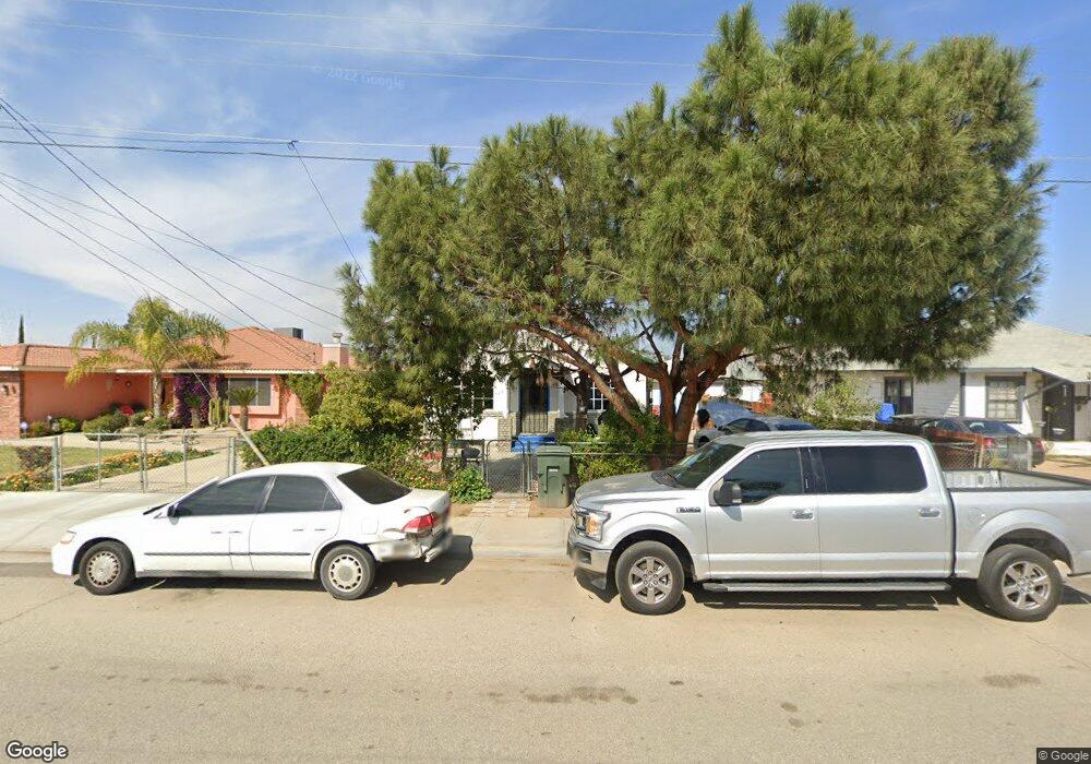
This home is located at 472 Hanson Ln, Arvin, CA 93203 and is currently estimated at $188,743, approximately $214 per square foot. 472 Hanson Ln is a home located in Kern County with nearby schools including Sierra Vista Elementary School, Haven Drive Middle School, and Arvin High School.
Ownership History
Date
Name
Owned For
Owner Type
Purchase Details
Closed on
Jan 26, 2007
Sold by
Patino Jose and Barrera Eulalia
Bought by
Patino Jose and Barrera Eulalia
Current Estimated Value
Home Financials for this Owner
Home Financials are based on the most recent Mortgage that was taken out on this home.
Original Mortgage
$74,000
Outstanding Balance
$44,200
Interest Rate
6.11%
Mortgage Type
New Conventional
Estimated Equity
$144,543
Purchase Details
Closed on
Jun 1, 1994
Sold by
Barrera Eulalia
Bought by
Barrera Eulalia and Patino Jose
Create a Home Valuation Report for This Property
The Home Valuation Report is an in-depth analysis detailing your home's value as well as a comparison with similar homes in the area
Home Values in the Area
Average Home Value in this Area
Purchase History
| Date | Buyer | Sale Price | Title Company |
|---|---|---|---|
| Patino Jose | -- | Nations Title Agency Inc | |
| Barrera Eulalia | -- | -- |
Source: Public Records
Mortgage History
| Date | Status | Borrower | Loan Amount |
|---|---|---|---|
| Open | Patino Jose | $74,000 |
Source: Public Records
Tax History Compared to Growth
Tax History
| Year | Tax Paid | Tax Assessment Tax Assessment Total Assessment is a certain percentage of the fair market value that is determined by local assessors to be the total taxable value of land and additions on the property. | Land | Improvement |
|---|---|---|---|---|
| 2025 | $1,420 | $21,564 | $3,040 | $18,524 |
| 2024 | $1,338 | $21,142 | $2,981 | $18,161 |
| 2023 | $1,338 | $20,728 | $2,923 | $17,805 |
| 2022 | $1,290 | $20,322 | $2,866 | $17,456 |
| 2021 | $1,218 | $19,924 | $2,810 | $17,114 |
| 2020 | $1,184 | $19,721 | $2,782 | $16,939 |
| 2019 | $1,171 | $19,721 | $2,782 | $16,939 |
| 2018 | $1,153 | $18,957 | $2,675 | $16,282 |
| 2017 | $1,104 | $18,586 | $2,623 | $15,963 |
| 2016 | $1,056 | $18,222 | $2,572 | $15,650 |
| 2015 | $1,017 | $17,949 | $2,534 | $15,415 |
| 2014 | $981 | $17,599 | $2,485 | $15,114 |
Source: Public Records
Map
Nearby Homes
- 345 Combs Ave
- 828 Stockton Ave
- 801 Schipper St Unit 30
- 801 Schipper St Unit 20
- 801 Schipper St Unit 45
- 801 Schipper St Unit 65
- 801 Schipper St Unit 31
- 776 Butte Ave
- 931 S Derby St
- 140 Langford Ave
- 795 S Derby St
- 1708 Payne Dr
- 0 Tejon Hwy
- 1200 Royal St
- 1348 Haven Dr
- 0 S Comanche Dr
- 1777 S Comanche Dr
- 698 S Comanche Dr
- 0 E Bear Mountain Blvd
- 200 5th Ave Unit 32
- 464 Hanson Ln
- 480 Hanson Ln
- 456 Hanson Ln
- 473 Hanson Ln
- 525 Langford Ave
- 447 Hanson Ln
- 442 Hanson Ln
- 509 Hanson Ln
- 524 Langford Ave
- 516 Langford Ave
- 532 Langford Ave
- 508 Langford Ave
- 540 Langford Ave
- 500 Langford Ave
- 432 Langford Ave
- 400 Hanson Ln
- 600 Langford Ave
- 424 Langford Ave
- 865 S A St
- 608 Langford Ave