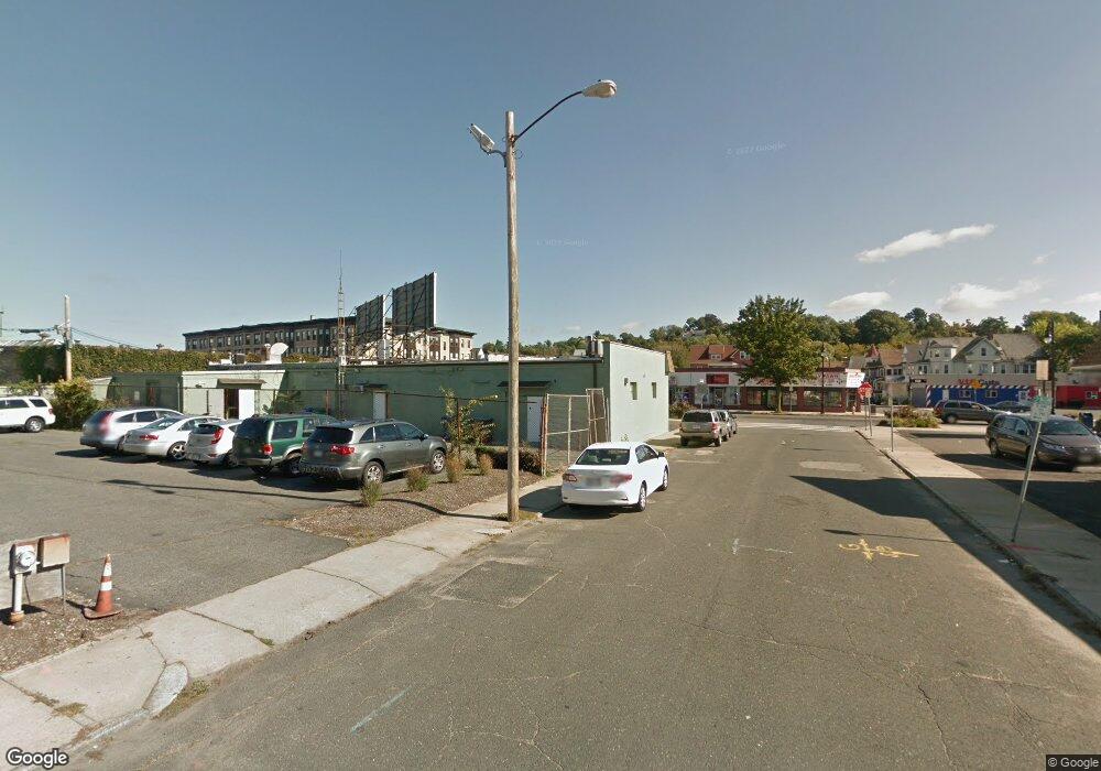
472 Main St Springfield, MA 01105
South End NeighborhoodEstimated Value: $240,000 - $260,369
4
Beds
1
Bath
1,622
Sq Ft
$154/Sq Ft
Est. Value
About This Home
This home is located at 472 Main St, Springfield, MA 01105 and is currently estimated at $250,092, approximately $154 per square foot. 472 Main St is a home located in Hampden County with nearby schools including Daniel B Brunton, South End Middle School, and High School Of Commerce.
Ownership History
Date
Name
Owned For
Owner Type
Purchase Details
Closed on
Aug 31, 2018
Sold by
Miller Christopher D
Bought by
Aastha Bansri Llc
Current Estimated Value
Purchase Details
Closed on
Mar 16, 2016
Sold by
Racicot Carolyn A and Fiore Donna L
Bought by
Bar S Land Holdings Ll
Purchase Details
Closed on
May 28, 2013
Sold by
Miller Lester E and Miller Nancy A
Bought by
Miller Christopher D
Purchase Details
Closed on
Nov 21, 2011
Sold by
Est Dynak Victor J and Dynak Joseph J
Bought by
Miller Lester E and Miller Nancy A
Purchase Details
Closed on
Aug 6, 2007
Sold by
Revocable Indenture Of and Racicot Carolyn A
Bought by
Racicot Carolyn A and Fiore Donna L
Purchase Details
Closed on
Mar 12, 2007
Sold by
Racicot Carolyn A and Ouellette Donald A
Bought by
Carolyn A Racicot T and Racicot Carolyn A
Create a Home Valuation Report for This Property
The Home Valuation Report is an in-depth analysis detailing your home's value as well as a comparison with similar homes in the area
Home Values in the Area
Average Home Value in this Area
Purchase History
| Date | Buyer | Sale Price | Title Company |
|---|---|---|---|
| Aastha Bansri Llc | $57,000 | -- | |
| Bar S Land Holdings Ll | $400,000 | -- | |
| Miller Christopher D | -- | -- | |
| Miller Lester E | $70,000 | -- | |
| Racicot Carolyn A | -- | -- | |
| Carolyn A Racicot T | -- | -- |
Source: Public Records
Tax History Compared to Growth
Tax History
| Year | Tax Paid | Tax Assessment Tax Assessment Total Assessment is a certain percentage of the fair market value that is determined by local assessors to be the total taxable value of land and additions on the property. | Land | Improvement |
|---|---|---|---|---|
| 2025 | $2,695 | $171,900 | $45,000 | $126,900 |
| 2024 | $2,481 | $154,500 | $42,100 | $112,400 |
| 2023 | $2,547 | $149,400 | $34,500 | $114,900 |
| 2022 | $2,735 | $145,300 | $32,300 | $113,000 |
| 2021 | $2,788 | $147,500 | $29,300 | $118,200 |
| 2020 | $2,385 | $122,100 | $29,300 | $92,800 |
| 2019 | $1,704 | $86,600 | $30,400 | $56,200 |
| 2018 | $1,775 | $90,200 | $30,400 | $59,800 |
| 2017 | $1,583 | $80,500 | $25,800 | $54,700 |
| 2016 | $1,569 | $79,800 | $25,800 | $54,000 |
| 2015 | $1,019 | $51,800 | $25,800 | $26,000 |
Source: Public Records
Map
Nearby Homes
- 570-582 Main St
- 32 Wendell Place
- 51 Acushnet Ave
- 72-74 Palmer Ave
- 29 Warriner Ave
- 120 Mill St
- 128 Mill St
- 62 Central St Unit 402
- 88 Central St Unit 307
- 82 Central St Unit 304
- 72 Central St Unit 407
- 64 Central St Unit 403
- 68 Central St Unit 405
- 66 Central St Unit 404
- 44 Central St Unit 501
- 50 Central St Unit 504
- 46 Central St Unit 502
- 48 Central St Unit 503
- 52 Central St Unit 504
- 54 Central St Unit 506
- 519 Main St
- 537 Main St
- 16 Broad St
- 15 Broad St Unit 17
- 18 Wendell Place
- 17 Norwood St
- 22 Broad St Unit 1
- 22 Broad St
- ns Marble
- 24 Elmwood St
- 0 Marble St Unit 72206195
- 21 Norwood St
- 469 Main St
- 22 Wendell Place
- 25 Norwood St
- 25 Norwood St Unit 1
- 25 Norwood St Unit 2
- 11 Marble St
- 459 Main St
- 21 Wendell Place
