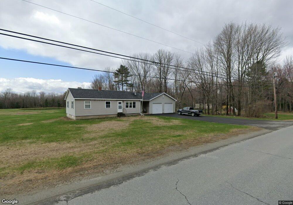
472 Mutton Ln Clinton, ME 04927
Estimated Value: $249,000 - $261,674
--
Bed
--
Bath
--
Sq Ft
3.2
Acres
About This Home
This home is located at 472 Mutton Ln, Clinton, ME 04927 and is currently estimated at $256,919. 472 Mutton Ln is a home with nearby schools including Lawrence High School.
Ownership History
Date
Name
Owned For
Owner Type
Purchase Details
Closed on
Dec 6, 2024
Sold by
Bickford Jr Russell S Est and Watson
Bought by
Duprey Eric P
Current Estimated Value
Home Financials for this Owner
Home Financials are based on the most recent Mortgage that was taken out on this home.
Original Mortgage
$112,600
Outstanding Balance
$111,671
Interest Rate
6.54%
Mortgage Type
Purchase Money Mortgage
Estimated Equity
$145,248
Purchase Details
Closed on
Sep 21, 2009
Sold by
Witham Wanetta
Bought by
Bickford Russell S
Create a Home Valuation Report for This Property
The Home Valuation Report is an in-depth analysis detailing your home's value as well as a comparison with similar homes in the area
Home Values in the Area
Average Home Value in this Area
Purchase History
| Date | Buyer | Sale Price | Title Company |
|---|---|---|---|
| Duprey Eric P | $250,000 | None Available | |
| Duprey Eric P | $250,000 | None Available | |
| Bickford Russell S | -- | -- | |
| Bickford Russell S | -- | -- |
Source: Public Records
Mortgage History
| Date | Status | Borrower | Loan Amount |
|---|---|---|---|
| Open | Duprey Eric P | $112,600 | |
| Closed | Duprey Eric P | $112,600 |
Source: Public Records
Tax History Compared to Growth
Tax History
| Year | Tax Paid | Tax Assessment Tax Assessment Total Assessment is a certain percentage of the fair market value that is determined by local assessors to be the total taxable value of land and additions on the property. | Land | Improvement |
|---|---|---|---|---|
| 2024 | $2,354 | $129,000 | $37,140 | $91,860 |
| 2023 | $2,167 | $129,000 | $37,140 | $91,860 |
| 2022 | $1,625 | $129,000 | $37,140 | $91,860 |
| 2021 | $1,948 | $129,000 | $37,140 | $91,860 |
| 2020 | $2,507 | $93,440 | $23,030 | $70,410 |
| 2017 | $1,793 | $92,440 | $23,030 | $69,410 |
| 2016 | $1,729 | $92,437 | $23,030 | $69,407 |
| 2015 | $1,711 | $93,521 | $23,030 | $70,491 |
| 2014 | $1,674 | $94,600 | $23,000 | $71,600 |
Source: Public Records
Map
Nearby Homes
- TBD Mutton Ln
- 389 Mutton Ln
- 262 Hill Rd
- 910 Mutton Ln
- 110 Hill Rd
- 1691 Bangor Rd
- 156 Railroad St
- 113 Morrison Ave
- 92 Morrison Ave
- 55 Cindy Blodgett Dr
- 48 Church St
- Lot31 Johnson Flat Rd
- 17 Baker St
- TBD Hillside Dr
- 10 Bush Rd
- 451 Johnson Flat Rd
- 385 Johnson Flat Rd
- 1107 Hill Rd
- 41 S Main St
- 208 Pleasant St