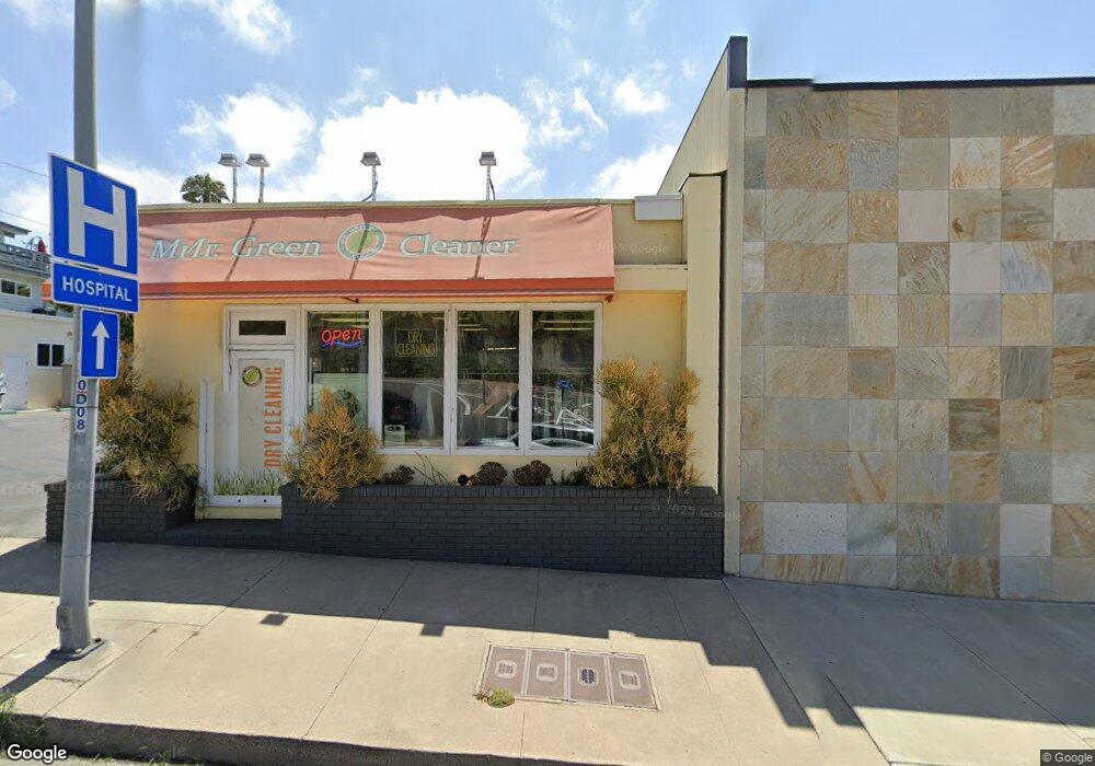
472 N Newport Blvd Newport Beach, CA 92663
Newport Heights NeighborhoodEstimated Value: $1,599,503
3
Beds
1
Bath
1,014
Sq Ft
$1,577/Sq Ft
Est. Value
About This Home
This home is located at 472 N Newport Blvd, Newport Beach, CA 92663 and is currently estimated at $1,599,503, approximately $1,577 per square foot. 472 N Newport Blvd is a home located in Orange County with nearby schools including Newport Heights Elementary, Horace Ensign Intermediate School, and Newport Harbor High School.
Ownership History
Date
Name
Owned For
Owner Type
Purchase Details
Closed on
Sep 30, 2024
Sold by
Jeannette Family Trust and Jeannette Brion
Bought by
Jeannette Black Book Properties Llc
Current Estimated Value
Purchase Details
Closed on
Aug 28, 2012
Sold by
Jeannette Brion and Jeanette Bonnie
Bought by
Muniz Joe and Muniz Geraldine Yvonne
Purchase Details
Closed on
May 15, 2012
Sold by
Muniz Joe and Muniz Geraldine Yvonne
Bought by
Jeannette Brion and Jeanette Bonnie
Purchase Details
Closed on
Mar 30, 1998
Sold by
Muniz Joe and Muniz Geraldine Yvonne
Bought by
Muniz Joe and Muniz Geraldine Yvonne
Purchase Details
Closed on
May 5, 1997
Sold by
Majid Dezahd
Bought by
Muniz Joe and Muniz Geraldine Yvonne
Home Financials for this Owner
Home Financials are based on the most recent Mortgage that was taken out on this home.
Original Mortgage
$180,000
Interest Rate
5.75%
Mortgage Type
Commercial
Create a Home Valuation Report for This Property
The Home Valuation Report is an in-depth analysis detailing your home's value as well as a comparison with similar homes in the area
Home Values in the Area
Average Home Value in this Area
Purchase History
| Date | Buyer | Sale Price | Title Company |
|---|---|---|---|
| Jeannette Black Book Properties Llc | -- | None Listed On Document | |
| Muniz Joe | -- | Accommodation | |
| Jeannette Brion | $575,000 | First American Title Company | |
| Muniz Joe | -- | -- | |
| Muniz Joe | $280,000 | Guardian Title |
Source: Public Records
Mortgage History
| Date | Status | Borrower | Loan Amount |
|---|---|---|---|
| Previous Owner | Muniz Joe | $180,000 |
Source: Public Records
Tax History Compared to Growth
Tax History
| Year | Tax Paid | Tax Assessment Tax Assessment Total Assessment is a certain percentage of the fair market value that is determined by local assessors to be the total taxable value of land and additions on the property. | Land | Improvement |
|---|---|---|---|---|
| 2025 | $7,898 | $722,225 | $690,915 | $31,310 |
| 2024 | $7,898 | $708,064 | $677,367 | $30,697 |
| 2023 | $7,712 | $694,181 | $664,085 | $30,096 |
| 2022 | $7,574 | $680,570 | $651,064 | $29,506 |
| 2021 | $7,428 | $667,226 | $638,298 | $28,928 |
| 2020 | $7,357 | $660,385 | $631,753 | $28,632 |
| 2019 | $7,211 | $647,437 | $619,366 | $28,071 |
| 2018 | $7,070 | $634,743 | $607,222 | $27,521 |
| 2017 | $6,947 | $622,298 | $595,316 | $26,982 |
| 2016 | $6,794 | $610,097 | $583,644 | $26,453 |
| 2015 | $6,728 | $600,933 | $574,877 | $26,056 |
| 2014 | $6,571 | $589,162 | $563,616 | $25,546 |
Source: Public Records
Map
Nearby Homes
- 516 Bolsa Ave
- 428 Holmwood Dr
- 510 Catalina Dr
- 337 Holmwood Dr
- 245 Palmer St
- 427 Santa Ana Ave
- 225 Knox St
- 316 Catalina Dr
- 1523 Sullivan Ave
- 543 Redlands Ave
- 2907 Cliff Dr
- 200 Mcneil Ln Unit 9
- 200 Mcneil Ln Unit 204
- 824 W 15th St Unit 43
- 628 Cardiff Reef
- 421 Tustin Ave
- 230 Ocean View Ave
- 101 Scholz Plaza Unit 120
- 100 Scholz Plaza Unit 205
- 102 Scholz Plaza Unit 34
- 3239 Broad St
- 3245 Broad St
- 3247 Broad St
- 3233 Broad St
- 3235 Broad St
- 3241 Broad St
- 3251 Broad St Unit 1
- 3227 Broad St
- 464 Old Newport Blvd
- 3253 Broad St Unit 2
- 3229 Broad St
- 3221 Broad St
- 471 Old Newport Blvd
- 471 Old Newport Blvd Unit 302
- 471 Old Newport Blvd Unit 304
- 471 Old Newport Blvd Unit 102
- 3244 Broad St Unit 2
- 3244 Broad St Unit 1
- 3256 Broad St
- 3250 Broad St
