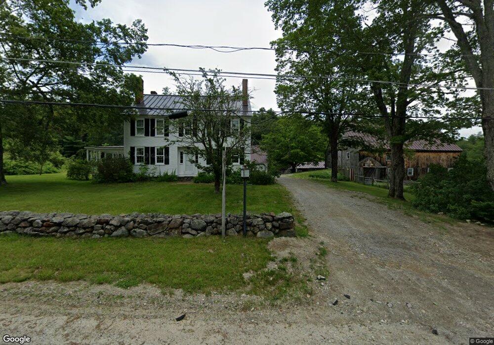
472 Poor Farm Rd Francestown, NH 03043
Greenfield NeighborhoodEstimated Value: $1,099,000 - $2,099,000
6
Beds
7
Baths
7,816
Sq Ft
$182/Sq Ft
Est. Value
About This Home
This home is located at 472 Poor Farm Rd, Francestown, NH 03043 and is currently estimated at $1,420,679, approximately $181 per square foot. 472 Poor Farm Rd is a home located in Hillsborough County with nearby schools including Francestown Elementary School, Great Brook School, and Conval Regional High School.
Ownership History
Date
Name
Owned For
Owner Type
Purchase Details
Closed on
Jun 26, 2002
Sold by
Bois Michael A
Bought by
Savage Lawrence A and Savage Diane L
Current Estimated Value
Purchase Details
Closed on
Mar 9, 2000
Sold by
Antoinette A Malouf Rv
Bought by
Bois Michael A
Home Financials for this Owner
Home Financials are based on the most recent Mortgage that was taken out on this home.
Original Mortgage
$252,000
Interest Rate
8.18%
Create a Home Valuation Report for This Property
The Home Valuation Report is an in-depth analysis detailing your home's value as well as a comparison with similar homes in the area
Home Values in the Area
Average Home Value in this Area
Purchase History
| Date | Buyer | Sale Price | Title Company |
|---|---|---|---|
| Savage Lawrence A | $860,000 | -- | |
| Bois Michael A | $695,000 | -- |
Source: Public Records
Mortgage History
| Date | Status | Borrower | Loan Amount |
|---|---|---|---|
| Open | Bois Michael A | $666,711 | |
| Closed | Bois Michael A | $250,000 | |
| Closed | Bois Michael A | $577,500 | |
| Previous Owner | Bois Michael A | $252,000 |
Source: Public Records
Tax History Compared to Growth
Tax History
| Year | Tax Paid | Tax Assessment Tax Assessment Total Assessment is a certain percentage of the fair market value that is determined by local assessors to be the total taxable value of land and additions on the property. | Land | Improvement |
|---|---|---|---|---|
| 2024 | $17,413 | $1,084,220 | $231,020 | $853,200 |
| 2023 | $17,303 | $620,639 | $125,339 | $495,300 |
| 2022 | $16,142 | $624,688 | $129,388 | $495,300 |
| 2021 | $15,459 | $630,463 | $135,163 | $495,300 |
| 2020 | $332 | $630,243 | $134,943 | $495,300 |
| 2019 | $15,234 | $630,270 | $134,970 | $495,300 |
| 2018 | $17,050 | $637,613 | $103,813 | $533,800 |
| 2017 | $15,859 | $638,436 | $104,636 | $533,800 |
| 2016 | $16,283 | $638,299 | $104,499 | $533,800 |
| 2015 | $16,169 | $641,895 | $108,095 | $533,800 |
| 2014 | $16,086 | $641,895 | $108,095 | $533,800 |
| 2013 | $14,306 | $628,294 | $213,794 | $414,500 |
Source: Public Records
Map
Nearby Homes
- 597 Poor Farm Rd
- 210 Main St
- 136 Main St
- 133 Hay Hill Rd
- 351 New Boston Rd
- 379 New Boston Rd
- 3 Old County Rd S
- 305 King Hill Rd
- 1115 Pleasant Pond Rd
- 1 Cross Rd
- 1195 Bennington Rd
- 1519 New Boston Rd
- 63 New Boston (Route 136) Rd
- Lot 1 Journeys End Rd
- Lot 7-13 Mountain Rd
- 0 Woodward Hill Rd Unit LOT E 4984900
- 0 Woodward Hill Rd Unit LOT B 4984898
- 37 Eastside Ln Unit 1
- 44 Trailside Ln Unit 15
- 008-043-000 School House Rd
- 523 Poor Farm Rd
- 8 Mount Crotched Dr
- 355 Poor Farm Rd
- 622 Poor Farm Rd
- 617 Poor Farm Rd
- 0 Todd Unit 27 4664150
- 0 Todd Unit 4726780
- 628 Poor Farm Rd
- 15 Todd Rd
- 284 Poor Farm Rd
- 000 Todd
- 8-93-1 Todd Rd
- 8-93-2 Todd Rd
- 1542 Bible Hill Rd
- 707 Poor Farm Rd
- 1490 Bible Hill Rd
- 85 Palmer Rd
- 265 Poor Farm Rd
- 1185 2nd Nh Francestown Turnpike
- 0 Bible Hill Extension Unit 4200992