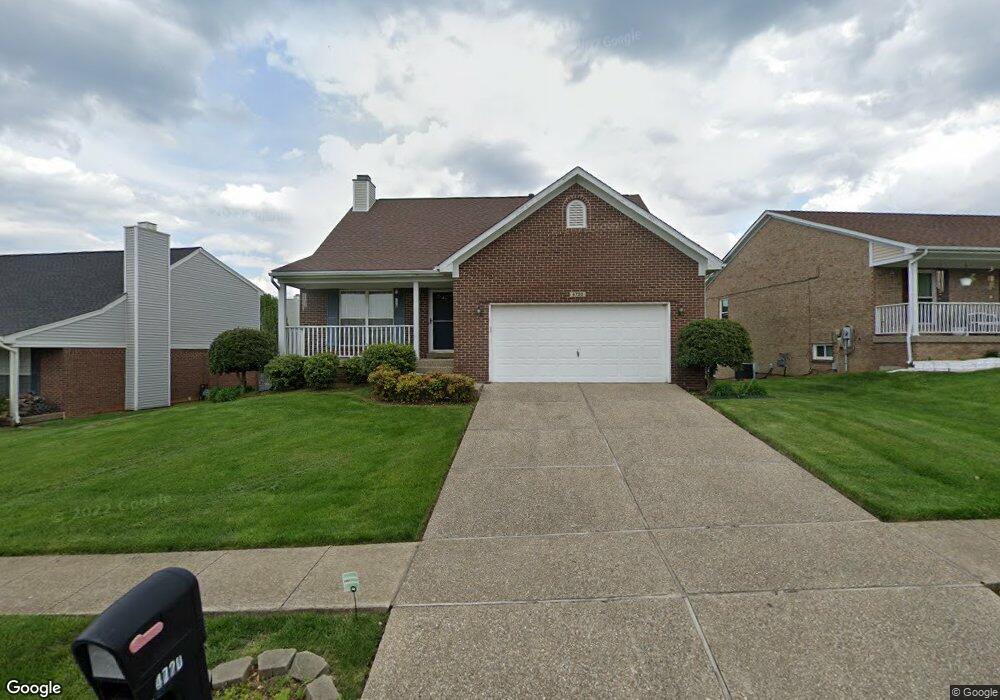
4720 Oak Pointe Dr Louisville, KY 40245
Worthington NeighborhoodEstimated Value: $328,000 - $368,000
3
Beds
3
Baths
2,763
Sq Ft
$128/Sq Ft
Est. Value
About This Home
This home is located at 4720 Oak Pointe Dr, Louisville, KY 40245 and is currently estimated at $353,808, approximately $128 per square foot. 4720 Oak Pointe Dr is a home located in Jefferson County with nearby schools including Wilder Elementary School, Zachary Taylor Elementary School, and Norton Elementary School.
Ownership History
Date
Name
Owned For
Owner Type
Purchase Details
Closed on
Mar 7, 2015
Sold by
Ganti Ravi and Ganti Daksha
Bought by
Vadula Shailaja
Current Estimated Value
Purchase Details
Closed on
Mar 28, 2005
Sold by
Martin Pamela F
Bought by
Ganti Ravis S and Ganti Shailaja
Home Financials for this Owner
Home Financials are based on the most recent Mortgage that was taken out on this home.
Original Mortgage
$154,000
Interest Rate
5.37%
Mortgage Type
Purchase Money Mortgage
Create a Home Valuation Report for This Property
The Home Valuation Report is an in-depth analysis detailing your home's value as well as a comparison with similar homes in the area
Home Values in the Area
Average Home Value in this Area
Purchase History
| Date | Buyer | Sale Price | Title Company |
|---|---|---|---|
| Vadula Shailaja | -- | None Available | |
| Ganti Ravis S | $192,500 | None Available |
Source: Public Records
Mortgage History
| Date | Status | Borrower | Loan Amount |
|---|---|---|---|
| Previous Owner | Ganti Ravis S | $154,000 | |
| Previous Owner | Ganti Ravis S | $19,200 |
Source: Public Records
Tax History Compared to Growth
Tax History
| Year | Tax Paid | Tax Assessment Tax Assessment Total Assessment is a certain percentage of the fair market value that is determined by local assessors to be the total taxable value of land and additions on the property. | Land | Improvement |
|---|---|---|---|---|
| 2024 | $3,302 | $290,170 | $52,000 | $238,170 |
| 2023 | $3,360 | $290,170 | $52,000 | $238,170 |
| 2022 | $3,372 | $220,840 | $35,000 | $185,840 |
| 2021 | $2,771 | $220,840 | $35,000 | $185,840 |
| 2020 | $2,544 | $220,840 | $35,000 | $185,840 |
| 2019 | $2,493 | $220,840 | $35,000 | $185,840 |
| 2018 | $2,364 | $220,840 | $35,000 | $185,840 |
| 2017 | $2,318 | $220,840 | $35,000 | $185,840 |
| 2013 | $1,925 | $192,500 | $31,000 | $161,500 |
Source: Public Records
Map
Nearby Homes
- 4800 Wooded Oak Cir
- 4708 Wooded Oak Cir
- 11310 Halifax Dr
- 4416 Shenandoah Dr
- 11012 Shady Hollow Dr
- 11209 Falling Springs Dr
- 5114 Rock Bluff Dr
- 11316 Prince George Ct
- 10912 Shady Hollow Dr
- 5204 Rock Bluff Dr
- 11502 Rock Bass Ct
- 4715 Lunenburg Dr
- 5215 Baywood Dr
- 11902 Queen Annes Ct
- 11909 Tazwell Dr Unit 5
- 11443 N Tazwell Dr
- 4658 Shenandoah Dr
- 5236 Pebble Creek Place
- 10800 Silvermoon Ct
- 11403 N Tazwell Dr
- 4722 Oak Pointe Dr
- 4718 Oak Pointe Dr
- 4831 Oak Pointe Dr
- 4716 Oak Pointe Dr
- 4724 Oak Pointe Dr
- 4718 Wooded Oak Cir
- 4720 Wooded Oak Cir
- 4716 Wooded Oak Cir
- 4722 Wooded Oak Cir
- 4726 Oak Pointe Dr
- 4714 Oak Pointe Dr
- 4719 Oak Pointe Dr
- 4727 Oak Pointe Dr
- 4714 Wooded Oak Cir
- 4724 Wooded Oak Cir
- 4729 Oak Pointe Dr
- 4800 Oak Pointe Dr
- 4712 Oak Pointe Dr
- 4717 Oak Pointe Dr
- 4712 Wooded Oak Cir