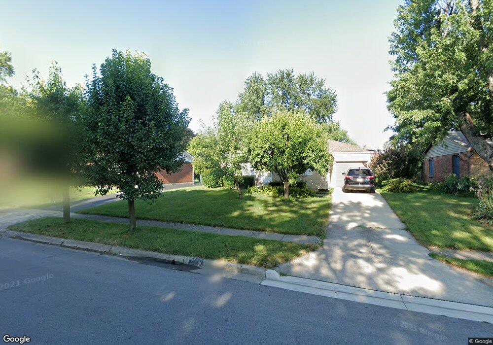
4721 Glendon Rd Columbus, OH 43229
Woodward Park NeighborhoodEstimated Value: $212,000 - $259,000
2
Beds
1
Bath
1,065
Sq Ft
$221/Sq Ft
Est. Value
About This Home
This home is located at 4721 Glendon Rd, Columbus, OH 43229 and is currently estimated at $235,583, approximately $221 per square foot. 4721 Glendon Rd is a home located in Franklin County with nearby schools including Valley Forge Elementary School, Woodward Park Middle School, and Northland High School.
Ownership History
Date
Name
Owned For
Owner Type
Purchase Details
Closed on
Jun 5, 1995
Sold by
Grubb Harold E
Bought by
Clyde R Mauger
Current Estimated Value
Home Financials for this Owner
Home Financials are based on the most recent Mortgage that was taken out on this home.
Original Mortgage
$33,500
Interest Rate
8.26%
Mortgage Type
New Conventional
Purchase Details
Closed on
Sep 1, 1978
Create a Home Valuation Report for This Property
The Home Valuation Report is an in-depth analysis detailing your home's value as well as a comparison with similar homes in the area
Home Values in the Area
Average Home Value in this Area
Purchase History
| Date | Buyer | Sale Price | Title Company |
|---|---|---|---|
| Clyde R Mauger | $78,500 | -- | |
| -- | $40,100 | -- |
Source: Public Records
Mortgage History
| Date | Status | Borrower | Loan Amount |
|---|---|---|---|
| Closed | Clyde R Mauger | $33,500 |
Source: Public Records
Tax History
| Year | Tax Paid | Tax Assessment Tax Assessment Total Assessment is a certain percentage of the fair market value that is determined by local assessors to be the total taxable value of land and additions on the property. | Land | Improvement |
|---|---|---|---|---|
| 2025 | $2,683 | $69,580 | $19,950 | $49,630 |
| 2024 | $2,683 | $69,580 | $19,950 | $49,630 |
| 2023 | $2,677 | $69,580 | $19,950 | $49,630 |
| 2022 | $1,565 | $38,920 | $10,500 | $28,420 |
| 2021 | $1,568 | $38,920 | $10,500 | $28,420 |
| 2020 | $1,570 | $38,920 | $10,500 | $28,420 |
| 2019 | $1,321 | $30,520 | $8,400 | $22,120 |
| 2018 | $1,318 | $30,520 | $8,400 | $22,120 |
| 2017 | $1,320 | $30,520 | $8,400 | $22,120 |
| 2016 | $1,452 | $30,670 | $7,810 | $22,860 |
| 2015 | $1,318 | $30,670 | $7,810 | $22,860 |
| 2014 | $1,321 | $30,670 | $7,810 | $22,860 |
| 2013 | $700 | $32,270 | $8,225 | $24,045 |
Source: Public Records
Map
Nearby Homes
- 1451 Merton Dr
- 4800 Bourke Rd
- 4815 Bourke Rd
- 4827 Glendon Rd
- 4795 Colonel Perry Dr
- 1414 Alvina Dr
- 4904 Almont Dr
- 4923 Karl Rd Unit 4925
- 1485 Norma Rd
- 4455 Kenfield Rd
- 1310 Fowler Dr
- 1637 Nestling Dr Unit 639
- 1116 Tulsa Dr
- 5004 Julie Place
- 4983 Almont Dr
- 1144 Reed Circle Dr
- 5008 Sienna Ln
- 1705 Ivyhill Loop S
- 4857 Tamarack Blvd
- 4143 Karl Rd Unit 314
- 4715 Glendon Rd
- 4733 Glendon Rd
- 4730 Mcfadden Rd
- 4709 Glendon Rd
- 4743 Glendon Rd
- 4722 Mcfadden Rd
- 4738 Mcfadden Rd
- 1441 Merton Dr
- 4714 Mcfadden Rd
- 4746 Mcfadden Rd
- 4714 Glendon Rd
- 4747 Glendon Rd
- 4687 Glendon Rd
- 4708 Glendon Rd
- 1440 Merton Dr
- 4683 Glendon Rd
- 4754 Mcfadden Rd
- 4755 Glendon Rd
- 4750 Glendon Rd
- 4762 Mcfadden Rd
Your Personal Tour Guide
Ask me questions while you tour the home.