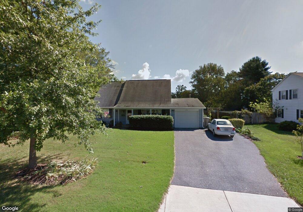
4722 Ramsgate Ln Bowie, MD 20715
Rockledge NeighborhoodEstimated Value: $449,304 - $478,000
4
Beds
2
Baths
1,512
Sq Ft
$308/Sq Ft
Est. Value
About This Home
This home is located at 4722 Ramsgate Ln, Bowie, MD 20715 and is currently estimated at $465,076, approximately $307 per square foot. 4722 Ramsgate Ln is a home located in Prince George's County with nearby schools including Rockledge Elementary School, Samuel Ogle Middle School, and Bowie High School.
Ownership History
Date
Name
Owned For
Owner Type
Purchase Details
Closed on
Oct 7, 2008
Sold by
Eagen Robert F
Bought by
Boyd Susan D
Current Estimated Value
Home Financials for this Owner
Home Financials are based on the most recent Mortgage that was taken out on this home.
Original Mortgage
$316,650
Outstanding Balance
$210,818
Interest Rate
6.54%
Mortgage Type
VA
Estimated Equity
$254,258
Purchase Details
Closed on
Sep 22, 2008
Sold by
Eagen Robert F
Bought by
Boyd Susan D
Home Financials for this Owner
Home Financials are based on the most recent Mortgage that was taken out on this home.
Original Mortgage
$316,650
Outstanding Balance
$210,818
Interest Rate
6.54%
Mortgage Type
VA
Estimated Equity
$254,258
Create a Home Valuation Report for This Property
The Home Valuation Report is an in-depth analysis detailing your home's value as well as a comparison with similar homes in the area
Home Values in the Area
Average Home Value in this Area
Purchase History
| Date | Buyer | Sale Price | Title Company |
|---|---|---|---|
| Boyd Susan D | $310,000 | -- | |
| Boyd Susan D | $310,000 | -- |
Source: Public Records
Mortgage History
| Date | Status | Borrower | Loan Amount |
|---|---|---|---|
| Open | Boyd Susan D | $316,650 | |
| Closed | Boyd Susan D | $316,650 |
Source: Public Records
Tax History
| Year | Tax Paid | Tax Assessment Tax Assessment Total Assessment is a certain percentage of the fair market value that is determined by local assessors to be the total taxable value of land and additions on the property. | Land | Improvement |
|---|---|---|---|---|
| 2025 | $5,096 | $340,300 | $101,200 | $239,100 |
| 2024 | $5,096 | $326,400 | -- | -- |
| 2023 | $4,895 | $312,500 | $0 | $0 |
| 2022 | $4,647 | $298,600 | $101,200 | $197,400 |
| 2021 | $4,430 | $286,400 | $0 | $0 |
| 2020 | $4,299 | $274,200 | $0 | $0 |
| 2019 | $4,168 | $262,000 | $100,600 | $161,400 |
| 2018 | $4,051 | $253,700 | $0 | $0 |
| 2017 | $3,962 | $245,400 | $0 | $0 |
| 2016 | -- | $237,100 | $0 | $0 |
| 2015 | $3,425 | $227,633 | $0 | $0 |
| 2014 | $3,425 | $218,167 | $0 | $0 |
Source: Public Records
Map
Nearby Homes
- 12109 Whitehall Dr
- 4003 Woodrow Ln
- 4005 Woodhaven Ln
- 12409 Rockledge Dr
- 13926 Pecan Ridge Way
- 13928 Pecan Ridge Way
- 12415 Round Tree Ln
- Monterey II - Craftsman Plan at Pecan Ridge
- Lure Plan at Pecan Ridge
- Pinehurst II Plan at Pecan Ridge
- Annapolis - Craftsman Plan at Pecan Ridge
- Colorado Plan at Pecan Ridge
- Deerfield Plan at Pecan Ridge
- Emory II - Craftsman Plan at Pecan Ridge
- 8512 River Park Rd
- 13814 Pecan Ridge Way
- 13812 Pecan Ridge Way
- 7011 Old Chapel Dr
- 8121 Triple Crown Rd
- 13306 Littlepage Place
- 4720 Ramsgate Ln
- 12011 Rockledge Dr
- 4726 Ramsgate Ln
- 12013 Rockledge Dr
- 4721 Ramsgate Ln
- 4723 Ramsgate Ln
- 4714 Ramsgate Ln
- 4708 Ramsgate Ln
- 4725 Ramsgate Ln
- 4719 Ramsgate Ln
- 12015 Rockledge Dr
- 4706 Ramsgate Ln
- 4727 Ramsgate Ln
- 4717 Ramsgate Ln
- 12010 Rockledge Dr
- 12008 Rockledge Dr
- 12100 Round Tree Ln
- 12017 Rockledge Dr
- 12006 Rockledge Dr
- 12004 Rockledge Dr