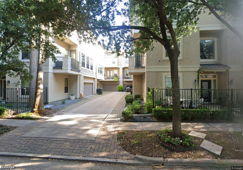
4724 Banning Dr Unit C Houston, TX 77027
Afton Oaks NeighborhoodEstimated Value: $718,343 - $1,110,000
3
Beds
4
Baths
3,070
Sq Ft
$276/Sq Ft
Est. Value
About This Home
This home is located at 4724 Banning Dr Unit C, Houston, TX 77027 and is currently estimated at $846,336, approximately $275 per square foot. 4724 Banning Dr Unit C is a home located in Harris County with nearby schools including School at St. George Place, Lanier Middle School, and Lamar High School.
Ownership History
Date
Name
Owned For
Owner Type
Purchase Details
Closed on
May 27, 2005
Sold by
Hhn Homes Lp
Bought by
Lo Richard K and Nagy Edina T
Current Estimated Value
Home Financials for this Owner
Home Financials are based on the most recent Mortgage that was taken out on this home.
Original Mortgage
$328,000
Outstanding Balance
$172,007
Interest Rate
5.83%
Mortgage Type
Fannie Mae Freddie Mac
Estimated Equity
$674,329
Purchase Details
Closed on
Jun 22, 1995
Sold by
Ammons Robert E
Bought by
Adair A F and Adair Donna
Home Financials for this Owner
Home Financials are based on the most recent Mortgage that was taken out on this home.
Original Mortgage
$123,000
Interest Rate
7.8%
Create a Home Valuation Report for This Property
The Home Valuation Report is an in-depth analysis detailing your home's value as well as a comparison with similar homes in the area
Home Values in the Area
Average Home Value in this Area
Purchase History
| Date | Buyer | Sale Price | Title Company |
|---|---|---|---|
| Lo Richard K | -- | Stewart Title Company | |
| Adair A F | -- | Lawyers Title |
Source: Public Records
Mortgage History
| Date | Status | Borrower | Loan Amount |
|---|---|---|---|
| Open | Lo Richard K | $328,000 | |
| Previous Owner | Adair A F | $123,000 | |
| Closed | Lo Richard K | $41,000 |
Source: Public Records
Tax History
| Year | Tax Paid | Tax Assessment Tax Assessment Total Assessment is a certain percentage of the fair market value that is determined by local assessors to be the total taxable value of land and additions on the property. | Land | Improvement |
|---|---|---|---|---|
| 2025 | $9,232 | $619,000 | $200,586 | $418,414 |
| 2024 | $9,232 | $547,604 | $200,586 | $347,018 |
| 2023 | $9,232 | $547,604 | $200,586 | $347,018 |
| 2022 | $11,516 | $523,000 | $165,189 | $357,811 |
| 2021 | $11,905 | $510,780 | $165,189 | $345,591 |
| 2020 | $12,201 | $503,825 | $165,189 | $338,636 |
| 2019 | $13,149 | $519,647 | $165,189 | $354,458 |
| 2018 | $9,953 | $534,000 | $165,189 | $368,811 |
| 2017 | $11,587 | $548,400 | $165,189 | $383,211 |
| 2016 | $10,534 | $549,591 | $165,189 | $384,402 |
| 2015 | $6,938 | $452,498 | $117,992 | $334,506 |
| 2014 | $6,938 | $424,104 | $117,992 | $306,112 |
Source: Public Records
Map
Nearby Homes
- 4738 Banning Dr
- 4740 Banning Dr
- 4724 Banning Dr Unit A
- 4723 Aftonshire Dr Unit A3
- 4514 Devon St
- 4510 Ivanhoe St
- 4547 Shetland Ln
- 3030 Post Oak Blvd Unit 203
- 5005 Hidalgo St Unit 312
- 5005 Hidalgo St Unit 601
- 5005 Hidalgo St Unit 613
- 5005 Hidalgo St Unit 413
- 2503 Mccue Rd Unit 5
- 2503 Mccue Rd Unit 6
- 2503 Mccue Rd Unit 36
- 2047 Westcreek Ln Unit 708
- 2047 Westcreek Ln Unit 601
- 2047 Westcreek Ln Unit 608
- 2047 Westcreek Ln Unit 505
- 3124 Mid Ln
- 4724 Banning Dr Unit A
- 4724 Banning Dr Unit B
- 4724 Banning Dr Unit D
- 4724 Banning Dr Unit E
- 4724 Banning Dr Unit F
- 4724 Banning Dr Unit B
- 4724 Banning Dr Unit F
- 4724 Banning Dr
- 4724 Banning Dr
- 4724 Banning Dr
- 4720 Banning Dr Unit B
- 4720 Banning Dr Unit C
- 4720 Banning Dr Unit A
- 4720 Banning Dr
- 4730 Banning Dr
- 4732 Banning Dr
- 4728 Banning Dr
- 4723 Ivanhoe St
- 4725 Banning Dr
- 4714 Banning Dr
Your Personal Tour Guide
Ask me questions while you tour the home.