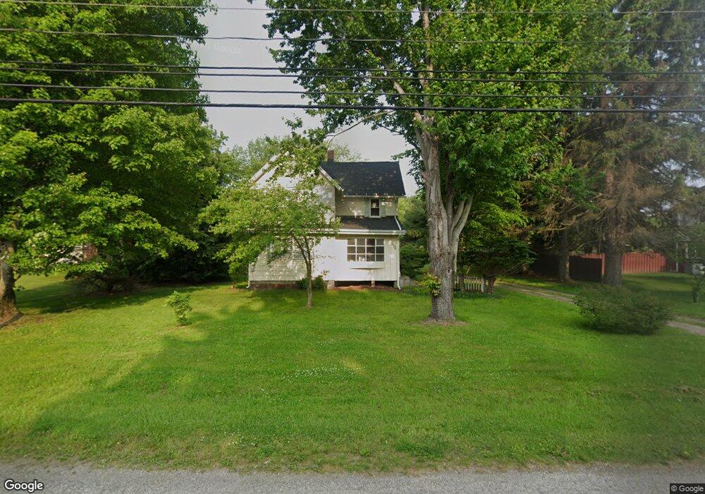
473 Center Rd Conneaut, OH 44030
Estimated Value: $149,000 - $217,000
3
Beds
2
Baths
1,737
Sq Ft
$101/Sq Ft
Est. Value
About This Home
This home is located at 473 Center Rd, Conneaut, OH 44030 and is currently estimated at $175,145, approximately $100 per square foot. 473 Center Rd is a home located in Ashtabula County with nearby schools including Lakeshore Primary Elementary School, Gateway Elementary School, and Conneaut Middle School.
Ownership History
Date
Name
Owned For
Owner Type
Purchase Details
Closed on
Jun 25, 2021
Sold by
Estate Of Amy Estelle Gulaian
Bought by
Troia Keith M
Current Estimated Value
Home Financials for this Owner
Home Financials are based on the most recent Mortgage that was taken out on this home.
Original Mortgage
$50,728
Outstanding Balance
$46,049
Interest Rate
2.93%
Mortgage Type
New Conventional
Estimated Equity
$129,096
Purchase Details
Closed on
Jun 13, 2006
Sold by
Troia Keith M
Bought by
Troia Keith M and Gulaian Amy E
Purchase Details
Closed on
Dec 28, 2001
Sold by
Boyce Thomas J
Bought by
Troia Keith M
Home Financials for this Owner
Home Financials are based on the most recent Mortgage that was taken out on this home.
Original Mortgage
$107,350
Interest Rate
6.53%
Mortgage Type
New Conventional
Create a Home Valuation Report for This Property
The Home Valuation Report is an in-depth analysis detailing your home's value as well as a comparison with similar homes in the area
Home Values in the Area
Average Home Value in this Area
Purchase History
| Date | Buyer | Sale Price | Title Company |
|---|---|---|---|
| Troia Keith M | -- | None Available | |
| Troia Keith M | -- | None Available | |
| Troia Keith M | $113,000 | -- |
Source: Public Records
Mortgage History
| Date | Status | Borrower | Loan Amount |
|---|---|---|---|
| Open | Troia Keith M | $50,728 | |
| Previous Owner | Troia Keith M | $107,350 |
Source: Public Records
Tax History Compared to Growth
Tax History
| Year | Tax Paid | Tax Assessment Tax Assessment Total Assessment is a certain percentage of the fair market value that is determined by local assessors to be the total taxable value of land and additions on the property. | Land | Improvement |
|---|---|---|---|---|
| 2024 | $2,200 | $30,070 | $7,140 | $22,930 |
| 2023 | $1,424 | $30,070 | $7,140 | $22,930 |
| 2022 | $1,283 | $23,840 | $5,500 | $18,340 |
| 2021 | $1,283 | $23,840 | $5,500 | $18,340 |
| 2020 | $1,283 | $23,840 | $5,500 | $18,340 |
| 2019 | $1,381 | $25,210 | $3,260 | $21,950 |
| 2018 | $1,317 | $25,210 | $3,260 | $21,950 |
| 2017 | $1,315 | $25,210 | $3,260 | $21,950 |
| 2016 | $1,170 | $24,440 | $3,190 | $21,250 |
| 2015 | $1,181 | $24,440 | $3,190 | $21,250 |
| 2014 | $1,041 | $24,440 | $3,190 | $21,250 |
| 2013 | $1,022 | $24,680 | $2,940 | $21,740 |
Source: Public Records
Map
Nearby Homes
- 0 Hillcrest Ct
- 18 Hillcrest Ct
- 855 Spring St Unit S9
- VL Center Rd
- 251 St Rt 7
- 247 Whitney St
- 589 Main St
- 455 Main St
- 536 Madison St
- 0 Dorman Rd
- 210 W Main Rd
- 220 Daniels Ave
- 474 Sherman St
- 202 W Main Rd Unit 49
- 202 W Main Rd Unit Lot 150
- 202 W Main Rd Unit 33
- 202 W Main Rd Unit 16
- 429 Depot St
- 0 Center Rd
- 459 Mill St