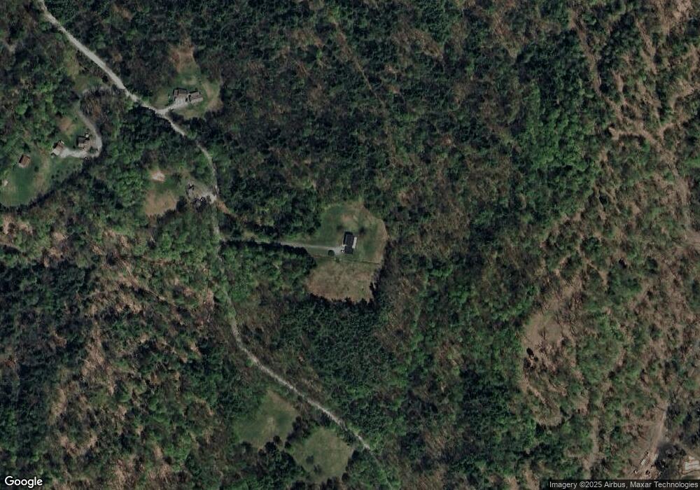
473 Parsonage Rd Cornish, NH 03745
Estimated Value: $348,000 - $797,000
4
Beds
3
Baths
2,910
Sq Ft
$203/Sq Ft
Est. Value
About This Home
This home is located at 473 Parsonage Rd, Cornish, NH 03745 and is currently estimated at $591,873, approximately $203 per square foot. 473 Parsonage Rd is a home located in Sullivan County with nearby schools including Cornish Elementary School.
Ownership History
Date
Name
Owned For
Owner Type
Purchase Details
Closed on
May 9, 2025
Sold by
Sandra G Guest Ft and Stevenson
Bought by
Picard Donald P
Current Estimated Value
Purchase Details
Closed on
Feb 19, 2013
Sold by
Sandra G Guest Ret and Guest
Bought by
Picard Donald P
Purchase Details
Closed on
Jan 19, 2013
Sold by
Sandra G Guest Ret and Guest
Bought by
Picard Donald P
Purchase Details
Closed on
Dec 12, 2012
Sold by
Sandra G Guest Ft and Guest
Bought by
Picard Donald P
Create a Home Valuation Report for This Property
The Home Valuation Report is an in-depth analysis detailing your home's value as well as a comparison with similar homes in the area
Home Values in the Area
Average Home Value in this Area
Purchase History
| Date | Buyer | Sale Price | Title Company |
|---|---|---|---|
| Picard Donald P | $95,000 | None Available | |
| Picard Donald P | $95,000 | None Available | |
| Picard Donald P | $95,000 | None Available | |
| Picard Donald P | -- | -- | |
| Picard Donald P | -- | -- | |
| Picard Donald P | -- | -- | |
| Picard Donald P | -- | -- | |
| Picard Donald P | -- | -- | |
| Picard Donald P | -- | -- | |
| Picard Donald P | $40,000 | -- | |
| Picard Donald P | $40,000 | -- |
Source: Public Records
Tax History Compared to Growth
Tax History
| Year | Tax Paid | Tax Assessment Tax Assessment Total Assessment is a certain percentage of the fair market value that is determined by local assessors to be the total taxable value of land and additions on the property. | Land | Improvement |
|---|---|---|---|---|
| 2024 | $8,857 | $547,091 | $119,891 | $427,200 |
| 2023 | $7,644 | $291,431 | $64,331 | $227,100 |
| 2022 | $6,911 | $291,952 | $64,852 | $227,100 |
| 2021 | $6,642 | $292,468 | $65,368 | $227,100 |
| 2020 | $6,218 | $292,064 | $65,364 | $226,700 |
| 2019 | $5,608 | $287,297 | $65,297 | $222,000 |
| 2018 | $5,838 | $265,479 | $58,379 | $207,100 |
| 2017 | $5,709 | $265,309 | $58,209 | $207,100 |
| 2016 | $5,528 | $258,332 | $58,132 | $200,200 |
| 2015 | $5,934 | $258,126 | $57,926 | $200,200 |
| 2014 | $5,865 | $258,143 | $57,943 | $200,200 |
| 2013 | $5,835 | $278,275 | $70,275 | $208,000 |
Source: Public Records
Map
Nearby Homes
- 466 Parsonage Rd
- 00 Tandy Brook Rd Unit 12
- 0 Route 120 Route Unit 48
- 614 Redwater Brook Rd
- Lot 73A & 74A East Rd
- 00 Hewitt Rd
- 68 Jarvis St Unit 70
- 0 Cat Hole Rd Unit 5052634
- 16 Eric Place
- 0 Hanover St Unit 1
- 17 Alderwood Ct
- 0 Slab City Rd Unit 5036741
- 11 Cubb Ct
- 84 Cubb Ct
- 108 Cubb Ct
- 517 Back Mountain Rd
- 23 Cubb Ct
- 505 Back Mountain Rd Unit 14
- 473 Taylor Dr
- 223 Taylor Dr
- 449 Parsonage Rd
- 528 Parsonage Rd
- 442 Parsonage Rd
- 413 Parsonage Rd
- 79 Pete Daniels Rd
- 418 Parsonage Rd
- 575 Parsonage Rd
- 10 Pete Daniels Rd
- SOUTH Parsonage
- 134 Jackson Rd
- 0 Tewksbury Rd
- 26 Tewksbury Rd
- 368 Parsonage Rd
- 133 Jackson Rd
- 88 Jackson Rd
- 252 Jackson Rd
- 7 Tewksbury Rd
- 260 Jackson Rd
- 248 Town House Rd
- 207 Town House Rd
