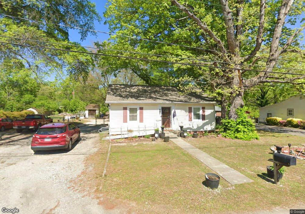
4732 Cooks Rd Richmond, VA 23224
McGuire Manor NeighborhoodEstimated Value: $211,000 - $259,000
2
Beds
1
Bath
952
Sq Ft
$239/Sq Ft
Est. Value
About This Home
This home is located at 4732 Cooks Rd, Richmond, VA 23224 and is currently estimated at $227,472, approximately $238 per square foot. 4732 Cooks Rd is a home located in Richmond City with nearby schools including Cardinal Elementary School, Richmond High School for the Arts, and Open High School.
Ownership History
Date
Name
Owned For
Owner Type
Purchase Details
Closed on
Aug 2, 2022
Sold by
Lane Charles B
Bought by
Shelton Constance and Davis Mary
Current Estimated Value
Home Financials for this Owner
Home Financials are based on the most recent Mortgage that was taken out on this home.
Original Mortgage
$166,550
Outstanding Balance
$159,467
Interest Rate
5.7%
Mortgage Type
FHA
Estimated Equity
$68,005
Purchase Details
Closed on
Apr 1, 2003
Sold by
Baker Beverly A
Bought by
Lane Charles B
Create a Home Valuation Report for This Property
The Home Valuation Report is an in-depth analysis detailing your home's value as well as a comparison with similar homes in the area
Home Values in the Area
Average Home Value in this Area
Purchase History
| Date | Buyer | Sale Price | Title Company |
|---|---|---|---|
| Shelton Constance | $169,623 | Old Republic National Title | |
| Lane Charles B | $33,000 | -- |
Source: Public Records
Mortgage History
| Date | Status | Borrower | Loan Amount |
|---|---|---|---|
| Open | Shelton Constance | $166,550 |
Source: Public Records
Tax History Compared to Growth
Tax History
| Year | Tax Paid | Tax Assessment Tax Assessment Total Assessment is a certain percentage of the fair market value that is determined by local assessors to be the total taxable value of land and additions on the property. | Land | Improvement |
|---|---|---|---|---|
| 2025 | $2,172 | $181,000 | $59,000 | $122,000 |
| 2024 | $2,136 | $178,000 | $59,000 | $119,000 |
| 2023 | $1,800 | $150,000 | $45,000 | $105,000 |
| 2022 | $1,584 | $132,000 | $45,000 | $87,000 |
| 2021 | $1,092 | $94,000 | $35,000 | $59,000 |
| 2020 | $1,092 | $91,000 | $35,000 | $56,000 |
| 2019 | $1,092 | $91,000 | $35,000 | $56,000 |
| 2018 | $1,044 | $87,000 | $35,000 | $52,000 |
| 2017 | $1,008 | $84,000 | $35,000 | $49,000 |
| 2016 | $912 | $76,000 | $24,000 | $52,000 |
| 2015 | $936 | $78,000 | $24,000 | $54,000 |
| 2014 | $936 | $78,000 | $24,000 | $54,000 |
Source: Public Records
Map
Nearby Homes
- 1741 Alaska Dr
- 2228 Cullen Rd
- 1827 Clarkson Rd
- 1519 Kingswood St
- 1549 Clarkson Rd
- 4136 Mckay Ave
- 2107 Broad Rock Blvd
- 1923 Powell Rd
- 5219 Bryce Ln
- 1100 Ridgecliff Dr
- 1957 Powell Rd
- 1237 Greystone Ave
- 5116 Alberene Rd
- 5343 Germain Rd
- 801 Bedrock Ln
- 4616 Ferguson Ln
- 920 E Belt Blvd
- 3811 Terminal Ave
- 3928 E Broad Rock Rd
- 1138 Hodges Rd