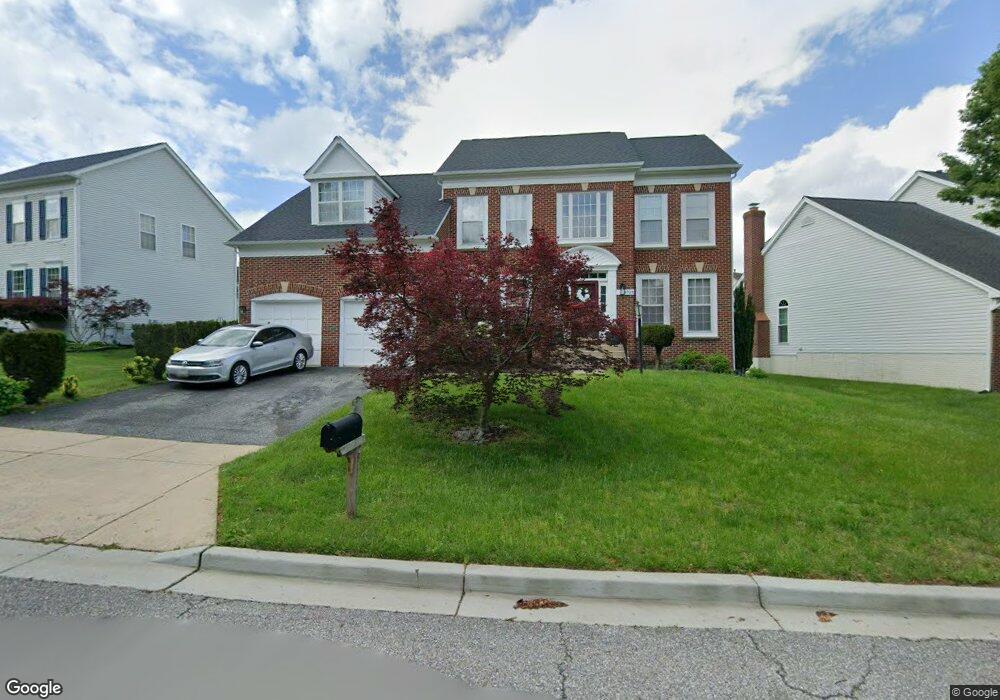
4733 New Kent Dr Upper Marlboro, MD 20772
Estimated Value: $586,335 - $679,000
--
Bed
3
Baths
3,083
Sq Ft
$203/Sq Ft
Est. Value
About This Home
This home is located at 4733 New Kent Dr, Upper Marlboro, MD 20772 and is currently estimated at $624,834, approximately $202 per square foot. 4733 New Kent Dr is a home located in Prince George's County with nearby schools including Barack Obama Elementary School, James Madison Middle School, and Dr. Henry A. Wise Jr. High School.
Ownership History
Date
Name
Owned For
Owner Type
Purchase Details
Closed on
Aug 9, 2005
Sold by
Foye Towanna
Bought by
Josephs Towanna S and Vernon Foye
Current Estimated Value
Home Financials for this Owner
Home Financials are based on the most recent Mortgage that was taken out on this home.
Original Mortgage
$285,000
Outstanding Balance
$148,100
Interest Rate
5.59%
Mortgage Type
New Conventional
Estimated Equity
$476,734
Purchase Details
Closed on
Jan 7, 1998
Sold by
Coscan Washington Inc
Bought by
Foye Towanna
Create a Home Valuation Report for This Property
The Home Valuation Report is an in-depth analysis detailing your home's value as well as a comparison with similar homes in the area
Home Values in the Area
Average Home Value in this Area
Purchase History
| Date | Buyer | Sale Price | Title Company |
|---|---|---|---|
| Josephs Towanna S | -- | -- | |
| Foye Towanna | $260,000 | -- |
Source: Public Records
Mortgage History
| Date | Status | Borrower | Loan Amount |
|---|---|---|---|
| Open | Josephs Towanna S | $285,000 |
Source: Public Records
Tax History Compared to Growth
Tax History
| Year | Tax Paid | Tax Assessment Tax Assessment Total Assessment is a certain percentage of the fair market value that is determined by local assessors to be the total taxable value of land and additions on the property. | Land | Improvement |
|---|---|---|---|---|
| 2025 | $8,001 | $554,300 | $101,200 | $453,100 |
| 2024 | $8,001 | $511,567 | $0 | $0 |
| 2023 | $7,365 | $468,833 | $0 | $0 |
| 2022 | $6,730 | $426,100 | $101,200 | $324,900 |
| 2021 | $6,620 | $418,733 | $0 | $0 |
| 2020 | $6,511 | $411,367 | $0 | $0 |
| 2019 | $7,094 | $404,000 | $100,600 | $303,400 |
| 2018 | $6,805 | $384,567 | $0 | $0 |
| 2017 | $6,516 | $365,133 | $0 | $0 |
| 2016 | -- | $345,700 | $0 | $0 |
| 2015 | $5,700 | $339,033 | $0 | $0 |
| 2014 | $5,700 | $332,367 | $0 | $0 |
Source: Public Records
Map
Nearby Homes
- 13139 Ripon Place
- 5222 Derby Manor Ln
- 11508 Pegasus Ct
- 5303 Chestnut Manor Ct
- 4655 Penzance Place
- 11504 Carriage Crossing Dr
- 4204 Rolling Paddock Dr
- 4411 Beckenham Place
- 4235 Chariot Way
- 4423 Beckenham Place
- 4302 Bridle Ridge Rd
- 3913 Rolling Paddock Dr
- 4504 Cross Country Terrace
- 4506 Cross Country Terrace
- 4006 Bridle Ridge Rd
- 13560 Lord Sterling Place
- 13550 Lord Sterling Place
- 5209 Mount Airy Ln
- 4506 Grazing Way
- 11007 Fillys Ford Crossing
- 4735 New Kent Dr
- 4729 New Kent Dr
- 4604 Rockbridge Ct
- 4737 New Kent Dr
- 4727 New Kent Dr
- 4606 Rockbridge Ct
- 4732 New Kent Dr
- 4734 New Kent Dr
- 12312 Foyette Ln
- 4736 New Kent Dr
- 4602 Rockbridge Ct
- 4730 New Kent Dr
- 4725 New Kent Dr
- 4728 New Kent Dr
- 12400 Foyette Ln
- 4506 Forsyth Ct
- 4723 New Kent Dr
- 4600 Rockbridge Ct
- 4409 Rockdale Ln
- 4501 Rockdale Ln