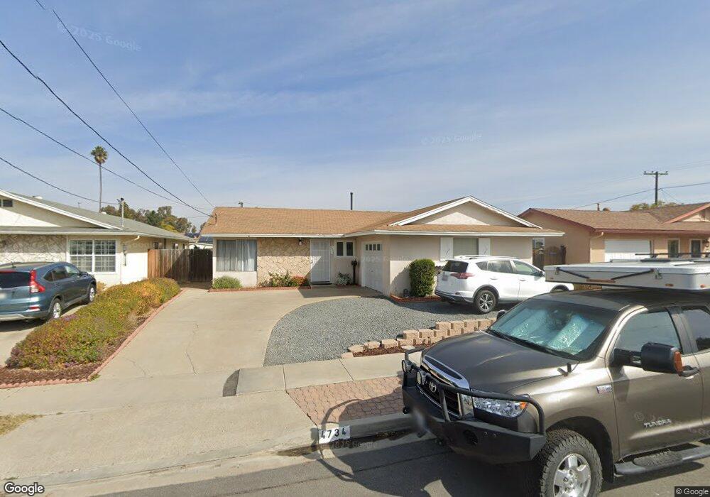
4734 Ramsay Ave San Diego, CA 92122
University City NeighborhoodEstimated Value: $1,367,000 - $1,573,000
3
Beds
2
Baths
1,720
Sq Ft
$860/Sq Ft
Est. Value
About This Home
This home is located at 4734 Ramsay Ave, San Diego, CA 92122 and is currently estimated at $1,478,648, approximately $859 per square foot. 4734 Ramsay Ave is a home located in San Diego County with nearby schools including Marie Curie Elementary School, Standley Middle School, and University City High School.
Ownership History
Date
Name
Owned For
Owner Type
Purchase Details
Closed on
Mar 21, 2001
Sold by
Gedminas Roger A and Gedminas Melanie M
Bought by
Gedminas Roger A and Gedminas Melanie M
Current Estimated Value
Home Financials for this Owner
Home Financials are based on the most recent Mortgage that was taken out on this home.
Original Mortgage
$237,000
Outstanding Balance
$86,557
Interest Rate
7.06%
Estimated Equity
$1,392,091
Purchase Details
Closed on
Jul 10, 1998
Sold by
Hunter Robert H and Hunter Christine S
Bought by
Gedminas Roger A and Hennell Melanie
Home Financials for this Owner
Home Financials are based on the most recent Mortgage that was taken out on this home.
Original Mortgage
$238,400
Interest Rate
7%
Purchase Details
Closed on
Oct 30, 1985
Create a Home Valuation Report for This Property
The Home Valuation Report is an in-depth analysis detailing your home's value as well as a comparison with similar homes in the area
Home Values in the Area
Average Home Value in this Area
Purchase History
| Date | Buyer | Sale Price | Title Company |
|---|---|---|---|
| Gedminas Roger A | -- | Stewart Title | |
| Gedminas Roger A | $251,000 | Chicago Title Co | |
| -- | $131,900 | -- |
Source: Public Records
Mortgage History
| Date | Status | Borrower | Loan Amount |
|---|---|---|---|
| Open | Gedminas Roger A | $237,000 | |
| Closed | Gedminas Roger A | $238,400 |
Source: Public Records
Tax History Compared to Growth
Tax History
| Year | Tax Paid | Tax Assessment Tax Assessment Total Assessment is a certain percentage of the fair market value that is determined by local assessors to be the total taxable value of land and additions on the property. | Land | Improvement |
|---|---|---|---|---|
| 2025 | $4,687 | $393,471 | $203,791 | $189,680 |
| 2024 | $4,687 | $385,757 | $199,796 | $185,961 |
| 2023 | $4,581 | $378,194 | $195,879 | $182,315 |
| 2022 | $4,458 | $370,780 | $192,039 | $178,741 |
| 2021 | $4,426 | $363,511 | $188,274 | $175,237 |
| 2020 | $4,371 | $359,785 | $186,344 | $173,441 |
| 2019 | $4,292 | $352,732 | $182,691 | $170,041 |
| 2018 | $4,012 | $345,816 | $179,109 | $166,707 |
| 2017 | $81 | $339,037 | $175,598 | $163,439 |
| 2016 | $3,851 | $332,390 | $172,155 | $160,235 |
| 2015 | $3,793 | $327,399 | $169,570 | $157,829 |
| 2014 | $3,732 | $320,987 | $166,249 | $154,738 |
Source: Public Records
Map
Nearby Homes
- 7056 Haworth St
- 4635 Pauling Ave
- 4612 Benhurst Ave
- 7212 Florey St
- 4627 Huggins St
- 4282 Robbins St
- 4224 Governor Dr
- 4138 Combe Way
- 7190 Shoreline Dr Unit 6313
- 6214 Agee St Unit 34
- 7160 Shoreline Dr Unit 4213
- 6180 Agee St Unit 159
- 6188 Agee St Unit 230
- 6190 Agee St Unit 260
- 6330 Genesee Ave Unit 319
- 6330 Genesee Ave Unit 220
- 6330 Genesee Ave Unit 119
- 6330 Genesee Ave Unit 112
- 6330 Genesee Ave Unit 213
- 6350 Genesee Ave Unit 107
- 4724 Ramsay Ave
- 4744 Ramsay Ave
- 4773 Pauling Ave
- 4714 Ramsay Ave
- 4767 Pauling Ave
- 4781 Pauling Ave
- 4761 Pauling Ave
- 4731 Ramsay Ave
- 4721 Ramsay Ave
- 4741 Ramsay Ave
- 4704 Ramsay Ave
- 4711 Ramsay Ave
- 4755 Pauling Ave
- 4676 Ramsay Ave
- 4701 Ramsay Ave
- 6959 Florey St
- 6969 Florey St
- 4749 Pauling Ave
- 6949 Florey St
- 6979 Florey St