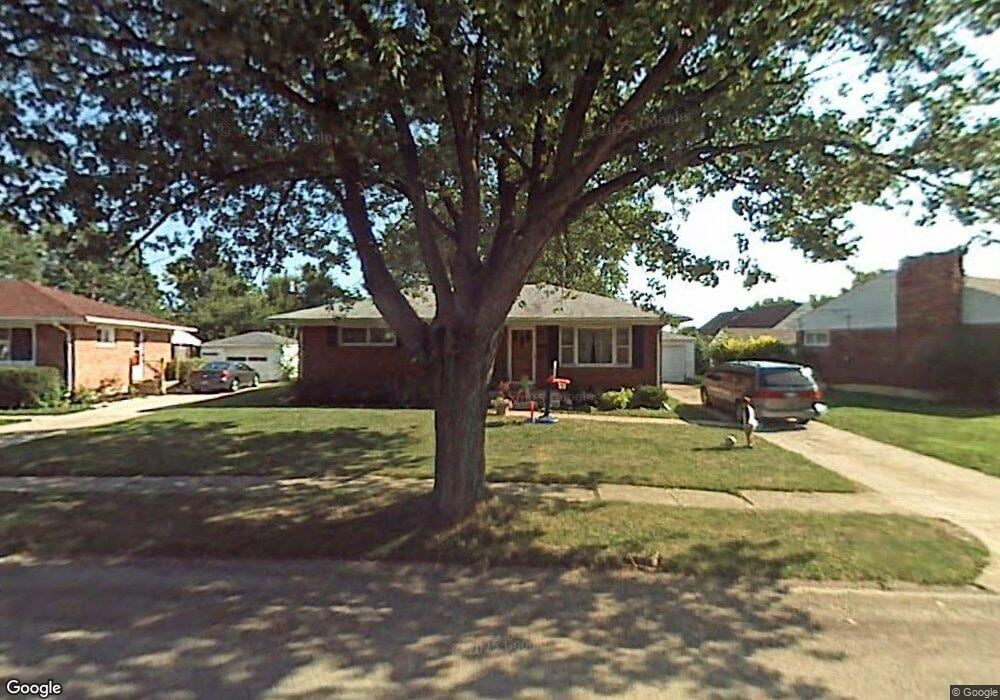
4739 Curtis Dr Springfield, OH 45503
Estimated Value: $170,000 - $202,000
3
Beds
1
Bath
1,075
Sq Ft
$171/Sq Ft
Est. Value
About This Home
This home is located at 4739 Curtis Dr, Springfield, OH 45503 and is currently estimated at $183,749, approximately $170 per square foot. 4739 Curtis Dr is a home located in Clark County with nearby schools including Northridge Elementary School, Kenton Ridge Middle & High School, and Emmanuel Christian Academy.
Ownership History
Date
Name
Owned For
Owner Type
Purchase Details
Closed on
Dec 9, 2004
Sold by
Havens Ray Albert
Bought by
Havens Douglas and Havens Marcia L
Current Estimated Value
Home Financials for this Owner
Home Financials are based on the most recent Mortgage that was taken out on this home.
Original Mortgage
$64,400
Interest Rate
7.37%
Mortgage Type
Purchase Money Mortgage
Create a Home Valuation Report for This Property
The Home Valuation Report is an in-depth analysis detailing your home's value as well as a comparison with similar homes in the area
Home Values in the Area
Average Home Value in this Area
Purchase History
| Date | Buyer | Sale Price | Title Company |
|---|---|---|---|
| Havens Douglas | $92,000 | -- |
Source: Public Records
Mortgage History
| Date | Status | Borrower | Loan Amount |
|---|---|---|---|
| Closed | Havens Douglas | $64,400 |
Source: Public Records
Tax History
| Year | Tax Paid | Tax Assessment Tax Assessment Total Assessment is a certain percentage of the fair market value that is determined by local assessors to be the total taxable value of land and additions on the property. | Land | Improvement |
|---|---|---|---|---|
| 2025 | $1,548 | $54,090 | $16,210 | $37,880 |
| 2024 | $1,497 | $35,400 | $9,430 | $25,970 |
| 2023 | $1,497 | $35,400 | $9,430 | $25,970 |
| 2022 | $1,503 | $35,400 | $9,430 | $25,970 |
| 2021 | $1,539 | $30,690 | $6,980 | $23,710 |
| 2020 | $1,540 | $30,690 | $6,980 | $23,710 |
| 2019 | $1,569 | $30,690 | $6,980 | $23,710 |
| 2018 | $1,491 | $27,980 | $8,910 | $19,070 |
| 2017 | $1,278 | $26,583 | $8,908 | $17,675 |
| 2016 | $1,269 | $26,583 | $8,908 | $17,675 |
| 2015 | $1,223 | $26,240 | $8,565 | $17,675 |
| 2014 | $1,222 | $26,240 | $8,565 | $17,675 |
| 2013 | $1,194 | $26,240 | $8,565 | $17,675 |
Source: Public Records
Map
Nearby Homes
- 4741 Cullen Ave
- 1033 Westmont Cir
- 862 Brendle Trace Unit 20
- 4343 Burchill St
- 593 Hiser Ave
- 4446 Ridgewood Rd E Unit 3
- 4256 Midfield St Unit 9
- 1709 Thomas Dr
- 4652 Reno Ln Unit 15
- 5564 Ridgewood Rd W
- 5564 Ridgewood Rd E Unit 7
- 1162 Kingsgate Rd
- 5722 Victorian Way Unit 31
- 1707 Berwick Dr
- 1201 Kingsgate Rd
- 0 Moorefield Rd
- 1327 Kingsgate Rd
- 937 Willow Rd
- 1836 Dunseth Ln
- 1325 Northfield Ct
- 4737 Curtis Dr
- 4741 Curtis Dr
- 1028 Westmont Dr
- 1034 Westmont Dr
- 4743 Curtis Dr
- 4740 Curtis Dr
- 1040 Westmont Dr
- 4738 Curtis Dr
- 1044 Westmont Dr
- 4747 Curtis Dr
- 4746 Curtis Dr
- 4735 Curtis Dr
- 1048 Westmont Dr
- 4804 Westmont Dr
- 1029 Westmont Dr
- 4723 Cullen Ave
- 1102 Westmont Dr
- 4749 Westmont Dr
- 4807 Curtis Dr
- 4731 Cullen Ave
Your Personal Tour Guide
Ask me questions while you tour the home.