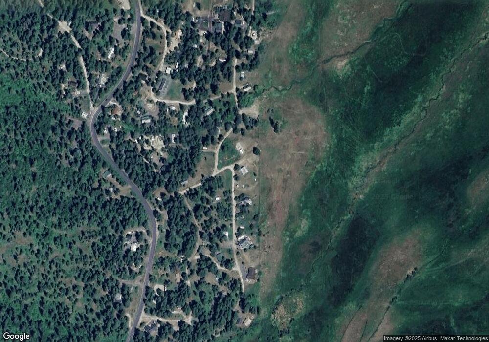
474 Bill Beth Rd Cascade, ID 83611
Estimated Value: $548,000 - $641,000
2
Beds
1
Bath
1,824
Sq Ft
$325/Sq Ft
Est. Value
About This Home
This home is located at 474 Bill Beth Rd, Cascade, ID 83611 and is currently estimated at $593,164, approximately $325 per square foot. 474 Bill Beth Rd is a home with nearby schools including Cascade Elementary School and Cascade Junior/Senior High School.
Ownership History
Date
Name
Owned For
Owner Type
Purchase Details
Closed on
Jul 21, 2025
Sold by
John Wilson And Carol Sue Fly Living Tru and Fly David Lee
Bought by
Fly Chase and Fly Megan
Current Estimated Value
Home Financials for this Owner
Home Financials are based on the most recent Mortgage that was taken out on this home.
Original Mortgage
$367,500
Outstanding Balance
$366,862
Interest Rate
6.72%
Mortgage Type
New Conventional
Estimated Equity
$226,302
Purchase Details
Closed on
Oct 7, 2008
Sold by
Fly John W and Fly Carol Sue
Bought by
The John Wilson And Carol Sue Fly Living
Create a Home Valuation Report for This Property
The Home Valuation Report is an in-depth analysis detailing your home's value as well as a comparison with similar homes in the area
Purchase History
| Date | Buyer | Sale Price | Title Company |
|---|---|---|---|
| Fly Chase | -- | Pioneer Title | |
| The John Wilson And Carol Sue Fly Living | -- | -- |
Source: Public Records
Mortgage History
| Date | Status | Borrower | Loan Amount |
|---|---|---|---|
| Open | Fly Chase | $367,500 |
Source: Public Records
Tax History
| Year | Tax Paid | Tax Assessment Tax Assessment Total Assessment is a certain percentage of the fair market value that is determined by local assessors to be the total taxable value of land and additions on the property. | Land | Improvement |
|---|---|---|---|---|
| 2025 | $1,173 | $529,324 | $247,768 | $281,556 |
| 2023 | $1,173 | $481,228 | $154,855 | $326,373 |
| 2022 | $1,191 | $412,342 | $102,638 | $309,704 |
| 2021 | $1,192 | $252,832 | $51,319 | $201,513 |
| 2020 | $1,057 | $183,926 | $50,558 | $133,368 |
| 2019 | $1,033 | $160,948 | $45,962 | $114,986 |
| 2018 | $932 | $142,856 | $47,744 | $95,112 |
| 2017 | $820 | $124,752 | $47,744 | $77,008 |
| 2016 | $869 | $130,734 | $47,744 | $82,990 |
| 2015 | $885 | $137,684 | $0 | $0 |
| 2013 | -- | $123,551 | $0 | $0 |
Source: Public Records
Map
Nearby Homes
- 4 Ogburn Ln
- 520 Susan Rd
- 616-618 Teepee Rd Unit 25 & 28
- 616-618 Teepee Rd
- 617 W Mountain Rd
- 23 Waterline Ln
- 0 Lakeshore Dr Unit 98794043
- 110 Warner Dr Unit 47
- 110 Warner Dr
- 135 Par Dr
- 126 Par Dr
- 126 Par Dr
- L129 Par Dr Unit 129
- L129 Par Dr
- 109 Par Dr
- L102 Lakeshore Dr Unit 102
- Tbd 80 W Fork Creek Rd
- 41 Clear Creek Rd
- 0 Tbd 42 Clear Creek Rd
- Tbd 2 Warm Lake Rd
- 470 Bill Beth Rd
- 12 Bernette Way
- 471 Bill Beth Rd
- 480 Henglow Dr
- 4 James Way
- 2 James Way Unit 33
- 2 James Way
- 11 Lige Ln
- 468 Billbeth Rd Unit 44
- 468 Billbeth Rd
- 484 Henglow Dr
- 470 Anns Ave
- 466 Bill Beth Rd
- L17 Bernette Way Unit 17
- L17 Bernette Way
- 7 Bernette Way
- TBD Bernette Way
- 6 Bernette Way Unit 18
- 6 Bernette Way
- 467 Bill Beth Rd
Your Personal Tour Guide
Ask me questions while you tour the home.
