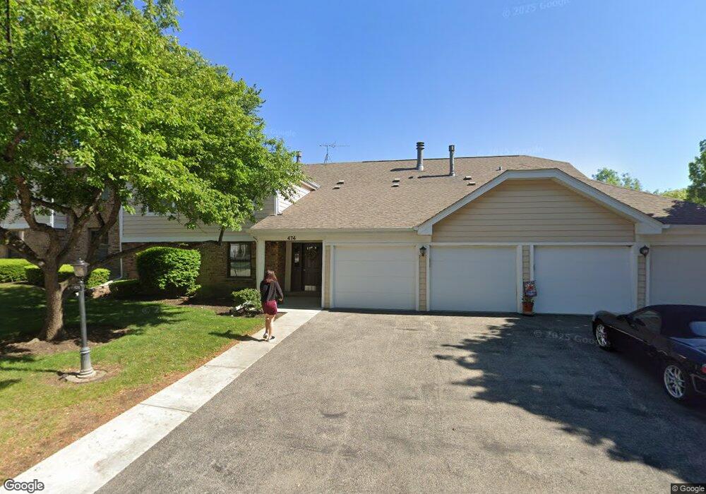
474 Lambert Dr Unit 1829R Schaumburg, IL 60193
East Schaumburg NeighborhoodEstimated Value: $233,651 - $282,000
2
Beds
--
Bath
1,500
Sq Ft
$175/Sq Ft
Est. Value
About This Home
This home is located at 474 Lambert Dr Unit 1829R, Schaumburg, IL 60193 and is currently estimated at $262,913, approximately $175 per square foot. 474 Lambert Dr Unit 1829R is a home located in Cook County with nearby schools including Michael Collins Elementary School, Robert Frost Junior High School, and J B Conant High School.
Ownership History
Date
Name
Owned For
Owner Type
Purchase Details
Closed on
Jan 23, 2014
Sold by
Chicago Title Land Trust Company
Bought by
Hur Eunyoung
Current Estimated Value
Purchase Details
Closed on
Aug 19, 2011
Sold by
Tehansky Donna M
Bought by
North Star Trust Company and Trust #11-12392
Purchase Details
Closed on
Nov 30, 2001
Sold by
Moller David A and Moller Barbara A
Bought by
Tehansky Donna H
Home Financials for this Owner
Home Financials are based on the most recent Mortgage that was taken out on this home.
Original Mortgage
$119,700
Interest Rate
6.52%
Create a Home Valuation Report for This Property
The Home Valuation Report is an in-depth analysis detailing your home's value as well as a comparison with similar homes in the area
Home Values in the Area
Average Home Value in this Area
Purchase History
| Date | Buyer | Sale Price | Title Company |
|---|---|---|---|
| Hur Eunyoung | $115,000 | Chicago Title Land Trust Co | |
| North Star Trust Company | -- | None Available | |
| Tehansky Donna H | $133,000 | Lawyers Title Insurance Corp |
Source: Public Records
Mortgage History
| Date | Status | Borrower | Loan Amount |
|---|---|---|---|
| Previous Owner | Tehansky Donna H | $119,700 |
Source: Public Records
Tax History
| Year | Tax Paid | Tax Assessment Tax Assessment Total Assessment is a certain percentage of the fair market value that is determined by local assessors to be the total taxable value of land and additions on the property. | Land | Improvement |
|---|---|---|---|---|
| 2025 | $4,067 | $20,065 | $3,483 | $16,582 |
| 2024 | $4,067 | $14,519 | $2,947 | $11,572 |
| 2023 | $3,943 | $14,519 | $2,947 | $11,572 |
| 2022 | $3,943 | $14,519 | $2,947 | $11,572 |
| 2021 | $3,878 | $12,794 | $2,344 | $10,450 |
| 2020 | $3,811 | $12,794 | $2,344 | $10,450 |
| 2019 | $3,808 | $14,207 | $2,344 | $11,863 |
| 2018 | $2,976 | $9,917 | $1,875 | $8,042 |
| 2017 | $2,929 | $9,917 | $1,875 | $8,042 |
| 2016 | $2,739 | $9,917 | $1,875 | $8,042 |
| 2015 | $2,698 | $9,018 | $1,674 | $7,344 |
| 2014 | $1,908 | $9,018 | $1,674 | $7,344 |
| 2013 | $1,842 | $9,018 | $1,674 | $7,344 |
Source: Public Records
Map
Nearby Homes
- 321 Carmelhead Ln
- 132 Wolcott Ct Unit M1
- 10 Waterbury Ln Unit M2
- 26 Waterbury Ln Unit N2
- 125 Cleveland Ct Unit M2
- 21 Superior Ct Unit N2
- 631 Schooner Point Unit 106B
- 25 Superior Ct Unit L2
- 5 Illinois Ave
- 601 Fairbanks Ct Unit V2
- 236 N Waterford Dr Unit 11B
- 730 Lamorak Dr
- 220 S Roselle Rd Unit 224
- 602 E Weathersfield Way
- 701 Preston Ln
- 98 Wiltshire Ct
- 168 Farmgate Dr
- 313 Lincoln St
- 1890 Pebble Beach Cir
- 1821 Pebble Beach Cir Unit 1
- 474 Lambert Dr Unit C1
- 474 Lambert Dr Unit 1829R
- 474 Lambert Dr Unit 1829R
- 474 Lambert Dr Unit 1829R
- 474 Lambert Dr Unit D1
- 474 Lambert Dr Unit D2
- 472 Lambert Dr Unit 1829L
- 472 Lambert Dr Unit 1829L
- 472 Lambert Dr Unit 1829L
- 472 Lambert Dr Unit 1829L
- 472 Lambert Dr Unit D1
- 472 Lambert Dr Unit B1
- 472 Lambert Dr Unit B2
- 29 Regent Cir Unit 1830R
- 29 Regent Cir Unit 1830R
- 29 Regent Cir Unit 1830R
- 29 Regent Cir Unit 1830R
- 29 Regent Cir Unit C-2
- 27 Regent Cir Unit B2
- 27 Regent Cir Unit 1830L
Your Personal Tour Guide
Ask me questions while you tour the home.