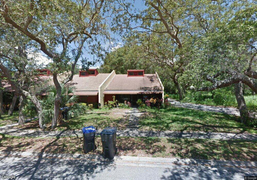
474 Valerie Dr Titusville, FL 32796
Estimated Value: $201,330 - $235,000
2
Beds
2
Baths
1,532
Sq Ft
$146/Sq Ft
Est. Value
About This Home
This home is located at 474 Valerie Dr, Titusville, FL 32796 and is currently estimated at $223,083, approximately $145 per square foot. 474 Valerie Dr is a home located in Brevard County with nearby schools including Oak Park Elementary School, James Madison Middle School, and Astronaut High School.
Ownership History
Date
Name
Owned For
Owner Type
Purchase Details
Closed on
Sep 30, 2009
Sold by
Cahrvet Beau D and Charvet Rebecca L
Bought by
Esposito Rachelle M
Current Estimated Value
Purchase Details
Closed on
Apr 28, 2006
Sold by
Peterson John A and Peterson Alice M
Bought by
Charvet Beau D and Charvet Rebecca L
Home Financials for this Owner
Home Financials are based on the most recent Mortgage that was taken out on this home.
Original Mortgage
$104,000
Interest Rate
6.28%
Create a Home Valuation Report for This Property
The Home Valuation Report is an in-depth analysis detailing your home's value as well as a comparison with similar homes in the area
Home Values in the Area
Average Home Value in this Area
Purchase History
| Date | Buyer | Sale Price | Title Company |
|---|---|---|---|
| Esposito Rachelle M | $89,000 | Accurate Title Group | |
| Charvet Beau D | $130,000 | Landamerica Gulfatlantic Tit |
Source: Public Records
Mortgage History
| Date | Status | Borrower | Loan Amount |
|---|---|---|---|
| Previous Owner | Charvet Beau D | $104,000 |
Source: Public Records
Tax History Compared to Growth
Tax History
| Year | Tax Paid | Tax Assessment Tax Assessment Total Assessment is a certain percentage of the fair market value that is determined by local assessors to be the total taxable value of land and additions on the property. | Land | Improvement |
|---|---|---|---|---|
| 2025 | $395 | $40,790 | -- | -- |
| 2024 | $368 | $39,650 | -- | -- |
| 2023 | $368 | $38,500 | $0 | $0 |
| 2022 | $332 | $37,380 | $0 | $0 |
| 2021 | $318 | $36,300 | $0 | $0 |
| 2020 | $312 | $35,800 | $0 | $0 |
| 2019 | $307 | $35,000 | $0 | $0 |
| 2018 | $299 | $34,350 | $0 | $0 |
| 2017 | $287 | $33,650 | $0 | $0 |
| 2016 | $233 | $32,960 | $4,000 | $28,960 |
| 2015 | $235 | $32,740 | $4,000 | $28,740 |
| 2014 | $230 | $32,480 | $4,000 | $28,480 |
Source: Public Records
Map
Nearby Homes
- 502 Vaughn St
- 160 N Williams Ave
- 671 N Dixie Ave Unit 18A
- 2015 Malinda Ln
- 614 West Ct
- 610 East Ct
- 424 Lenore Ave
- 2196 Pamela St
- 1636 Violet Ave
- 2135 Mayfair Way Unit Lot 71
- 2135 Mayfair Way Unit 84
- 2135 Mayfair Way Unit 98
- 1615 Violet Ave
- 195 N Hilltop Dr
- 106 S Mantor Ave
- 105 McNeela Dr Unit 105
- 1539 Violet Ave
- 2537 Evergreen Ave
- 302 W Virginia Dr
- 7.26 Route 1
- 472 Valerie Dr
- 470 Valerie Dr
- 468 Valerie Dr
- 466 Valerie Dr
- 475 Valerie Dr
- 473 Valerie Dr
- 495 Valerie Dr
- 471 Valerie Dr
- 469 Valerie Dr
- 452 Valerie Dr
- 467 Valerie Dr
- 493 Valerie Dr
- 465 Valerie Dr
- 450 Valerie Dr
- 491 Valerie Dr
- 510 N Dixie Ave
- 463 Valerie Dr
- 489 Valerie Dr
- 448 Valerie Dr
- 461 Valerie Dr