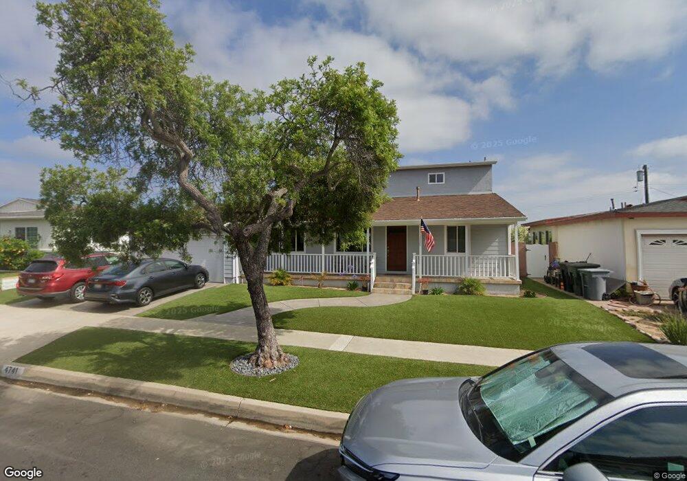
4741 Bindewald Rd Torrance, CA 90505
Seaside NeighborhoodEstimated Value: $1,523,952 - $1,695,000
4
Beds
3
Baths
1,862
Sq Ft
$847/Sq Ft
Est. Value
About This Home
This home is located at 4741 Bindewald Rd, Torrance, CA 90505 and is currently estimated at $1,576,738, approximately $846 per square foot. 4741 Bindewald Rd is a home located in Los Angeles County with nearby schools including Seaside Elementary School, Calle Mayor Middle School, and South High School.
Ownership History
Date
Name
Owned For
Owner Type
Purchase Details
Closed on
May 18, 2009
Sold by
Hebson Matthew J and Hebson Leah M
Bought by
Hebson Matthew James
Current Estimated Value
Purchase Details
Closed on
Jan 28, 2000
Sold by
Ly Trust Vander Byl William J & Constance H
Bought by
Hebson Matthew J
Home Financials for this Owner
Home Financials are based on the most recent Mortgage that was taken out on this home.
Original Mortgage
$319,200
Interest Rate
8.21%
Purchase Details
Closed on
Jul 11, 1996
Sold by
Vanderbyl William J
Bought by
Vanderbyl William J and Vanderbyl Constance H
Create a Home Valuation Report for This Property
The Home Valuation Report is an in-depth analysis detailing your home's value as well as a comparison with similar homes in the area
Home Values in the Area
Average Home Value in this Area
Purchase History
| Date | Buyer | Sale Price | Title Company |
|---|---|---|---|
| Hebson Matthew James | -- | None Available | |
| Hebson Matthew J | $399,000 | Stewart Title | |
| Vanderbyl William J | -- | -- |
Source: Public Records
Mortgage History
| Date | Status | Borrower | Loan Amount |
|---|---|---|---|
| Previous Owner | Hebson Matthew J | $319,200 |
Source: Public Records
Tax History
| Year | Tax Paid | Tax Assessment Tax Assessment Total Assessment is a certain percentage of the fair market value that is determined by local assessors to be the total taxable value of land and additions on the property. | Land | Improvement |
|---|---|---|---|---|
| 2025 | $7,650 | $668,650 | $490,595 | $178,055 |
| 2024 | $7,650 | $655,540 | $480,976 | $174,564 |
| 2023 | $7,509 | $642,688 | $471,546 | $171,142 |
| 2022 | $7,408 | $630,087 | $462,300 | $167,787 |
| 2021 | $7,270 | $617,734 | $453,236 | $164,498 |
| 2019 | $7,059 | $599,414 | $439,794 | $159,620 |
| 2018 | $6,829 | $587,662 | $431,171 | $156,491 |
| 2016 | $6,519 | $564,844 | $414,429 | $150,415 |
| 2015 | $6,377 | $556,360 | $408,204 | $148,156 |
| 2014 | $6,213 | $545,462 | $400,208 | $145,254 |
Source: Public Records
Map
Nearby Homes
- 5013 Macafee Rd
- 22631 Kathryn Ave
- 5267 Doris Way
- 22826 Marjorie Ave
- 23333 Anza Ave
- 23505 Ladeene Ave
- 23315 Ocean Ave
- 4515 Greenmeadows Ave
- 205 Via Los Altos
- 1920 S Pacific Coast Hwy Unit 314
- 1062 Palos Verdes Blvd
- 22305 Ladeene Ave
- 425 Via el Chico
- 1041 Avenue D
- 523 Avenue G
- 4509 Vista Largo
- 21913 Palos Verdes Blvd
- 1108 Camino Real Unit 407
- 1108 Camino Real Unit 409
- 1800 S Pacific Coast Hwy Unit 21
- 4737 Bindewald Rd
- 4805 Bindewald Rd
- 4733 Bindewald Rd
- 4744 Reese Rd
- 4806 Reese Rd
- 4809 Bindewald Rd
- 4740 Reese Rd
- 4729 Bindewald Rd
- 4812 Reese Rd
- 4736 Reese Rd
- 4742 Bindewald Rd
- 4738 Bindewald Rd
- 4806 Bindewald Rd
- 4734 Bindewald Rd
- 4813 Bindewald Rd
- 4732 Reese Rd
- 4810 Bindewald Rd
- 4725 Bindewald Rd
- 4818 Reese Rd
- 4730 Bindewald Rd
Your Personal Tour Guide
Ask me questions while you tour the home.